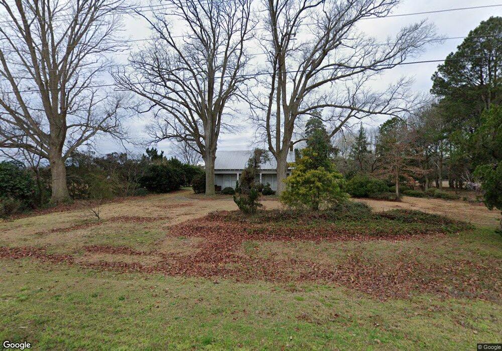
3352 Taylors Bridge Hwy Clinton, NC 28328
Estimated Value: $204,000 - $227,000
3
Beds
2
Baths
1,704
Sq Ft
$126/Sq Ft
Est. Value
About This Home
This home is located at 3352 Taylors Bridge Hwy, Clinton, NC 28328 and is currently estimated at $214,333, approximately $125 per square foot. 3352 Taylors Bridge Hwy is a home located in Sampson County with nearby schools including Union Elementary School, Union Intermediate School, and Union Middle School.
Ownership History
Date
Name
Owned For
Owner Type
Purchase Details
Closed on
Mar 8, 2013
Sold by
Peterson Christopher
Bought by
Peterson Monty Christopher and Peterson Carla Jean
Current Estimated Value
Home Financials for this Owner
Home Financials are based on the most recent Mortgage that was taken out on this home.
Original Mortgage
$72,800
Outstanding Balance
$49,495
Interest Rate
2.75%
Mortgage Type
Adjustable Rate Mortgage/ARM
Estimated Equity
$164,838
Create a Home Valuation Report for This Property
The Home Valuation Report is an in-depth analysis detailing your home's value as well as a comparison with similar homes in the area
Home Values in the Area
Average Home Value in this Area
Purchase History
| Date | Buyer | Sale Price | Title Company |
|---|---|---|---|
| Peterson Monty Christopher | $91,000 | None Available |
Source: Public Records
Mortgage History
| Date | Status | Borrower | Loan Amount |
|---|---|---|---|
| Open | Peterson Monty Christopher | $72,800 |
Source: Public Records
Tax History Compared to Growth
Tax History
| Year | Tax Paid | Tax Assessment Tax Assessment Total Assessment is a certain percentage of the fair market value that is determined by local assessors to be the total taxable value of land and additions on the property. | Land | Improvement |
|---|---|---|---|---|
| 2025 | $1,397 | $179,041 | $18,975 | $160,066 |
| 2024 | $1,271 | $179,041 | $18,975 | $160,066 |
| 2023 | $905 | $97,820 | $16,500 | $81,320 |
| 2022 | $905 | $97,820 | $16,500 | $81,320 |
| 2021 | $905 | $97,820 | $16,500 | $81,320 |
| 2020 | $905 | $97,820 | $16,500 | $81,320 |
| 2019 | $905 | $97,820 | $0 | $0 |
| 2018 | $816 | $91,209 | $0 | $0 |
| 2017 | $816 | $91,209 | $0 | $0 |
| 2016 | $821 | $91,209 | $0 | $0 |
| 2015 | $821 | $91,209 | $0 | $0 |
| 2014 | -- | $91,209 | $0 | $0 |
Source: Public Records
Map
Nearby Homes
- 0 Reedsford Rd
- 1855 Beaman Woods Rd
- Off of Reedsford Rd Unit LotWP001
- 865 Cecil Odie Rd
- 2153 Rowan Rd
- 0 Waycross Rd
- N11 0 1 Sr 1004
- 393 Moltonville Rd
- 2228 Indian Town Rd
- 500 Rowan Rd
- 471 John Mark Rd
- 0 Moltonville Rd
- 1206 Southwest Blvd
- 400 Airplane Ln
- 0 Hillside Ln
- 1116 Phillips St
- 112 Martin Luther King Junior Blvd
- 0 Boykin Bridge Rd
- 1 Boykin Bridge Rd
- 111 Colonial Dr
- 3446 Taylors Bridge Hwy
- 135 Quiet Water Ln
- 3199 Taylors Bridge Hwy
- 3467 Taylors Bridge Hwy
- 209 Quiet Water Ln
- 117 Quiet Water Ln
- 3063 Taylors Bridge Hwy
- 3037 Taylors Bridge Hwy
- 3010 Taylors Bridge Hwy
- 3085 Taylors Bridge Hwy
- 101 Stanbourne Ln
- 3689 Taylors Bridge Hwy
- 3553 Taylors Bridge Hwy
- 2985 Taylors Bridge Hwy
- 2947 Taylors Bridge Hwy
- 3808 Taylors Bridge Hwy
- 265 Stanbourne Ln
- 2845 Taylors Bridge Hwy
- 2814 Taylors Bridge Hwy
- 3904 Taylors Bridge Hwy