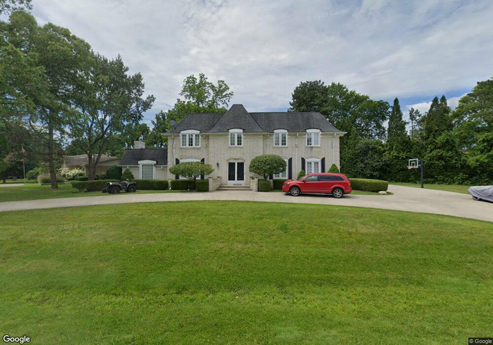
3357 Parkland Dr Unit Bldg-Unit West Bloomfield, MI 48322
Estimated Value: $645,000 - $789,005
4
Beds
6
Baths
3,841
Sq Ft
$185/Sq Ft
Est. Value
About This Home
This home is located at 3357 Parkland Dr Unit Bldg-Unit, West Bloomfield, MI 48322 and is currently estimated at $709,001, approximately $184 per square foot. 3357 Parkland Dr Unit Bldg-Unit is a home located in Oakland County with nearby schools including Sheiko Elementary School, West Bloomfield Middle School, and Bloomfield Maples Montessori.
Ownership History
Date
Name
Owned For
Owner Type
Purchase Details
Closed on
Oct 16, 2018
Sold by
Pardanani Krishnakumar and Pardanani K P
Bought by
Simmons Kwame T and Simmons Tamika L
Current Estimated Value
Create a Home Valuation Report for This Property
The Home Valuation Report is an in-depth analysis detailing your home's value as well as a comparison with similar homes in the area
Home Values in the Area
Average Home Value in this Area
Purchase History
| Date | Buyer | Sale Price | Title Company |
|---|---|---|---|
| Simmons Kwame T | $412,000 | Equity Title Agency Llc |
Source: Public Records
Tax History Compared to Growth
Tax History
| Year | Tax Paid | Tax Assessment Tax Assessment Total Assessment is a certain percentage of the fair market value that is determined by local assessors to be the total taxable value of land and additions on the property. | Land | Improvement |
|---|---|---|---|---|
| 2024 | $6,427 | $304,280 | $0 | $0 |
| 2022 | $6,433 | $270,820 | $44,450 | $226,370 |
| 2021 | $10,019 | $253,710 | $0 | $0 |
| 2020 | $6,259 | $237,400 | $44,450 | $192,950 |
| 2018 | $8,740 | $230,390 | $44,450 | $185,940 |
| 2015 | -- | $208,750 | $0 | $0 |
| 2014 | -- | $193,360 | $0 | $0 |
| 2011 | -- | $172,030 | $0 | $0 |
Source: Public Records
Map
Nearby Homes
- 5780 Swan Lake Ct
- 5622 Powder Horn Dr
- 3865 Stonecrest Rd
- 5415 Fairway Ln
- 3104 Spring St
- 5321 Fairway Ln Unit 7
- 3035 Parkland Dr
- 6151 Orchard Lake Rd Unit 103
- 6109 Orchard Lake Rd Unit 101
- 6145 Orchard Lake Rd Unit 204
- 3930 Harris Ln
- 5946 Cherry Crest Dr
- 5352 W Doherty Dr
- 6322 Pepper Hill St Unit 62
- 6222 Pepper Hill St
- 6624 Mellow Wood Ln
- 4117 Marlwood Dr
- 6564 Alderley Way
- 4163 Autumn Ridge Dr
- 3961 Will O Way Ln
- 3357 Parkland Dr
- 5821 Tabor Dr
- 3345 Parkland Dr
- 3362 Parkland Dr
- 3425 Parkland Dr
- 5839 Tabor Dr
- 3350 Parkland Dr
- 5859 Tabor Dr
- 3333 Hartslock Woods Dr
- 3332 Parkland Dr
- 3400 Parkland Dr
- 5840 Tabor Dr
- 5822 Tabor Dr
- 3451 Parkland Dr
- 5877 Tabor Dr
- 3428 Parkland Dr
- 3321 Hartslock Woods Dr
- 3324 Hartslock Woods Dr
- 3316 Parkland Dr
- 5858 Tabor Dr