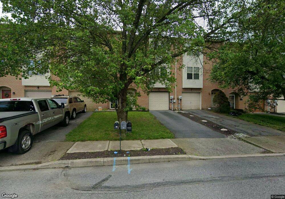
336 Avi Dr Alburtis, PA 18011
Estimated Value: $293,000 - $338,000
3
Beds
2
Baths
1,836
Sq Ft
$168/Sq Ft
Est. Value
About This Home
This home is located at 336 Avi Dr, Alburtis, PA 18011 and is currently estimated at $307,627, approximately $167 per square foot. 336 Avi Dr is a home located in Lehigh County with nearby schools including Alburtis Elementary School, Lower Macungie Middle School, and Emmaus High School.
Ownership History
Date
Name
Owned For
Owner Type
Purchase Details
Closed on
Sep 26, 2003
Sold by
Johnson Robert and Saukko Ronald E
Bought by
Williams Brian J and Williams Tammy S
Current Estimated Value
Home Financials for this Owner
Home Financials are based on the most recent Mortgage that was taken out on this home.
Original Mortgage
$117,967
Outstanding Balance
$55,201
Interest Rate
6.25%
Mortgage Type
FHA
Estimated Equity
$252,426
Purchase Details
Closed on
Nov 6, 1998
Sold by
Jean Burna Nancy and Lick Miriam
Bought by
Johnson Robert and Saukko Ronald E
Purchase Details
Closed on
Sep 17, 1992
Sold by
Hornstein Enterprises Inc
Bought by
Burna Nancy Jean and Lick Miriam E
Purchase Details
Closed on
Aug 14, 1990
Bought by
Hornstein Enterprises Inc
Create a Home Valuation Report for This Property
The Home Valuation Report is an in-depth analysis detailing your home's value as well as a comparison with similar homes in the area
Home Values in the Area
Average Home Value in this Area
Purchase History
| Date | Buyer | Sale Price | Title Company |
|---|---|---|---|
| Williams Brian J | $118,900 | First American Title Ins Co | |
| Johnson Robert | $85,000 | -- | |
| Burna Nancy Jean | $82,500 | -- | |
| Hornstein Enterprises Inc | $708,500 | -- |
Source: Public Records
Mortgage History
| Date | Status | Borrower | Loan Amount |
|---|---|---|---|
| Open | Williams Brian J | $117,967 |
Source: Public Records
Tax History
| Year | Tax Paid | Tax Assessment Tax Assessment Total Assessment is a certain percentage of the fair market value that is determined by local assessors to be the total taxable value of land and additions on the property. | Land | Improvement |
|---|---|---|---|---|
| 2025 | $3,655 | $124,500 | $8,600 | $115,900 |
| 2024 | $3,562 | $124,500 | $8,600 | $115,900 |
| 2023 | $3,397 | $124,500 | $8,600 | $115,900 |
| 2022 | $3,326 | $124,500 | $115,900 | $8,600 |
| 2021 | $3,263 | $124,500 | $8,600 | $115,900 |
| 2020 | $3,236 | $124,500 | $8,600 | $115,900 |
| 2019 | $3,218 | $124,500 | $8,600 | $115,900 |
| 2018 | $3,182 | $124,500 | $8,600 | $115,900 |
| 2017 | $3,133 | $124,500 | $8,600 | $115,900 |
| 2016 | -- | $124,500 | $8,600 | $115,900 |
| 2015 | -- | $124,500 | $8,600 | $115,900 |
| 2014 | -- | $124,500 | $8,600 | $115,900 |
Source: Public Records
Map
Nearby Homes
- 314 Ridgeview Dr
- 112 Front St
- 38 E 2nd St
- 428 Thomas St
- 317 Lockridge Ln
- 195 Maple Ct
- 7695 Barrow Dr
- 46 Wetzel Rd
- 7528 Buttercup Rd
- 7264 Snowberry Ct
- 1649 Thorndale Rd
- 1649 Thorndale Rd Unit LOT 70
- 7699 Catalpa Dr
- 1616 Greystone Cir
- 7687 Catalpa Dr
- 1600 Greystone Cir
- 0 Clauss Hunt Knight Dr Unit 10 Units
- 2301 Goldenrod Dr
- 7501 Spring Creek Rd
- 8012 Century Blvd
Your Personal Tour Guide
Ask me questions while you tour the home.