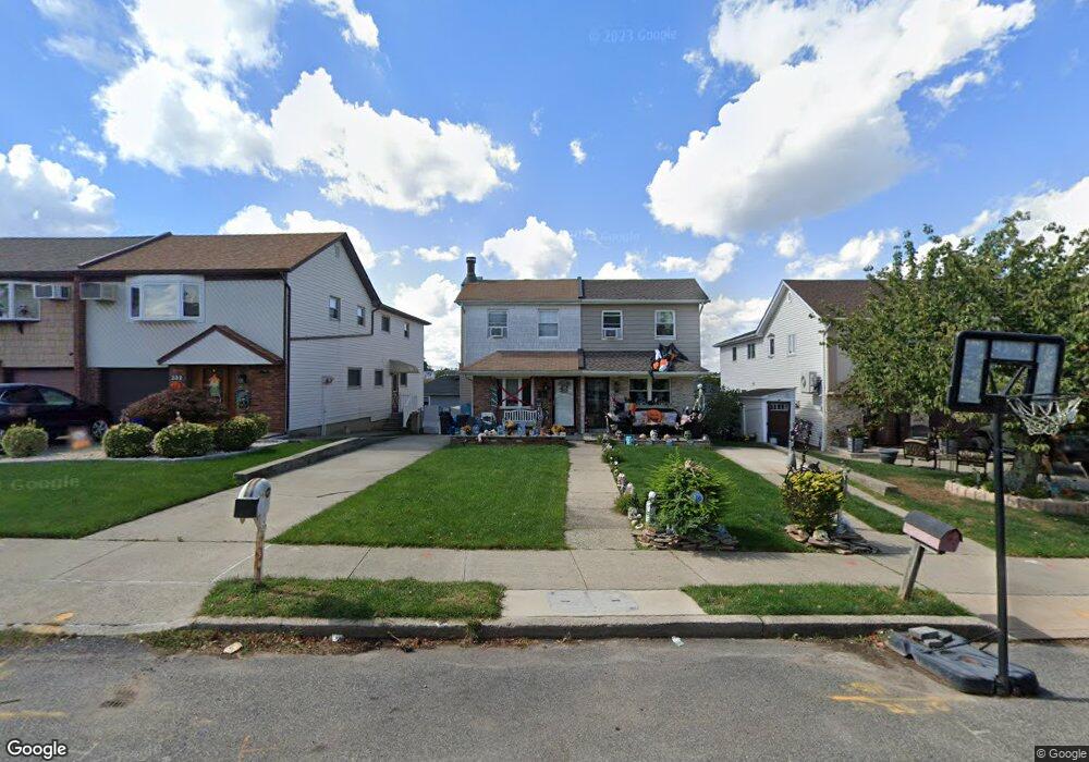
336 Brookfield Ave Staten Island, NY 10308
Great Kills NeighborhoodEstimated Value: $700,000 - $884,000
3
Beds
2
Baths
1,260
Sq Ft
$630/Sq Ft
Est. Value
About This Home
This home is located at 336 Brookfield Ave, Staten Island, NY 10308 and is currently estimated at $793,740, approximately $629 per square foot. 336 Brookfield Ave is a home located in Richmond County with nearby schools including P.S. 32 The Gifford School, I.S. 075 Frank D. Paulo, and Susan E Wagner High School.
Ownership History
Date
Name
Owned For
Owner Type
Purchase Details
Closed on
May 24, 2007
Sold by
Zimring Richard and Zimring Barbara
Bought by
Altuna Lawrence and Altuna Trisha
Current Estimated Value
Home Financials for this Owner
Home Financials are based on the most recent Mortgage that was taken out on this home.
Original Mortgage
$425,000
Outstanding Balance
$258,796
Interest Rate
6.19%
Mortgage Type
Purchase Money Mortgage
Estimated Equity
$534,944
Create a Home Valuation Report for This Property
The Home Valuation Report is an in-depth analysis detailing your home's value as well as a comparison with similar homes in the area
Home Values in the Area
Average Home Value in this Area
Purchase History
| Date | Buyer | Sale Price | Title Company |
|---|---|---|---|
| Altuna Lawrence | $425,000 | None Available |
Source: Public Records
Mortgage History
| Date | Status | Borrower | Loan Amount |
|---|---|---|---|
| Open | Altuna Lawrence | $425,000 |
Source: Public Records
Tax History Compared to Growth
Tax History
| Year | Tax Paid | Tax Assessment Tax Assessment Total Assessment is a certain percentage of the fair market value that is determined by local assessors to be the total taxable value of land and additions on the property. | Land | Improvement |
|---|---|---|---|---|
| 2025 | $7,260 | $48,780 | $7,156 | $41,624 |
| 2024 | $7,260 | $41,940 | $8,015 | $33,925 |
| 2023 | $7,070 | $34,814 | $7,035 | $27,779 |
| 2022 | $6,667 | $37,440 | $9,300 | $28,140 |
| 2021 | $6,977 | $37,860 | $9,300 | $28,560 |
| 2020 | $6,620 | $38,580 | $9,300 | $29,280 |
| 2019 | $6,301 | $36,000 | $9,300 | $26,700 |
| 2018 | $5,914 | $29,012 | $7,276 | $21,736 |
| 2017 | $5,674 | $27,832 | $9,120 | $18,712 |
| 2016 | $5,523 | $27,627 | $8,429 | $19,198 |
| 2015 | $4,817 | $26,064 | $7,845 | $18,219 |
| 2014 | $4,817 | $25,102 | $8,441 | $16,661 |
Source: Public Records
Map
Nearby Homes
- 350 Brookfield Ave
- 379 Brookfield Ave
- 26 E Brandis Ave
- 339 Abingdon Ave
- 466 Doane Ave
- 414 Elverton Ave
- 259 Brookfield Ave
- 74 E Brandis Ave
- 345 Colon Ave
- 307 Abingdon Ave
- 72 Eric Ln
- 12 Lexington Ln
- 919 Armstrong Ave
- 87 Pemberton Ave
- 924 Armstrong Ave Unit 2-3
- 248 Abingdon Ave
- 185 Brookfield Ave
- 88 Cortelyou Ave
- 131 Cortelyou Ave Unit 1-1
- 443 Ridgewood Ave
- 338 Brookfield Ave
- 332 Brookfield Ave
- 342 Brookfield Ave
- 330 Brookfield Ave
- 344 Brookfield Ave
- 326 Brookfield Ave
- 385 Abingdon Ave
- 381 Abingdon Ave
- 387 Abingdon Ave
- 348 Brookfield Ave
- 324 Brookfield Ave
- 379 Abingdon Ave
- 391 Abingdon Ave
- 377 Abingdon Ave
- 320 Brookfield Ave
- 395 Abingdon Ave
- 375 Abingdon Ave
- 354 Brookfield Ave
- 337 Brookfield Ave
- 339 Brookfield Ave