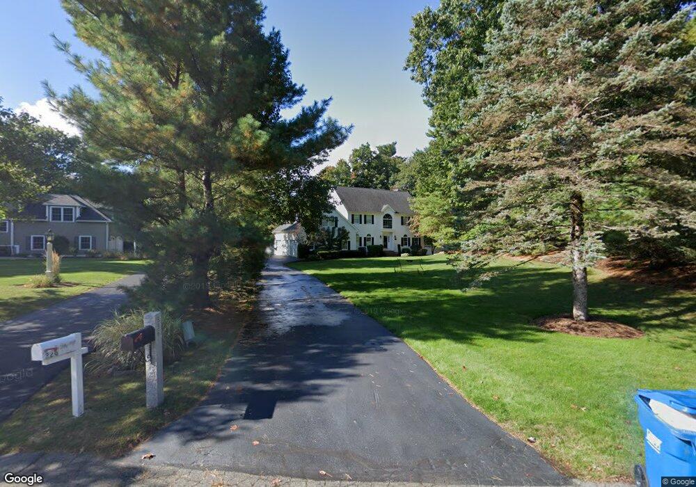
336 Candlestick Rd North Andover, MA 01845
Estimated Value: $1,167,929 - $1,336,000
4
Beds
3
Baths
3,138
Sq Ft
$389/Sq Ft
Est. Value
About This Home
This home is located at 336 Candlestick Rd, North Andover, MA 01845 and is currently estimated at $1,221,482, approximately $389 per square foot. 336 Candlestick Rd is a home located in Essex County with nearby schools including Annie L Sargent Elementary School, North Andover Middle School, and North Andover High School.
Ownership History
Date
Name
Owned For
Owner Type
Purchase Details
Closed on
Dec 4, 2020
Sold by
Dee Brian P and Dee Kristen M
Bought by
Kristen M Dee Rt
Current Estimated Value
Purchase Details
Closed on
Nov 30, 2018
Sold by
Porcaro Mary E and Madden John
Bought by
Dee Brian P and Dee Kristen M
Home Financials for this Owner
Home Financials are based on the most recent Mortgage that was taken out on this home.
Original Mortgage
$325,000
Interest Rate
4.8%
Mortgage Type
New Conventional
Create a Home Valuation Report for This Property
The Home Valuation Report is an in-depth analysis detailing your home's value as well as a comparison with similar homes in the area
Home Values in the Area
Average Home Value in this Area
Purchase History
| Date | Buyer | Sale Price | Title Company |
|---|---|---|---|
| Kristen M Dee Rt | -- | None Available | |
| Dee Brian P | $875,000 | -- |
Source: Public Records
Mortgage History
| Date | Status | Borrower | Loan Amount |
|---|---|---|---|
| Previous Owner | Dee Brian P | $325,000 |
Source: Public Records
Tax History Compared to Growth
Tax History
| Year | Tax Paid | Tax Assessment Tax Assessment Total Assessment is a certain percentage of the fair market value that is determined by local assessors to be the total taxable value of land and additions on the property. | Land | Improvement |
|---|---|---|---|---|
| 2025 | $11,572 | $1,027,700 | $435,600 | $592,100 |
| 2024 | $12,654 | $1,141,000 | $413,800 | $727,200 |
| 2023 | $11,812 | $965,000 | $331,100 | $633,900 |
| 2022 | $11,293 | $834,700 | $287,500 | $547,200 |
| 2021 | $10,887 | $768,300 | $261,400 | $506,900 |
| 2020 | $10,466 | $761,700 | $254,800 | $506,900 |
| 2019 | $10,214 | $761,700 | $254,800 | $506,900 |
| 2018 | $9,523 | $655,400 | $254,800 | $400,600 |
| 2017 | $10,167 | $712,000 | $230,900 | $481,100 |
| 2016 | $9,648 | $676,100 | $235,200 | $440,900 |
| 2015 | $9,979 | $693,500 | $219,700 | $473,800 |
Source: Public Records
Map
Nearby Homes
- 30 Sherwood Dr
- 453 Forest St
- 54 Sterling Ln
- 105 Weyland Cir
- 125 Lancaster Rd
- 155 Duncan Dr
- 82 Raleigh Tavern Ln
- 793 Forest St
- 590 Foster St
- 851 Forest St
- 50 Rocky Brook Rd
- 194 Olympic Ln
- 2050 Salem St
- 127 Tucker Farm Rd
- 80 Compass Point Unit 80
- 75 Thistle Rd
- 495 Johnson St
- 43 Mill Rd
- 26 Woodberry Ln
- 120 Gray St
- 326 Candlestick Rd
- 25 Jerad Place
- 316 Candlestick Rd
- 333 Candlestick Rd
- 42 Jerad Place
- 315 Candlestick Rd
- 28 Jerad Place
- 206 Forest St
- 345 Candlestick Rd
- 10 Jerad Place
- 216 Forest St
- 230 Forest St
- 357 Candlestick Rd
- 220 Forest St
- 175 Forest St
- 25 Sunset Rock Rd
- 292 Candlestick Rd
- 226 Forest St
- 158 Forest St
- 183 Forest St