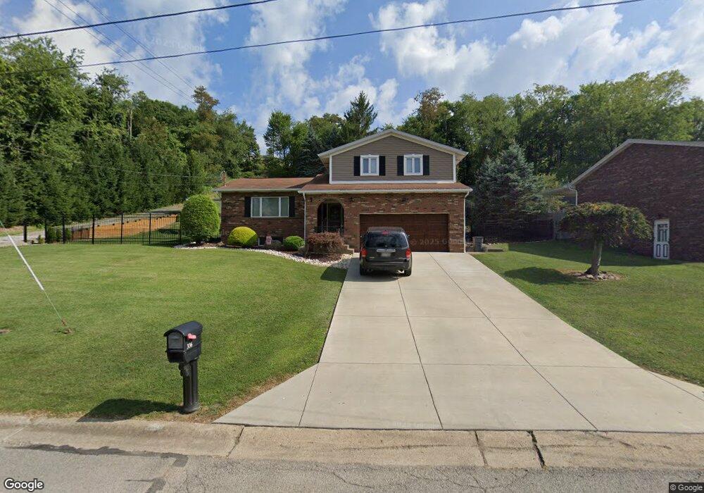
336 Putnam Ln Weirton, WV 26062
Estimated Value: $199,000 - $302,000
3
Beds
3
Baths
1,716
Sq Ft
$142/Sq Ft
Est. Value
About This Home
This home is located at 336 Putnam Ln, Weirton, WV 26062 and is currently estimated at $244,057, approximately $142 per square foot. 336 Putnam Ln is a home located in Hancock County with nearby schools including St. Joseph the Worker Grade School, St. Paul School, and Weirton Christian Academy.
Ownership History
Date
Name
Owned For
Owner Type
Purchase Details
Closed on
Jun 10, 2021
Sold by
Kensington Investments Llc
Bought by
Wyatt Timothy and Wyatt Melissa
Current Estimated Value
Purchase Details
Closed on
Sep 11, 2007
Sold by
Stump Gregory Allen and Stump Fay Asfour
Bought by
Wyatt Timothy and Wyatt Melissa
Home Financials for this Owner
Home Financials are based on the most recent Mortgage that was taken out on this home.
Original Mortgage
$165,815
Interest Rate
6.7%
Mortgage Type
New Conventional
Create a Home Valuation Report for This Property
The Home Valuation Report is an in-depth analysis detailing your home's value as well as a comparison with similar homes in the area
Home Values in the Area
Average Home Value in this Area
Purchase History
| Date | Buyer | Sale Price | Title Company |
|---|---|---|---|
| Wyatt Timothy | -- | None Available | |
| Wyatt Timothy | -- | Guida Daniel J | |
| Wyatt Timothy | $177,700 | None Available |
Source: Public Records
Mortgage History
| Date | Status | Borrower | Loan Amount |
|---|---|---|---|
| Previous Owner | Wyatt Timothy | $165,815 |
Source: Public Records
Tax History Compared to Growth
Tax History
| Year | Tax Paid | Tax Assessment Tax Assessment Total Assessment is a certain percentage of the fair market value that is determined by local assessors to be the total taxable value of land and additions on the property. | Land | Improvement |
|---|---|---|---|---|
| 2024 | $1,517 | $95,100 | $6,960 | $88,140 |
| 2023 | $1,451 | $94,560 | $6,420 | $88,140 |
| 2022 | $1,483 | $95,820 | $6,420 | $89,400 |
| 2021 | $1,490 | $96,000 | $9,000 | $87,000 |
| 2020 | $1,446 | $93,480 | $8,820 | $84,660 |
| 2019 | $1,421 | $90,720 | $8,400 | $82,320 |
| 2018 | $1,402 | $89,160 | $8,040 | $81,120 |
| 2017 | $1,367 | $86,220 | $7,620 | $78,600 |
| 2016 | $1,374 | $86,700 | $7,020 | $79,680 |
| 2015 | $1,178 | $83,820 | $6,660 | $77,160 |
| 2014 | $1,178 | $79,860 | $6,480 | $73,380 |
Source: Public Records
Map
Nearby Homes
- 229 High St
- 0 Putnam Ln Unit 5074239
- 0 Culler Rd Unit 4293715
- TBD Marie Ave
- 103 Marie Ave
- 249 Greenlawn Blvd
- 131 Forest Rd
- 124 California Ave
- 114 Stroud Ave
- 133 Bass Dr
- 126 Pike St
- 3466 Pennsylvania Ave
- 3465 Pennsylvania Ave
- TBD McHendry St
- TBD Estes Ave
- 0 Braxton Rd
- 175 Gilson Ave
- 136 McHendry St
- 205 Millsop Dr
- 0 Woodview Dr