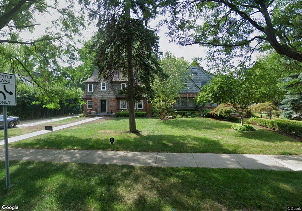
336 S Adams Rd Birmingham, MI 48009
Estimated Value: $702,354 - $949,000
4
Beds
3
Baths
2,250
Sq Ft
$382/Sq Ft
Est. Value
About This Home
This home is located at 336 S Adams Rd, Birmingham, MI 48009 and is currently estimated at $859,589, approximately $382 per square foot. 336 S Adams Rd is a home located in Oakland County with nearby schools including Harlan Elementary School, Derby Middle School, and Ernest W. Seaholm High School.
Ownership History
Date
Name
Owned For
Owner Type
Purchase Details
Closed on
Oct 22, 2010
Sold by
Kinloch Properties Llc and Paciocco Antonino
Bought by
Lampi Kathryn Marie
Current Estimated Value
Purchase Details
Closed on
Jan 13, 2009
Sold by
Shoup Craig S
Bought by
Jpmorgan Chase Bank National Association and Washington Mutual Bank
Purchase Details
Closed on
Jun 1, 2000
Sold by
Shoup Craig S
Bought by
Shoup Craig S
Purchase Details
Closed on
Nov 4, 1999
Sold by
Quintal Steven
Bought by
Shoup Craig S
Create a Home Valuation Report for This Property
The Home Valuation Report is an in-depth analysis detailing your home's value as well as a comparison with similar homes in the area
Home Values in the Area
Average Home Value in this Area
Purchase History
| Date | Buyer | Sale Price | Title Company |
|---|---|---|---|
| Lampi Kathryn Marie | $296,500 | Fntic | |
| Jpmorgan Chase Bank National Association | $310,000 | None Available | |
| Shoup Craig S | -- | -- | |
| Shoup Craig S | $297,000 | -- |
Source: Public Records
Mortgage History
| Date | Status | Borrower | Loan Amount |
|---|---|---|---|
| Closed | Shoup Craig S | -- |
Source: Public Records
Tax History Compared to Growth
Tax History
| Year | Tax Paid | Tax Assessment Tax Assessment Total Assessment is a certain percentage of the fair market value that is determined by local assessors to be the total taxable value of land and additions on the property. | Land | Improvement |
|---|---|---|---|---|
| 2024 | $5,642 | $290,810 | $0 | $0 |
| 2023 | $5,407 | $259,960 | $0 | $0 |
| 2022 | $5,797 | $247,950 | $0 | $0 |
| 2021 | $5,849 | $234,470 | $0 | $0 |
| 2020 | $5,211 | $217,260 | $0 | $0 |
| 2019 | $5,898 | $213,290 | $0 | $0 |
| 2018 | $5,852 | $213,180 | $0 | $0 |
| 2017 | $5,843 | $210,100 | $0 | $0 |
| 2016 | $5,853 | $209,400 | $0 | $0 |
| 2015 | -- | $192,440 | $0 | $0 |
| 2014 | -- | $162,000 | $0 | $0 |
| 2011 | -- | $122,610 | $0 | $0 |
Source: Public Records
Map
Nearby Homes
- 1207 Villa Rd
- 475 S Adams Rd Unit 21
- 820 Hazel St
- 411 S Old Woodward Ave Unit 708
- 411 S Old Woodward Ave Unit 923
- 411 S Old Woodward Ave Unit 911
- 411 S Old Woodward Ave Unit 1022
- 411 S Old Woodward Ave Unit 907
- 411 S Old Woodward Ave Unit 524
- 411 S Old Woodward Ave Unit 1007
- 1633 Villa Rd
- 1324 Holland St
- 647 Ann St
- 1489 Holland St
- 1673 Hazel St
- 787 Ann St
- 1696 Hazel St
- 907 Ann St
- 967 Ann St
- 1773 Villa Rd
- 368 S Adams Rd
- 312 S Adams Rd
- 1044 Forest Ave
- 390 S Adams Rd
- 1030 Forest Ave
- 1043 Chestnut St
- 359 S Adams Rd
- 1061 Forest Ave
- 1035 Chestnut St Unit Bldg-Unit
- 1035 Chestnut St
- 1000 Forest Ave Unit Bldg-Unit
- 1000 Forest Ave
- 1045 Forest Ave
- 1133 Villa Rd
- 1007 Chestnut St
- 412 S Adams Rd
- 1122 Yosemite Blvd
- 991 Chestnut St
- 984 Forest Ave
- 1027 Forest Ave