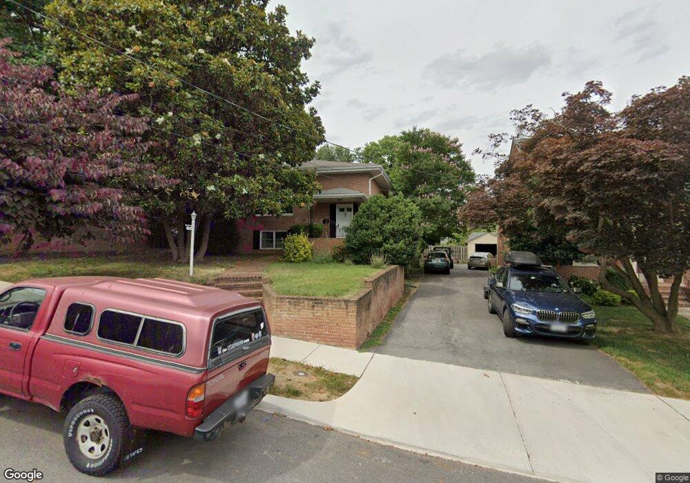
336 W Whitlock Ave Winchester, VA 22601
Estimated Value: $444,000 - $489,000
4
Beds
3
Baths
1,368
Sq Ft
$338/Sq Ft
Est. Value
About This Home
This home is located at 336 W Whitlock Ave, Winchester, VA 22601 and is currently estimated at $462,050, approximately $337 per square foot. 336 W Whitlock Ave is a home located in Winchester City with nearby schools including Garland R. Quarles Elementary School, Daniel Morgan Middle School, and John Handley High School.
Ownership History
Date
Name
Owned For
Owner Type
Purchase Details
Closed on
Jul 26, 2006
Sold by
Watts Dabney W and Watts Dabney W
Bought by
Taylor Jefrey D and Taylor Robeta F
Current Estimated Value
Home Financials for this Owner
Home Financials are based on the most recent Mortgage that was taken out on this home.
Original Mortgage
$272,000
Outstanding Balance
$165,423
Interest Rate
7%
Mortgage Type
New Conventional
Estimated Equity
$296,627
Create a Home Valuation Report for This Property
The Home Valuation Report is an in-depth analysis detailing your home's value as well as a comparison with similar homes in the area
Home Values in the Area
Average Home Value in this Area
Purchase History
| Date | Buyer | Sale Price | Title Company |
|---|---|---|---|
| Taylor Jefrey D | $340,000 | None Available |
Source: Public Records
Mortgage History
| Date | Status | Borrower | Loan Amount |
|---|---|---|---|
| Open | Taylor Jefrey D | $272,000 |
Source: Public Records
Tax History Compared to Growth
Tax History
| Year | Tax Paid | Tax Assessment Tax Assessment Total Assessment is a certain percentage of the fair market value that is determined by local assessors to be the total taxable value of land and additions on the property. | Land | Improvement |
|---|---|---|---|---|
| 2025 | $3,586 | $451,100 | $100,000 | $351,100 |
| 2024 | $3,331 | $401,300 | $100,000 | $301,300 |
| 2023 | $3,331 | $401,300 | $100,000 | $301,300 |
| 2022 | $2,767 | $297,500 | $100,000 | $197,500 |
| 2021 | $2,767 | $297,500 | $100,000 | $197,500 |
| 2020 | $2,546 | $273,800 | $100,000 | $173,800 |
| 2019 | $2,546 | $273,800 | $100,000 | $173,800 |
| 2018 | $2,421 | $266,000 | $100,000 | $166,000 |
| 2017 | $2,277 | $266,000 | $100,000 | $166,000 |
| 2016 | $2,277 | $250,200 | $100,000 | $150,200 |
| 2015 | $2,277 | $250,200 | $100,000 | $150,200 |
| 2014 | $2,228 | $234,500 | $100,000 | $134,500 |
Source: Public Records
Map
Nearby Homes
- 352 Sheridan Ave
- 227 Miller St
- 236 Miller St
- 1400 Valley Ave
- 106 W Southwerk St
- 31 W Whitlock Ave
- 501 Jefferson St
- 553 Bellview Ave
- 20 E Hart St
- 1004 S Cameron St
- 1006 S Cameron St
- 510 S Washington St
- 1815 Reese
- Adams Plan at Abrams Crossing at Meadow Branch
- Adams II Plan at Abrams Crossing at Meadow Branch
- 400 Handley Ave
- 312 W Cecil St
- 1829 Harvest Dr
- 1805 Harvest Dr
- 1817 Harvest Dr
- 332 W Whitlock Ave
- 342 W Whitlock Ave
- 328 W Whitlock Ave
- 348 W Whitlock Ave
- 324 W Whitlock Ave
- 329 Miller St
- 320 W Whitlock Ave
- 335 W Whitlock Ave
- 339 W Whitlock Ave
- 331 W Whitlock Ave
- 343 W Whitlock Ave
- 352 W Whitlock Ave
- 1322 Handley Ave
- 327 W Whitlock Ave
- 318 W Whitlock Ave
- 347 W Whitlock Ave
- 323 W Whitlock Ave
- 339 Miller St
- 351 W Whitlock Ave
- 343 Miller St