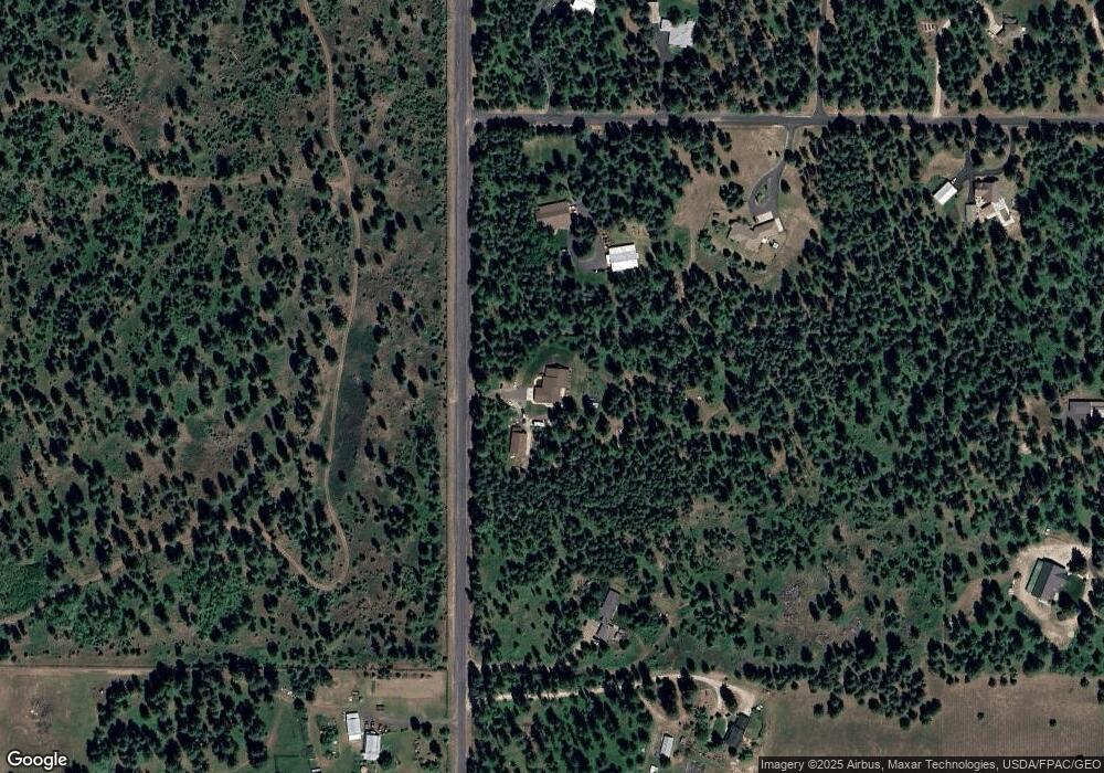
33612 N Missile Site Rd Deer Park, WA 99006
Estimated Value: $924,000 - $1,222,892
5
Beds
4
Baths
6,582
Sq Ft
$162/Sq Ft
Est. Value
About This Home
This home is located at 33612 N Missile Site Rd, Deer Park, WA 99006 and is currently estimated at $1,063,631, approximately $161 per square foot. 33612 N Missile Site Rd is a home located in Spokane County with nearby schools including Deer Park Elementary School, Arcadia Elementary School, and Deer Park Home Link Program.
Ownership History
Date
Name
Owned For
Owner Type
Purchase Details
Closed on
Jan 4, 2011
Sold by
Mccrum Dean B
Bought by
Mccrum Dean B and Mccrum Family Trust
Current Estimated Value
Purchase Details
Closed on
Jul 2, 2010
Sold by
Stratton Kelly J and Stratton Mike
Bought by
Mccrum Dean B
Home Financials for this Owner
Home Financials are based on the most recent Mortgage that was taken out on this home.
Original Mortgage
$200,000
Interest Rate
4.79%
Mortgage Type
New Conventional
Purchase Details
Closed on
Apr 1, 2005
Sold by
Stephens Brain G and Stephens Edith Elaine
Bought by
Stephens John R and Stephens Kim
Purchase Details
Closed on
Sep 13, 2004
Sold by
Moeller Gregory G and Moeller Margaret E
Bought by
Stephens Brian G and Stephens Edith Elaine
Create a Home Valuation Report for This Property
The Home Valuation Report is an in-depth analysis detailing your home's value as well as a comparison with similar homes in the area
Home Values in the Area
Average Home Value in this Area
Purchase History
| Date | Buyer | Sale Price | Title Company |
|---|---|---|---|
| Mccrum Dean B | -- | Pacific Northwest Title | |
| Mccrum Dean B | $380,280 | Stewart Title Of Spokane | |
| Stephens John R | -- | -- | |
| Stephens Brian G | $51,000 | Spokane County Title Co |
Source: Public Records
Mortgage History
| Date | Status | Borrower | Loan Amount |
|---|---|---|---|
| Previous Owner | Mccrum Dean B | $200,000 |
Source: Public Records
Tax History Compared to Growth
Tax History
| Year | Tax Paid | Tax Assessment Tax Assessment Total Assessment is a certain percentage of the fair market value that is determined by local assessors to be the total taxable value of land and additions on the property. | Land | Improvement |
|---|---|---|---|---|
| 2025 | $11,067 | $1,295,000 | $166,000 | $1,129,000 |
| 2024 | $11,067 | $1,230,500 | $161,000 | $1,069,500 |
| 2023 | $8,104 | $1,076,200 | $152,000 | $924,200 |
| 2022 | $7,094 | $886,400 | $128,000 | $758,400 |
| 2021 | $6,414 | $565,700 | $81,000 | $484,700 |
| 2020 | $6,181 | $522,600 | $84,000 | $438,600 |
| 2019 | $5,602 | $476,300 | $80,000 | $396,300 |
| 2018 | $6,240 | $468,200 | $80,000 | $388,200 |
| 2017 | $5,883 | $447,800 | $80,000 | $367,800 |
| 2016 | $5,354 | $396,600 | $80,000 | $316,600 |
| 2015 | $5,153 | $372,000 | $80,000 | $292,000 |
| 2014 | -- | $322,500 | $80,000 | $242,500 |
| 2013 | -- | $0 | $0 | $0 |
Source: Public Records
Map
Nearby Homes
- 914 E Deer Park Milan Rd
- 000 E Deer Park Milan Rd
- 32825 N Perry Rd
- TBD Lot 25 N Vista Point Ln
- Lot 3 N Division Rd
- 2419 E Canter Ln
- 30600 N Mill Rd
- Lot 6 E Westmoreland Rd
- 346XX N Regal Ln
- 717 W Antler Rd
- 31xx E Westmoreland Rd
- 29xxx N Cedar Rd
- 35120 N Regal Ln
- 30628 N Liz Ln
- 127 W Montgomery Rd
- 31515 N Cedar Rd
- 937 N Oasis Ave
- 1821 E A St
- 107 S Braeburn Ave
- 1118 N Country Club Dr
- 616 E Shelter Ln
- 33518 N Missile Site Rd
- 711 E Shelter Ln
- 33402 N Missile Site Rd
- 33415 N Missile Site Rd
- 613 E Shelter Ln
- 908 E Shelter Ln
- 33221 N Missile Site Rd
- 33521 N Charby Ln
- 33412 N Missile Site Rd
- 33219 N Missile Site Rd
- 909 E Shelter Ln
- 33615 N Charby Ln
- 33125 N Missile Site Rd
- 1108 E Shelter Ln
- 33723 N Charby Ln
- 0 No Site Address Unit 29022040
- 1023 E Shelter Ln
- 33042 N Missile Site Rd
- 33029 N Missile Site Rd
