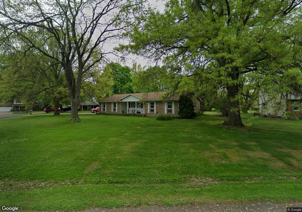
3362 Broad Vista St NW Uniontown, OH 44685
Estimated Value: $257,305 - $350,000
3
Beds
2
Baths
1,540
Sq Ft
$187/Sq Ft
Est. Value
About This Home
This home is located at 3362 Broad Vista St NW, Uniontown, OH 44685 and is currently estimated at $287,826, approximately $186 per square foot. 3362 Broad Vista St NW is a home located in Stark County with nearby schools including Lake Middle/High School, Lake Center Christian School, and Mayfair Christian School.
Ownership History
Date
Name
Owned For
Owner Type
Purchase Details
Closed on
Jul 5, 2002
Sold by
Carpenter Clarence R and Carpenter Dorothy J
Bought by
Shannon Dale and Shannon Patricia
Current Estimated Value
Home Financials for this Owner
Home Financials are based on the most recent Mortgage that was taken out on this home.
Original Mortgage
$119,600
Interest Rate
6.91%
Mortgage Type
Purchase Money Mortgage
Create a Home Valuation Report for This Property
The Home Valuation Report is an in-depth analysis detailing your home's value as well as a comparison with similar homes in the area
Home Values in the Area
Average Home Value in this Area
Purchase History
| Date | Buyer | Sale Price | Title Company |
|---|---|---|---|
| Shannon Dale | $125,900 | Midland Commerce Group |
Source: Public Records
Mortgage History
| Date | Status | Borrower | Loan Amount |
|---|---|---|---|
| Closed | Shannon Dale | $119,600 |
Source: Public Records
Tax History Compared to Growth
Tax History
| Year | Tax Paid | Tax Assessment Tax Assessment Total Assessment is a certain percentage of the fair market value that is determined by local assessors to be the total taxable value of land and additions on the property. | Land | Improvement |
|---|---|---|---|---|
| 2025 | -- | $86,630 | $23,840 | $62,790 |
| 2024 | -- | $86,630 | $23,840 | $62,790 |
| 2023 | $4,120 | $66,720 | $17,890 | $48,830 |
| 2022 | $2,066 | $66,720 | $17,890 | $48,830 |
| 2021 | $4,169 | $66,720 | $17,890 | $48,830 |
| 2020 | $4,021 | $57,060 | $15,440 | $41,620 |
| 2019 | $3,986 | $57,060 | $15,440 | $41,620 |
| 2018 | $4,003 | $57,060 | $15,440 | $41,620 |
| 2017 | $3,939 | $51,770 | $13,760 | $38,010 |
| 2016 | $3,945 | $51,770 | $13,760 | $38,010 |
| 2015 | $3,946 | $51,770 | $13,760 | $38,010 |
| 2014 | $1,586 | $47,260 | $12,570 | $34,690 |
| 2013 | $1,793 | $47,260 | $12,570 | $34,690 |
Source: Public Records
Map
Nearby Homes
- 3310 Linden St NW
- 0 Pine St NW
- 3100 Linden St NW
- 3796 Sweitzer St NW
- 13792 Amodio Ave NW
- 13025 Sunset Cir NW
- 13704 Greenland Ave NW
- 2944 Pontius St NW
- 3979 Northdale St NW
- 13341 Sugar Bush Ave NW
- 2498 Foxfire St NW
- 2771 Superior Dr
- 835 Brodie Ct
- 843 Brodie Ct
- 91 Pontius Rd
- 12494 Bridgemont Ave NW
- 2693 Ledgestone Dr NW
- 2399 Ledgestone Dr NW
- 2455 Ledgestone Dr NW
- 2439 Ledgestone Dr NW
- 3366 Broad Vista St NW
- 13321 Tina Cir NW
- 3300 Broad Vista St NW
- 3351 Broad Vista St NW
- 3323 Broad Vista St NW
- 13318 Tina Cir NW
- 3367 Marquette St NW
- 13328 Tina Cir NW
- 3383 Marquette St NW
- 3343 Marquette St NW
- 3335 Broad Vista St NW
- 3401 Marquette St NW
- 3280 Broad Vista St NW
- 3409 Broad Vista St NW
- 3355 Broad Vista St NW
- 3305 Marquette St NW
- 3353 Broad Vista St NW
- 3409 Broad Vista St NW
- 3427 Marquette St NW
- 13311 Carla Ave NW