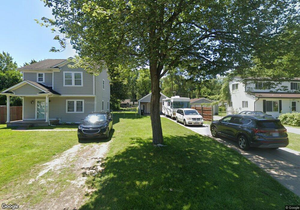
33647 Somerset St Unit Bldg-Unit Westland, MI 48186
Estimated Value: $206,000 - $269,054
--
Bed
2
Baths
1,493
Sq Ft
$163/Sq Ft
Est. Value
About This Home
This home is located at 33647 Somerset St Unit Bldg-Unit, Westland, MI 48186 and is currently estimated at $243,764, approximately $163 per square foot. 33647 Somerset St Unit Bldg-Unit is a home located in Wayne County with nearby schools including Alexander Hamilton Elementary School, Marshall Upper Elementary School, and John Glenn High School.
Ownership History
Date
Name
Owned For
Owner Type
Purchase Details
Closed on
Mar 10, 2023
Sold by
Sjostrom Timothy
Bought by
Williams Amber
Current Estimated Value
Purchase Details
Closed on
Jul 31, 2018
Sold by
81 Marshall Llc
Bought by
Sjostrom Timothy
Purchase Details
Closed on
Jul 19, 2017
Sold by
Ingle Lonnie
Bought by
81 Marshall Llc
Purchase Details
Closed on
Jan 27, 1998
Sold by
Hacker Cecil G and Hacker Janet G
Bought by
Burkeen Gregory R
Create a Home Valuation Report for This Property
The Home Valuation Report is an in-depth analysis detailing your home's value as well as a comparison with similar homes in the area
Home Values in the Area
Average Home Value in this Area
Purchase History
| Date | Buyer | Sale Price | Title Company |
|---|---|---|---|
| Williams Amber | $230,000 | Title One | |
| Sjostrom Timothy | $195,000 | Fidelity National Title | |
| 81 Marshall Llc | $60,000 | Fidelity National Title | |
| Burkeen Gregory R | $40,000 | -- |
Source: Public Records
Tax History Compared to Growth
Tax History
| Year | Tax Paid | Tax Assessment Tax Assessment Total Assessment is a certain percentage of the fair market value that is determined by local assessors to be the total taxable value of land and additions on the property. | Land | Improvement |
|---|---|---|---|---|
| 2025 | $80 | $86,600 | $0 | $0 |
| 2024 | $80 | $86,500 | $0 | $0 |
| 2023 | $2,353 | $77,800 | $0 | $0 |
| 2022 | $2,739 | $70,400 | $0 | $0 |
| 2021 | $2,671 | $65,400 | $0 | $0 |
| 2020 | $2,642 | $57,300 | $0 | $0 |
| 2019 | $2,546 | $50,700 | $0 | $0 |
| 2018 | $2,714 | $44,200 | $0 | $0 |
| 2017 | $632 | $41,800 | $0 | $0 |
| 2016 | $1,595 | $38,200 | $0 | $0 |
| 2015 | $3,045 | $32,430 | $0 | $0 |
| 2013 | $2,998 | $31,000 | $0 | $0 |
| 2012 | $1,525 | $31,340 | $0 | $0 |
Source: Public Records
Map
Nearby Homes
- 711 S Hawthorne St
- 451 Darwin St
- 754 Alvin St
- 00000 Cherry Hill Rd
- 33532 Leona St
- 183 Daniel Ave Unit 6
- 366 S Wildwood St
- 34114 Avondale St
- 232 S Wildwood St
- 360 van Sull St
- 284 S Byfield St
- 34728 Somerset St
- 357 S Dobson St
- 1163 Denice St
- 34610 School St
- 344 S Christine
- 33230 Rosslyn Ave
- 32732 Glen St
- 960 Radcliff St
- 34553 Hazelwood St
- 33647 Somerset St
- 33635 Somerset St
- 33679 Somerset St
- 33646 Hiveley St
- 33658 Hiveley St
- 33670 Hiveley St
- 33634 Hiveley St
- 33615 Somerset St
- 33715 Somerset St
- 33626 Hiveley St
- 33700 Hiveley St
- 33678 Somerset St
- 33712 Hiveley St
- 33706 Somerset St
- 33636 Somerset St
- 33735 Somerset St
- 33724 Hiveley St
- 33608 Hiveley St
- 33722 Somerset St
- 33622 Somerset St