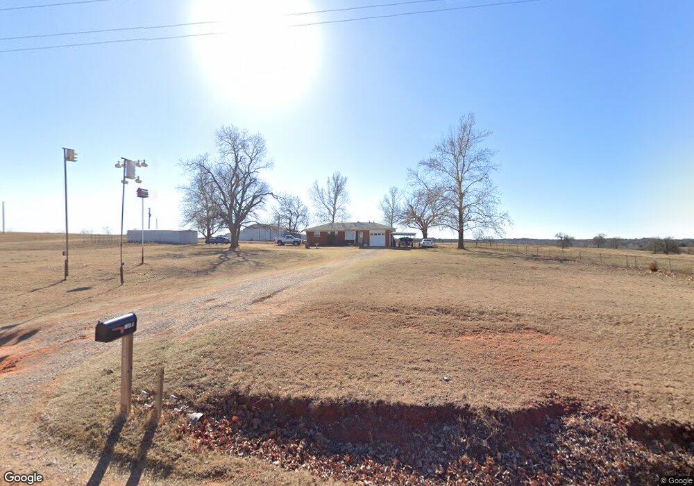
336689 E 930 Rd Wellston, OK 74881
Estimated Value: $132,923 - $200,000
2
Beds
2
Baths
1,172
Sq Ft
$139/Sq Ft
Est. Value
About This Home
This home is located at 336689 E 930 Rd, Wellston, OK 74881 and is currently estimated at $163,231, approximately $139 per square foot. 336689 E 930 Rd is a home located in Lincoln County with nearby schools including Wellston Elementary School, Wellston Middle School, and Wellston High School.
Ownership History
Date
Name
Owned For
Owner Type
Purchase Details
Closed on
Nov 30, 2021
Sold by
Biggs Glen A and Biggs Carol A
Bought by
Biggs Family Trust
Current Estimated Value
Purchase Details
Closed on
Mar 11, 2014
Sold by
Biggs Sheldon and Biggs Glen
Bought by
Biggs Glen A and Biggs Carol A
Home Financials for this Owner
Home Financials are based on the most recent Mortgage that was taken out on this home.
Original Mortgage
$50,000
Interest Rate
4.36%
Mortgage Type
New Conventional
Purchase Details
Closed on
Nov 12, 2004
Sold by
White L Lorene Biggs
Bought by
White L Lorene Biggs Tru
Purchase Details
Closed on
Jan 14, 1982
Sold by
White Carl H and Lorene Biggs
Bought by
White Lorene L and White Carl H
Create a Home Valuation Report for This Property
The Home Valuation Report is an in-depth analysis detailing your home's value as well as a comparison with similar homes in the area
Purchase History
| Date | Buyer | Sale Price | Title Company |
|---|---|---|---|
| Biggs Family Trust | -- | None Listed On Document | |
| Biggs Glen A | $77,000 | None Available | |
| White L Lorene Biggs Tru | -- | -- | |
| White Lorene L | -- | -- |
Source: Public Records
Mortgage History
| Date | Status | Borrower | Loan Amount |
|---|---|---|---|
| Previous Owner | Biggs Glen A | $50,000 |
Source: Public Records
Tax History
| Year | Tax Paid | Tax Assessment Tax Assessment Total Assessment is a certain percentage of the fair market value that is determined by local assessors to be the total taxable value of land and additions on the property. | Land | Improvement |
|---|---|---|---|---|
| 2025 | $657 | $7,445 | $1,939 | $5,506 |
| 2024 | $588 | $7,244 | $1,616 | $5,628 |
| 2023 | $588 | $9,022 | $1,292 | $7,730 |
| 2022 | $562 | $6,802 | $953 | $5,849 |
| 2021 | $538 | $6,478 | $983 | $5,495 |
| 2020 | $522 | $6,170 | $1,042 | $5,128 |
| 2019 | $497 | $5,876 | $981 | $4,895 |
| 2018 | $467 | $5,596 | $963 | $4,633 |
| 2017 | $464 | $5,330 | $985 | $4,345 |
| 2016 | $442 | $5,076 | $833 | $4,243 |
| 2015 | $436 | $4,834 | $801 | $4,033 |
| 2014 | $416 | $4,604 | $411 | $4,193 |
Source: Public Records
Map
Nearby Homes
- 0 S Highway 177
- 335867 E 930 Rd
- 910796 S 3350 Rd
- 940605 S 3350 Rd
- 330633 E 875 Rd
- 337897 E 903
- 0 Oklahoma 66
- 335624 E 960 Rd
- 123 Key Dr
- 0 Hwy 177 Hwy Unit OKC1215954
- 0 Hwy 177 Hwy Unit 1201609
- 0 Hwy 177 Hwy Unit 1201604
- 0 Hwy 177 Hwy Unit 1201602
- 900690 S Oak Ridge Dr
- 337248 E Pecan Meadows Ln
- 332913 E 930 Rd
- 102 Ash St
- 960964 S Hoot Owl Ln
- 201 Dogwood Ave
- 960402 S 3340 Rd
- 336817 E 930 Rd
- 930297 S Pilot Dr
- 930242 S Pilot Dr
- 930335 S Pilot Dr
- 930344 S Pilot Dr
- 0 S Pilot Dr Unit 1014888
- 337076 E 930 Rd
- 920720 S 3370 Rd
- 930533 S 3370 Rd
- 930400 S Highway 177
- 336057 E 930 Rd
- 930658 S 3370 Rd
- 930804 S Highway 177
- 930235 S Highway 177
- 930514 S 3360 Rd
- 930849 S 3370 Rd
- 940034 S Highway 177
Your Personal Tour Guide
Ask me questions while you tour the home.