Estimated Value: $53,000 - $65,000
--
Bed
--
Bath
--
Sq Ft
6,098
Sq Ft Lot
About This Home
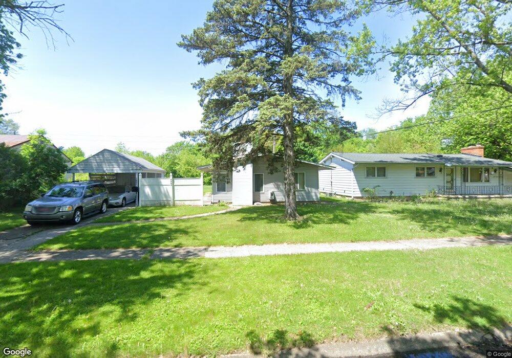
This home is located at 3367 Maywood Dr, Flint, MI 48504 and is currently estimated at $57,247. 3367 Maywood Dr is a home located in Genesee County with nearby schools including Col. Donald McMonagle Elementary School, Hamady Community Middle/High School, and Eagle's Nest Academy.
Ownership History
Date
Name
Owned For
Owner Type
Purchase Details
Closed on
Aug 1, 2024
Sold by
Thomas Alana G and Thompson Rondal J
Bought by
Thomas Alana G and Thompson Tasheena T
Current Estimated Value
Purchase Details
Closed on
Jun 3, 2013
Sold by
Huddleston Terri M and Workmon Tina C
Bought by
Workkmon Tina C and Huddleston Teresa L
Purchase Details
Closed on
Oct 18, 2007
Sold by
Huddleston Terri M and Thompson Terri M
Bought by
Huddleston Terri M and Workmon Tina C
Purchase Details
Closed on
Aug 14, 2006
Sold by
Federal Home Loan Mortgage Corporation
Bought by
Thompson Terri M
Purchase Details
Closed on
Sep 14, 2005
Sold by
Tyler Lisa and Tyler Larry M
Bought by
Federal Home Loan Mortgage Corporation
Create a Home Valuation Report for This Property
The Home Valuation Report is an in-depth analysis detailing your home's value as well as a comparison with similar homes in the area
Home Values in the Area
Average Home Value in this Area
Purchase History
| Date | Buyer | Sale Price | Title Company |
|---|---|---|---|
| Thomas Alana G | -- | None Listed On Document | |
| Workkmon Tina C | -- | None Available | |
| Huddleston Terri M | -- | None Available | |
| Thompson Terri M | $20,200 | First American Title Ins Co | |
| Federal Home Loan Mortgage Corporation | $37,790 | -- |
Source: Public Records
Tax History Compared to Growth
Tax History
| Year | Tax Paid | Tax Assessment Tax Assessment Total Assessment is a certain percentage of the fair market value that is determined by local assessors to be the total taxable value of land and additions on the property. | Land | Improvement |
|---|---|---|---|---|
| 2025 | $1,086 | $23,800 | $0 | $0 |
| 2024 | $245 | $21,300 | $0 | $0 |
| 2023 | $165 | $17,600 | $0 | $0 |
| 2022 | $728 | $17,000 | $0 | $0 |
| 2021 | $724 | $18,500 | $0 | $0 |
| 2020 | $151 | $18,500 | $0 | $0 |
| 2019 | $149 | $18,000 | $0 | $0 |
| 2018 | $664 | $15,400 | $0 | $0 |
| 2017 | $642 | $15,600 | $0 | $0 |
| 2016 | $637 | $15,400 | $0 | $0 |
| 2015 | $498 | $12,100 | $0 | $0 |
| 2014 | $155 | $13,500 | $0 | $0 |
| 2012 | -- | $14,500 | $14,500 | $0 |
Source: Public Records
Map
Nearby Homes
- 3330 Maywood Dr
- 2118 Santa Barbara Dr
- 1913 Cherrylawn Dr
- 4201 Winona St
- 5106 Cloverlawn Dr
- 3145 Raywood St
- 3084 Roanoke St
- 3819 Brownell Blvd
- 1621 Shamrock Ln
- 3617 Kellar Ave
- VL W Parkway Ave
- 1902 Marlowe Dr
- 1720 Marlowe Dr
- 5620 Marlowe Dr
- 5616 Griggs Dr
- 5806 Marlowe Dr
- 3412 Comstock Ave
- 1705 W Pasadena Ave
- 0 Gracelawn Ave
- 3420 Fleming Rd
- 3361 Maywood Dr
- 3373 Maywood Dr
- 3355 Maywood Dr
- 3366 Maywood Dr
- 3360 Maywood Dr
- 3349 Maywood Dr
- 3354 Maywood Dr Unit Bldg-Unit
- 3354 Maywood Dr
- 3064 Canterbury Ln
- 3058 Canterbury Ln
- 3348 Maywood Dr
- 3343 Maywood Dr
- 3052 Canterbury Ln
- 3037 Canterbury Ln
- 3046 Canterbury Ln
- 3342 Maywood Dr
- 3337 Maywood Dr
- 3040 Canterbury Ln
- 3336 Maywood Dr
- 3331 Maywood Dr