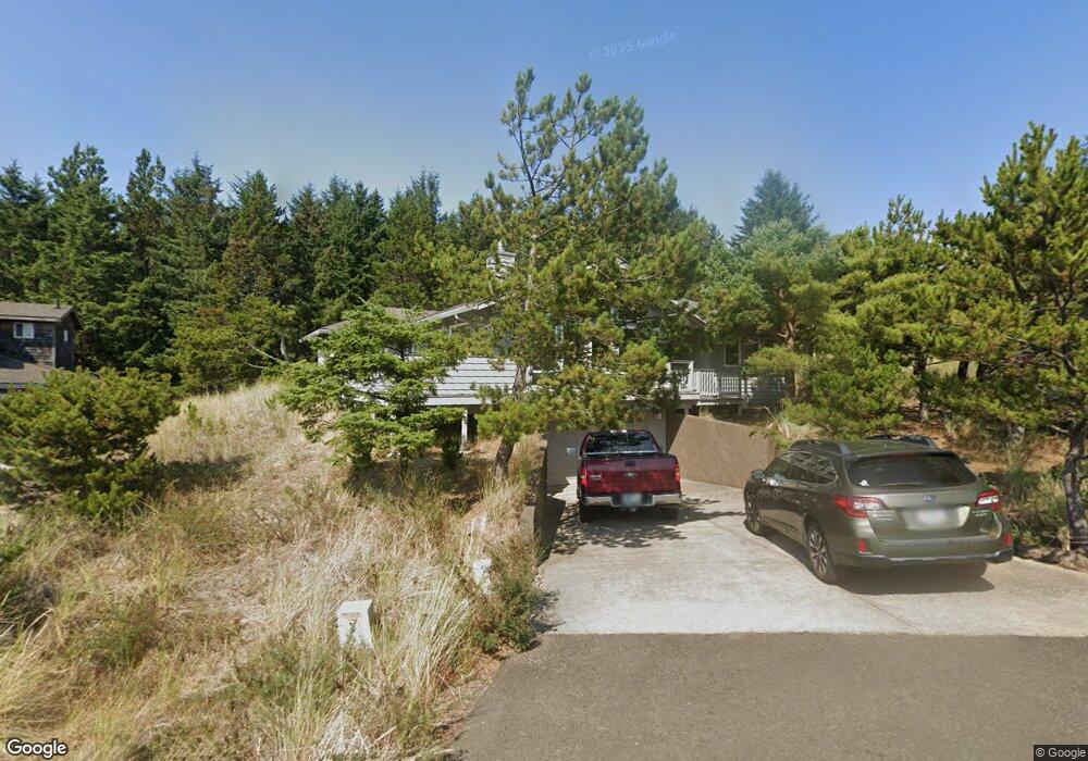
33690 High Tide Rd Cloverdale, OR 97112
Estimated Value: $574,000 - $1,018,000
2
Beds
2
Baths
2,103
Sq Ft
$407/Sq Ft
Est. Value
About This Home
This home is located at 33690 High Tide Rd, Cloverdale, OR 97112 and is currently estimated at $855,287, approximately $406 per square foot. 33690 High Tide Rd is a home located in Tillamook County with nearby schools including Nestucca K-8 School and Nestucca High School.
Ownership History
Date
Name
Owned For
Owner Type
Purchase Details
Closed on
Oct 29, 2024
Sold by
Tigner Calvin K and Tigner Peggy P
Bought by
Calvin Margret Tigner Revocable Living Trust and Tigner
Current Estimated Value
Purchase Details
Closed on
Apr 9, 2018
Sold by
Katz Susan F
Bought by
Tigner Calvin K and Tigner Peggy P
Home Financials for this Owner
Home Financials are based on the most recent Mortgage that was taken out on this home.
Original Mortgage
$363,300
Interest Rate
4.43%
Mortgage Type
New Conventional
Purchase Details
Closed on
Dec 21, 2006
Sold by
Katz Susan F
Bought by
Katz Susan F and Jack H Fellman Q-Tip Trust
Create a Home Valuation Report for This Property
The Home Valuation Report is an in-depth analysis detailing your home's value as well as a comparison with similar homes in the area
Home Values in the Area
Average Home Value in this Area
Purchase History
| Date | Buyer | Sale Price | Title Company |
|---|---|---|---|
| Calvin Margret Tigner Revocable Living Trust | -- | None Listed On Document | |
| Calvin Margret Tigner Revocable Living Trust | -- | None Listed On Document | |
| Tigner Calvin K | $519,000 | Ticor Title | |
| Katz Susan F | -- | None Available |
Source: Public Records
Mortgage History
| Date | Status | Borrower | Loan Amount |
|---|---|---|---|
| Previous Owner | Tigner Calvin K | $363,300 |
Source: Public Records
Tax History Compared to Growth
Tax History
| Year | Tax Paid | Tax Assessment Tax Assessment Total Assessment is a certain percentage of the fair market value that is determined by local assessors to be the total taxable value of land and additions on the property. | Land | Improvement |
|---|---|---|---|---|
| 2024 | $5,452 | $446,310 | $145,320 | $300,990 |
| 2023 | $5,415 | $433,320 | $141,090 | $292,230 |
| 2022 | $5,226 | $420,700 | $136,990 | $283,710 |
| 2021 | $5,104 | $408,450 | $133,010 | $275,440 |
| 2020 | $4,982 | $396,560 | $129,140 | $267,420 |
| 2019 | $4,874 | $385,010 | $125,380 | $259,630 |
| 2018 | $4,477 | $373,800 | $121,730 | $252,070 |
| 2017 | $4,097 | $362,920 | $118,180 | $244,740 |
| 2016 | $4,028 | $352,350 | $114,740 | $237,610 |
| 2015 | $3,938 | $342,090 | $111,390 | $230,700 |
| 2014 | $3,860 | $332,130 | $108,150 | $223,980 |
| 2013 | -- | $322,460 | $105,000 | $217,460 |
Source: Public Records
Map
Nearby Homes
- 34475 Brooten Rd
- 5950 Neptune Dr
- 34320 Cape Kiwanda Dr
- 5904 Barefoot Ln
- 5930 Summerhouse Ln
- 34270 Sea Swallow Dr
- 0 Dory Pointe Loop Unit TL8100 229390931
- 6925 Parker St
- 5706 Four Sisters Ln
- 5685 Barefoot Ln
- 33520 Cape Kiwanda Dr
- 6415 Dory Pointe Loop
- 6930 Parker St
- 5755 Barefoot Ln
- 33495 Cape Kiwanda Dr
- TL8100 Dory Pointe Loop
- 33515 Madrona Dr
- 34700 Hill St
- TL 2714 Tent St
- 33480 Ferry St
- 33700 High Tide Dr
- 33690 High Tide Dr
- 0 High Tide Rd Unit 8016576
- 0 High Tide Rd Unit 65 11573781
- 0 High Tide Rd Unit 69
- 33670 High Tide Dr
- 33670 High Tide Dr
- 33750 High Tide Dr
- 33750 High Tide Dr
- 33660 High Tide Dr
- 33705 High Tide Dr
- 6705 Nestucca Ridge Rd
- 33650 High Tide Rd
- 33685 High Tide Rd
- 33650 High Tide Dr
- 33685 High Tide Dr
- 0 Tl5300nestucca Ridge Rd Unit 14631085
- Lot 69 High Tide Dr
- 33820 Rip Tide Dr
- 6755 Nestucca Ridge Rd