Estimated Value: $448,000 - $488,000
4
Beds
2
Baths
2,714
Sq Ft
$175/Sq Ft
Est. Value
About This Home
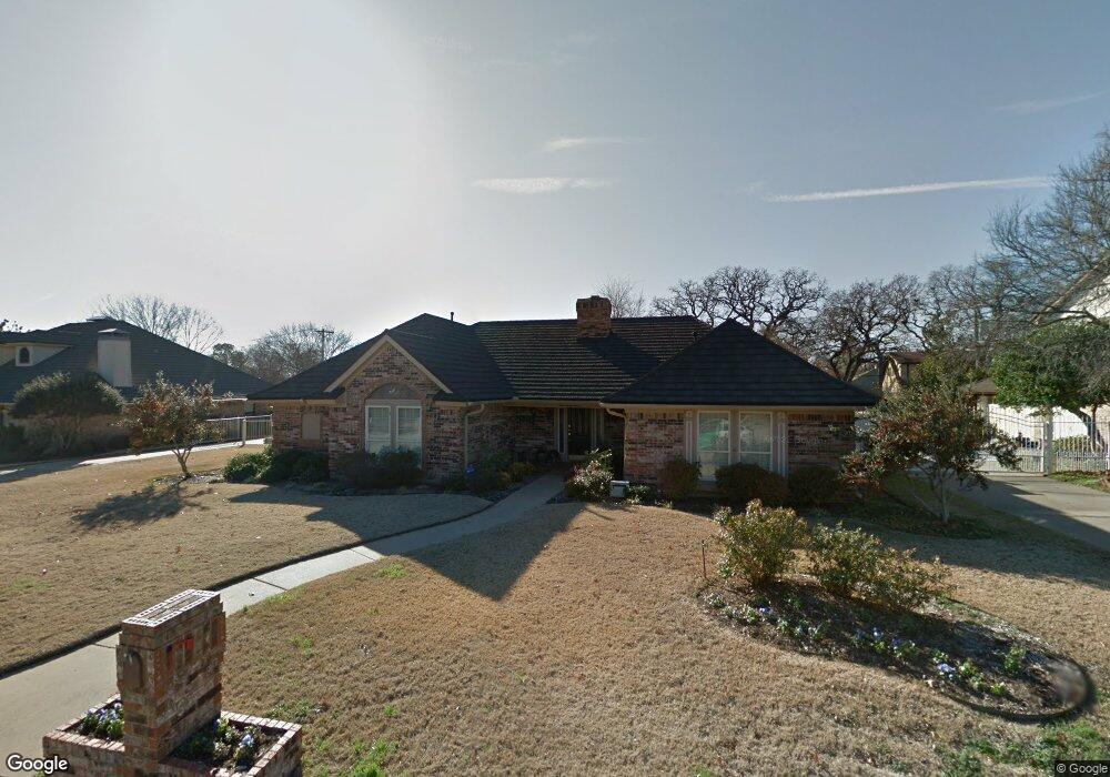
This home is located at 337 Charleston Place, Hurst, TX 76054 and is currently estimated at $473,861, approximately $174 per square foot. 337 Charleston Place is a home located in Tarrant County with nearby schools including Shady Oaks Elementary School, Bedford Junior High School, and L.D. Bell High School.
Ownership History
Date
Name
Owned For
Owner Type
Purchase Details
Closed on
May 12, 1997
Sold by
Mayer Danny Ray and Mayer Susan
Bought by
Cyrier Mark A and Cyrier Sherrie L
Current Estimated Value
Home Financials for this Owner
Home Financials are based on the most recent Mortgage that was taken out on this home.
Original Mortgage
$141,200
Interest Rate
8.17%
Create a Home Valuation Report for This Property
The Home Valuation Report is an in-depth analysis detailing your home's value as well as a comparison with similar homes in the area
Home Values in the Area
Average Home Value in this Area
Purchase History
| Date | Buyer | Sale Price | Title Company |
|---|---|---|---|
| Cyrier Mark A | -- | Alamo Title Co |
Source: Public Records
Mortgage History
| Date | Status | Borrower | Loan Amount |
|---|---|---|---|
| Closed | Cyrier Mark A | $141,200 |
Source: Public Records
Tax History Compared to Growth
Tax History
| Year | Tax Paid | Tax Assessment Tax Assessment Total Assessment is a certain percentage of the fair market value that is determined by local assessors to be the total taxable value of land and additions on the property. | Land | Improvement |
|---|---|---|---|---|
| 2025 | $6,833 | $405,195 | $80,000 | $325,195 |
| 2024 | $6,833 | $431,059 | $80,000 | $351,059 |
| 2023 | $7,733 | $418,188 | $55,000 | $363,188 |
| 2022 | $8,079 | $360,000 | $55,000 | $305,000 |
| 2021 | $7,694 | $345,360 | $55,000 | $290,360 |
| 2020 | $6,977 | $290,000 | $55,000 | $235,000 |
| 2019 | $6,959 | $290,000 | $55,000 | $235,000 |
| 2018 | $5,645 | $258,500 | $55,000 | $203,500 |
| 2017 | $6,559 | $273,486 | $40,000 | $233,486 |
| 2016 | $5,962 | $235,647 | $40,000 | $195,647 |
| 2015 | $5,083 | $214,200 | $20,100 | $194,100 |
| 2014 | $5,083 | $214,200 | $20,100 | $194,100 |
Source: Public Records
Map
Nearby Homes
- 440 W Louella Dr
- 520 Baker Dr
- 421 Cavender Ct
- 100 Hillview Ct
- 425 W Pleasantview Dr
- 121 Kay Ct
- 124 Jeannie Ct
- 229 Brookview Dr
- 1732 Jeannie Ln
- 608 W Pleasantview Dr
- 521 Brookview Dr
- 432 Sunnybrook Ct
- 2212 Hurstview Dr
- 1625 Oak Creek Dr
- 113 Sunnyvale Terrace
- 404 Heather Ln
- 1352 Simpson Dr
- 1740 Brown Trail
- 1337 Harrison Ln
- 2244 Hurstview Dr
- 333 Charleston Place
- 332 Mayfair Dr
- 336 Mayfair Dr
- 328 Mayfair Dr
- 336 Charleston Place
- 340 Charleston Place
- 345 Charleston Place
- 324 Mayfair Dr
- 344 Mayfair Dr
- 329 Charleston Place
- 344 Charleston Place
- 337 Mayfair Dr
- 316 Charleston Place
- 333 Mayfair Dr
- 341 Mayfair Dr
- 320 Mayfair Dr
- 329 Mayfair Dr
- 325 Charleston Place
- 321 Charleston Place
- 325 Mayfair Dr