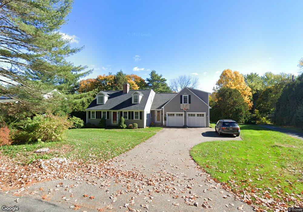
337 Conant Rd Weston, MA 02493
Estimated Value: $1,326,000 - $1,596,000
4
Beds
3
Baths
2,474
Sq Ft
$593/Sq Ft
Est. Value
About This Home
This home is located at 337 Conant Rd, Weston, MA 02493 and is currently estimated at $1,467,348, approximately $593 per square foot. 337 Conant Rd is a home located in Middlesex County with nearby schools including Country Elementary School, Woodland Elementary School, and Weston Middle School.
Ownership History
Date
Name
Owned For
Owner Type
Purchase Details
Closed on
Nov 3, 2023
Sold by
Osborn Henry C and Osborn Sara T
Bought by
Henry C Osborn Iv Ret and Osborn
Current Estimated Value
Purchase Details
Closed on
Jul 24, 1996
Sold by
Watkins Alan M and Watkins Christine
Bought by
Osborn Henry and Osborn Sara
Create a Home Valuation Report for This Property
The Home Valuation Report is an in-depth analysis detailing your home's value as well as a comparison with similar homes in the area
Home Values in the Area
Average Home Value in this Area
Purchase History
| Date | Buyer | Sale Price | Title Company |
|---|---|---|---|
| Henry C Osborn Iv Ret | -- | None Available | |
| Henry C Osborn Iv Ret | -- | None Available | |
| Henry C Osborn Iv Ret | -- | None Available | |
| Osborn Henry | $307,500 | -- | |
| Osborn Henry | $307,500 | -- |
Source: Public Records
Mortgage History
| Date | Status | Borrower | Loan Amount |
|---|---|---|---|
| Previous Owner | Osborn Henry | $405,600 | |
| Previous Owner | Osborn Henry | $410,000 |
Source: Public Records
Tax History Compared to Growth
Tax History
| Year | Tax Paid | Tax Assessment Tax Assessment Total Assessment is a certain percentage of the fair market value that is determined by local assessors to be the total taxable value of land and additions on the property. | Land | Improvement |
|---|---|---|---|---|
| 2025 | $12,240 | $1,102,700 | $679,100 | $423,600 |
| 2024 | $12,135 | $1,091,300 | $680,000 | $411,300 |
| 2023 | $12,035 | $1,016,500 | $680,000 | $336,500 |
| 2022 | $11,995 | $936,400 | $652,200 | $284,200 |
| 2021 | $8,059 | $889,700 | $618,300 | $271,400 |
| 2020 | $5,429 | $869,400 | $618,300 | $251,100 |
| 2019 | $10,149 | $806,100 | $572,500 | $233,600 |
| 2018 | $10,084 | $806,100 | $572,500 | $233,600 |
| 2017 | $9,996 | $806,100 | $572,500 | $233,600 |
| 2016 | $9,802 | $806,100 | $572,500 | $233,600 |
| 2015 | $8,542 | $695,600 | $473,800 | $221,800 |
Source: Public Records
Map
Nearby Homes
- 345 Conant Rd
- 345 Conant Rd Unit 345
- 335 Conant Rd
- 333 Conant Rd Unit A
- 333 Conant Rd
- 331 Conant Rd
- 338 Conant Rd
- 334 Conant Rd
- 342 Conant Rd
- 0 Conant Rd L:2
- 332 Conant Rd
- 59 Bradyll Rd
- 352 Conant Rd
- 352 Conant Rd
- 352 Conant Rd Unit 352
- 352 Conant Rd Unit 1
- 365 Conant Rd
- 325 Conant Rd
- 58 Bradyll Rd
- 367 Conant Rd