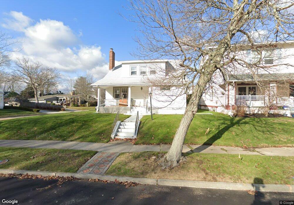
337 Euclid Ave Allenhurst, NJ 07711
Estimated Value: $2,317,000 - $2,982,000
3
Beds
2
Baths
1,816
Sq Ft
$1,480/Sq Ft
Est. Value
About This Home
This home is located at 337 Euclid Ave, Allenhurst, NJ 07711 and is currently estimated at $2,688,555, approximately $1,480 per square foot. 337 Euclid Ave is a home located in Monmouth County with nearby schools including Ocean Township High School, Hope Academy Charter School, and St. Mary of the Assumption School.
Ownership History
Date
Name
Owned For
Owner Type
Purchase Details
Closed on
Aug 16, 2021
Sold by
C & C Asbury Development Llc
Bought by
Dweck Mylo
Current Estimated Value
Home Financials for this Owner
Home Financials are based on the most recent Mortgage that was taken out on this home.
Original Mortgage
$783,750
Outstanding Balance
$710,038
Interest Rate
2.8%
Mortgage Type
New Conventional
Estimated Equity
$1,978,517
Purchase Details
Closed on
Jan 29, 2021
Sold by
Blum Gary and Blum Cynthia Bradshaw
Bought by
C & C Asbury Development Llc
Purchase Details
Closed on
Oct 27, 2018
Sold by
Blum Gary and The Estate Of Sherry Lichtman
Bought by
Blum Gary and Blum Cynthia Bradshaw
Create a Home Valuation Report for This Property
The Home Valuation Report is an in-depth analysis detailing your home's value as well as a comparison with similar homes in the area
Home Values in the Area
Average Home Value in this Area
Purchase History
| Date | Buyer | Sale Price | Title Company |
|---|---|---|---|
| Dweck Mylo | $1,250,000 | Title Link Llc | |
| C & C Asbury Development Llc | $995,000 | All Ahead Title | |
| Blum Gary | -- | All Jersey Title Llc |
Source: Public Records
Mortgage History
| Date | Status | Borrower | Loan Amount |
|---|---|---|---|
| Open | Dweck Mylo | $783,750 |
Source: Public Records
Tax History
| Year | Tax Paid | Tax Assessment Tax Assessment Total Assessment is a certain percentage of the fair market value that is determined by local assessors to be the total taxable value of land and additions on the property. | Land | Improvement |
|---|---|---|---|---|
| 2025 | $10,930 | $3,237,900 | $1,524,200 | $1,713,700 |
| 2024 | $5,822 | $3,019,400 | $1,385,400 | $1,634,000 |
| 2023 | $5,822 | $1,512,100 | $1,204,500 | $307,600 |
| 2022 | $7,163 | $1,223,700 | $960,000 | $263,700 |
| 2021 | $7,163 | $1,094,100 | $768,400 | $325,700 |
| 2020 | $7,304 | $1,037,500 | $731,400 | $306,100 |
| 2019 | $7,498 | $813,200 | $572,200 | $241,000 |
| 2018 | $8,069 | $794,200 | $559,700 | $234,500 |
| 2017 | $9,906 | $659,100 | $450,700 | $208,400 |
| 2016 | $13,135 | $611,800 | $479,000 | $132,800 |
| 2015 | $12,541 | $607,900 | $479,000 | $128,900 |
| 2014 | $11,977 | $595,000 | $479,000 | $116,000 |
Source: Public Records
Map
Nearby Homes
- 309 Hume St
- 315 Allen Ave
- 510 Deal Lake Dr Unit 8J
- 500 Deal Lake Dr Unit 5E
- 400 Deal Lake Dr Unit 3J
- 400 Deal Lake Dr Unit 6G
- 400 Deal Lake Dr Unit 2L
- 400 Deal Lake Dr Unit 8F
- 400 Deal Lake Dr Unit 7H & 7G
- 400 Deal Lake Dr Unit 6E
- 400 Deal Lake Dr Unit 4B
- 400 Deal Lake Dr Unit 3K
- 1702 Grand Ave
- 205 Edgemont Dr Unit 1
- 205 Edgemont Dr Unit 2
- 205 Edgemont Dr Unit 3
- 205 Edgemont Dr Unit BUILDING
- 1701 Park Ave Unit 2C
- 1706 Park Ave Unit 2d
- 505 8th Ave
Your Personal Tour Guide
Ask me questions while you tour the home.