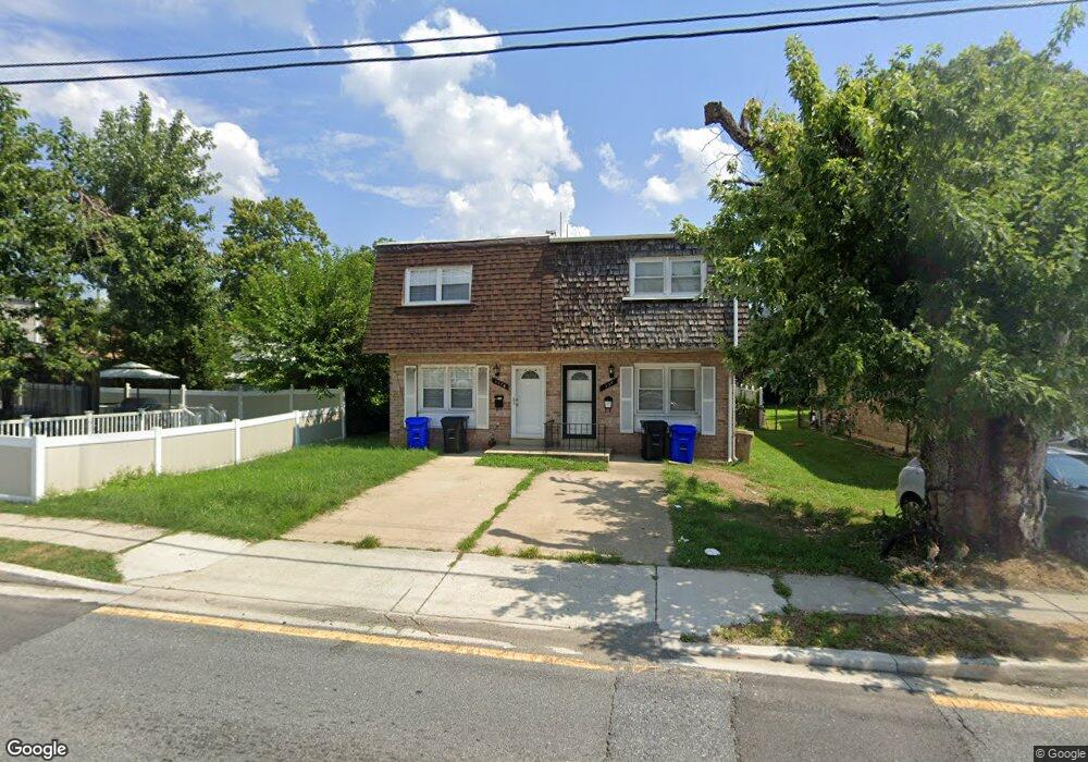
337 Gorman Ave Laurel, MD 20707
Estimated Value: $240,000 - $357,000
--
Bed
2
Baths
1,216
Sq Ft
$248/Sq Ft
Est. Value
About This Home
This home is located at 337 Gorman Ave, Laurel, MD 20707 and is currently estimated at $301,866, approximately $248 per square foot. 337 Gorman Ave is a home located in Prince George's County with nearby schools including Laurel Elementary School, Laurel High School, and Julia Brown Montessori Schools.
Ownership History
Date
Name
Owned For
Owner Type
Purchase Details
Closed on
Jun 5, 2007
Sold by
Harley Philip
Bought by
Springer Farah
Current Estimated Value
Home Financials for this Owner
Home Financials are based on the most recent Mortgage that was taken out on this home.
Original Mortgage
$139,500
Outstanding Balance
$85,177
Interest Rate
6.24%
Mortgage Type
Purchase Money Mortgage
Estimated Equity
$216,689
Purchase Details
Closed on
May 18, 2007
Sold by
Harley Philip
Bought by
Springer Farah
Home Financials for this Owner
Home Financials are based on the most recent Mortgage that was taken out on this home.
Original Mortgage
$139,500
Outstanding Balance
$85,177
Interest Rate
6.24%
Mortgage Type
Purchase Money Mortgage
Estimated Equity
$216,689
Purchase Details
Closed on
Apr 7, 2000
Sold by
Tajudeen Henry
Bought by
Harley Philip
Purchase Details
Closed on
Apr 16, 1999
Sold by
Secretary Of H U D
Bought by
Tajudeen Henry
Purchase Details
Closed on
Nov 9, 1998
Sold by
Brvenik David E and Brvenik Deborah S
Bought by
Secretary Of H U D and Union Center Plaza Phase Ii
Create a Home Valuation Report for This Property
The Home Valuation Report is an in-depth analysis detailing your home's value as well as a comparison with similar homes in the area
Home Values in the Area
Average Home Value in this Area
Purchase History
| Date | Buyer | Sale Price | Title Company |
|---|---|---|---|
| Springer Farah | $155,000 | -- | |
| Springer Farah | $155,000 | -- | |
| Harley Philip | $98,000 | -- | |
| Tajudeen Henry | $75,101 | -- | |
| Secretary Of H U D | $79,307 | -- |
Source: Public Records
Mortgage History
| Date | Status | Borrower | Loan Amount |
|---|---|---|---|
| Open | Springer Farah | $139,500 | |
| Closed | Springer Farah | $139,500 |
Source: Public Records
Tax History Compared to Growth
Tax History
| Year | Tax Paid | Tax Assessment Tax Assessment Total Assessment is a certain percentage of the fair market value that is determined by local assessors to be the total taxable value of land and additions on the property. | Land | Improvement |
|---|---|---|---|---|
| 2025 | $4,766 | $263,900 | $100,000 | $163,900 |
| 2024 | $4,766 | $255,967 | $0 | $0 |
| 2023 | $4,592 | $248,033 | $0 | $0 |
| 2022 | $4,406 | $240,100 | $100,000 | $140,100 |
| 2021 | $4,377 | $240,100 | $100,000 | $140,100 |
| 2020 | $4,375 | $240,100 | $100,000 | $140,100 |
| 2019 | $5,000 | $274,500 | $75,000 | $199,500 |
| 2018 | $4,529 | $248,000 | $0 | $0 |
| 2017 | $4,063 | $221,500 | $0 | $0 |
| 2016 | -- | $195,000 | $0 | $0 |
| 2015 | $3,206 | $191,467 | $0 | $0 |
| 2014 | $3,206 | $187,933 | $0 | $0 |
Source: Public Records
Map
Nearby Homes
- 410 Carroll Ave
- 1000 8th St
- 413 Montgomery St
- 103 Irving St
- 1004 Marton St
- 612 9th St
- 120 2nd St
- 610 Main St Unit 413
- 19 Post Office Ave Unit 203
- 1002 West Ct
- 9560 Cissell Ave
- 14604 Bowie Rd
- 14902 Ashford Place
- 1106 Snowden Place
- 9268 Cherry Ln Unit 62
- 200 1/2 11th St
- 8112 Fenwick Ct
- 1103 Montgomery St
- 1210 Westview Terrace
- Lot 5 Cissell Ave