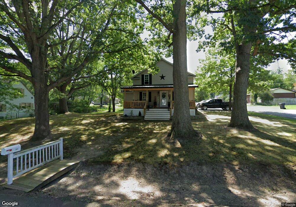
337 Harding Rd Mansfield, OH 44906
Estimated Value: $100,000 - $130,000
4
Beds
1
Bath
1,300
Sq Ft
$91/Sq Ft
Est. Value
About This Home
This home is located at 337 Harding Rd, Mansfield, OH 44906 and is currently estimated at $118,331, approximately $91 per square foot. 337 Harding Rd is a home located in Richland County with nearby schools including Foundation Academy, Mansfield Elective Academy, and Interactive Media & Construction (IMAC) Academy.
Ownership History
Date
Name
Owned For
Owner Type
Purchase Details
Closed on
Oct 14, 2016
Sold by
Caudell Douglas
Bought by
Duncaryn Christina
Current Estimated Value
Purchase Details
Closed on
Jan 13, 2012
Sold by
Tolley Charles
Bought by
Caudell Christina
Purchase Details
Closed on
May 24, 2011
Sold by
Estate Of Rose Mary Tolley
Bought by
Tolley Charles
Purchase Details
Closed on
Jul 24, 1991
Sold by
Harrington Ralph B
Bought by
Duncan Rose Mary
Create a Home Valuation Report for This Property
The Home Valuation Report is an in-depth analysis detailing your home's value as well as a comparison with similar homes in the area
Home Values in the Area
Average Home Value in this Area
Purchase History
| Date | Buyer | Sale Price | Title Company |
|---|---|---|---|
| Duncaryn Christina | -- | Attorney | |
| Caudell Christina | $1,625 | Attorney | |
| Tolley Charles | -- | Attorney | |
| Duncan Rose Mary | $13,000 | -- |
Source: Public Records
Tax History
| Year | Tax Paid | Tax Assessment Tax Assessment Total Assessment is a certain percentage of the fair market value that is determined by local assessors to be the total taxable value of land and additions on the property. | Land | Improvement |
|---|---|---|---|---|
| 2024 | $829 | $18,100 | $2,250 | $15,850 |
| 2023 | $848 | $18,100 | $2,250 | $15,850 |
| 2022 | $754 | $13,500 | $2,000 | $11,500 |
| 2021 | $760 | $13,500 | $2,000 | $11,500 |
| 2020 | $777 | $13,500 | $2,000 | $11,500 |
| 2019 | $861 | $13,500 | $2,000 | $11,500 |
| 2018 | $849 | $13,500 | $2,000 | $11,500 |
| 2017 | $826 | $13,500 | $2,000 | $11,500 |
| 2016 | $918 | $14,550 | $1,900 | $12,650 |
| 2015 | $918 | $14,550 | $1,900 | $12,650 |
| 2014 | $866 | $14,550 | $1,900 | $12,650 |
| 2012 | $660 | $14,550 | $2,000 | $12,550 |
Source: Public Records
Map
Nearby Homes
- 640 Hanna Rd
- 0 Highway 30
- 891 Springmill Rd
- 739 Armstrong St
- 1077 Benedict Ave
- 1501 Bowman St
- 572 France St
- 701 Springmill St
- 878 Fairfax Ave
- 118 Raymond Ave
- 641 Averill Ave
- 933 Fairfax Ave
- 1087 Fairfax Ave
- 580 N Mulberry St
- 492 Stark St
- 524 Lida St
- 1101 Lenox Ave
- 0 State Route 314 Unit 9069650
- 1092 N Trimble Rd
- 688 Mcpherson St
- 327 Harding Rd
- 336 Harding Rd
- 324 Pomerene Rd
- 317 Harding Rd
- 353 Harding Rd
- 346 Pomerene Rd
- 326 Harding Rd
- 322 Pomerene Rd
- 275 Tower Dr
- 346 Harding Rd
- 357 Harding Rd
- 352 Pomerene Rd
- 352 Harding Rd
- 316 Pomerene Rd
- 313 Harding Rd
- 363 Harding Rd
- 312 Pomerene Rd
- 356 Harding Rd
- 0 Pomerene Rd
- 337 Pomerene Rd
Your Personal Tour Guide
Ask me questions while you tour the home.