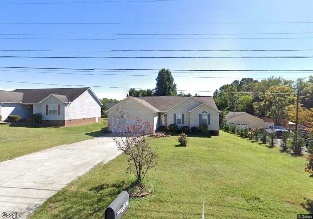
337 Jarrett Rd Thomasville, NC 27360
Estimated Value: $242,000 - $267,000
3
Beds
2
Baths
1,965
Sq Ft
$129/Sq Ft
Est. Value
About This Home
This home is located at 337 Jarrett Rd, Thomasville, NC 27360 and is currently estimated at $252,663, approximately $128 per square foot. 337 Jarrett Rd is a home located in Davidson County with nearby schools including Fair Grove Elementary School, E. Lawson Brown Middle School, and East Davidson High School.
Ownership History
Date
Name
Owned For
Owner Type
Purchase Details
Closed on
Jun 6, 2007
Sold by
Branch Banking & Trust Co
Bought by
Mcclary Ursula K
Current Estimated Value
Home Financials for this Owner
Home Financials are based on the most recent Mortgage that was taken out on this home.
Original Mortgage
$112,100
Outstanding Balance
$68,482
Interest Rate
6.16%
Mortgage Type
Purchase Money Mortgage
Estimated Equity
$184,181
Purchase Details
Closed on
Dec 8, 2006
Sold by
Hodges Jeffrey Keith and Hodges Deborah Sue
Bought by
Branch Banking & Trust Co
Purchase Details
Closed on
Jul 14, 2000
Sold by
Doug Cranford Construction Inc
Bought by
Hodges Jeffrey Keith and Hodges Deborah
Purchase Details
Closed on
Jun 1, 1998
Create a Home Valuation Report for This Property
The Home Valuation Report is an in-depth analysis detailing your home's value as well as a comparison with similar homes in the area
Home Values in the Area
Average Home Value in this Area
Purchase History
| Date | Buyer | Sale Price | Title Company |
|---|---|---|---|
| Mcclary Ursula K | $118,000 | None Available | |
| Branch Banking & Trust Co | $38,816 | None Available | |
| Hodges Jeffrey Keith | $107,500 | -- | |
| -- | $34,500 | -- |
Source: Public Records
Mortgage History
| Date | Status | Borrower | Loan Amount |
|---|---|---|---|
| Open | Mcclary Ursula K | $112,100 |
Source: Public Records
Tax History Compared to Growth
Tax History
| Year | Tax Paid | Tax Assessment Tax Assessment Total Assessment is a certain percentage of the fair market value that is determined by local assessors to be the total taxable value of land and additions on the property. | Land | Improvement |
|---|---|---|---|---|
| 2025 | $1,553 | $135,940 | $0 | $0 |
| 2024 | $1,553 | $135,940 | $0 | $0 |
| 2023 | $1,553 | $135,940 | $0 | $0 |
| 2022 | $1,553 | $135,940 | $0 | $0 |
| 2021 | $1,553 | $135,940 | $0 | $0 |
| 2020 | $1,256 | $111,820 | $0 | $0 |
| 2019 | $1,275 | $111,820 | $0 | $0 |
| 2018 | $1,275 | $111,820 | $0 | $0 |
| 2017 | $1,275 | $111,820 | $0 | $0 |
| 2016 | $1,230 | $111,820 | $0 | $0 |
| 2015 | $1,230 | $111,820 | $0 | $0 |
| 2014 | $1,393 | $126,600 | $0 | $0 |
Source: Public Records
Map
Nearby Homes
- 109 Fletcher's Farm Dr
- 107 Fletcher's Farm Dr
- 73 Harris Farm Ct
- 1111 Forest Ln
- 122 S Old Fisher Ferry Rd
- 123 Brooke Ridge Dr
- 223 S Westwood Ave
- 1 Westwood Ave
- 307 Fisher Ferry St
- 106 Kincemac Dr
- 300 Willowbrook Dr
- 0 Smith Dr
- 296 Fairgrove Rd
- 1142 Kendall Mill Rd
- 2501 Denton Rd
- 25 Cedar Lodge Rd
- 708 Ferndale Dr
- 1125 Hillcrest Dr
- 283 Reid Rd
- 1107 Harvest Dr
- 335 Jarrett Rd
- Lot 11 Jarrett Rd
- 202 John Mills Ln
- 333 Jarrett Rd
- 204 John Mills Ln
- 338 Jarrett Rd
- 200 John Mills Ln
- 331 Jarrett Rd
- 205 John Mills Ln
- 334 Jarrett Rd
- 101 John Mills Ln
- 203 John Mills Ln
- 201 John Mills Ln
- 342 Jarrett Rd
- 329 Jarrett Rd
- 103 John Mills Ln
- 202 H E Clement Ln
- 100 John Mills Ln
- 330 Jarrett Rd
- 327 Jarrett Rd