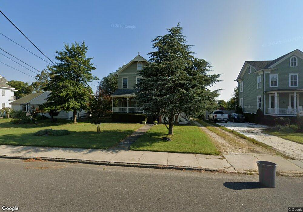
337 Liberty St Long Branch, NJ 07740
Estimated Value: $536,000 - $672,000
4
Beds
3
Baths
1,552
Sq Ft
$383/Sq Ft
Est. Value
About This Home
This home is located at 337 Liberty St, Long Branch, NJ 07740 and is currently estimated at $594,953, approximately $383 per square foot. 337 Liberty St is a home located in Monmouth County with nearby schools including Long Branch High School and Holy Trinity School.
Ownership History
Date
Name
Owned For
Owner Type
Purchase Details
Closed on
May 20, 1997
Sold by
Hertz Daniel
Bought by
James Marcus
Current Estimated Value
Create a Home Valuation Report for This Property
The Home Valuation Report is an in-depth analysis detailing your home's value as well as a comparison with similar homes in the area
Home Values in the Area
Average Home Value in this Area
Purchase History
| Date | Buyer | Sale Price | Title Company |
|---|---|---|---|
| James Marcus | $126,000 | -- |
Source: Public Records
Tax History Compared to Growth
Tax History
| Year | Tax Paid | Tax Assessment Tax Assessment Total Assessment is a certain percentage of the fair market value that is determined by local assessors to be the total taxable value of land and additions on the property. | Land | Improvement |
|---|---|---|---|---|
| 2025 | $5,814 | $390,100 | $118,400 | $271,700 |
| 2024 | $5,614 | $378,300 | $118,400 | $259,900 |
| 2023 | $5,614 | $361,500 | $113,400 | $248,100 |
| 2022 | $6,259 | $341,900 | $123,400 | $218,500 |
| 2021 | $6,259 | $312,800 | $108,400 | $204,400 |
| 2020 | $6,366 | $304,600 | $101,400 | $203,200 |
| 2019 | $6,035 | $287,100 | $93,400 | $193,700 |
| 2018 | $5,814 | $275,000 | $88,400 | $186,600 |
| 2017 | $5,528 | $268,200 | $88,400 | $179,800 |
| 2016 | $5,327 | $263,600 | $88,400 | $175,200 |
| 2015 | $6,325 | $284,000 | $107,900 | $176,100 |
| 2014 | $5,995 | $283,700 | $127,400 | $156,300 |
Source: Public Records
Map
Nearby Homes
- 392 Florence Ave
- 323 Florence Ave
- 188 Chelton Ave
- 211 Rockwell Ave
- 172 Chelton Ave
- 164 Airsdale Ave
- 184 N 5th Ave
- 154 Atlantic Ave
- 151 N 5th Ave
- 28 Patten Ln
- 190 Spruce St Unit 4
- 40 University Dr
- 231 Long Branch Ave
- 148 Sixth Ave
- 138 Rosewood Ave
- 381 Long Branch Ave
- 165 Kingsley St
- 401 Joline Ave
- 16 Shore Dr
- 222 Coleman Ave
- 331 Liberty St
- 341 Liberty St
- 323 Liberty St
- 349 Liberty St
- 336 Liberty St
- 322 Liberty St
- 340 Liberty St
- 344 Liberty St
- 321 Liberty St
- 246 Atlantic Ave
- 231 Allen Place
- 312 Liberty St
- 248 Atlantic Ave
- 311 Liberty St
- 235 Allen Place
- 232 Allen Place
- 254 Atlantic Ave
- 234 Allen Place
- 308 Liberty St
- 250 Atlantic Ave