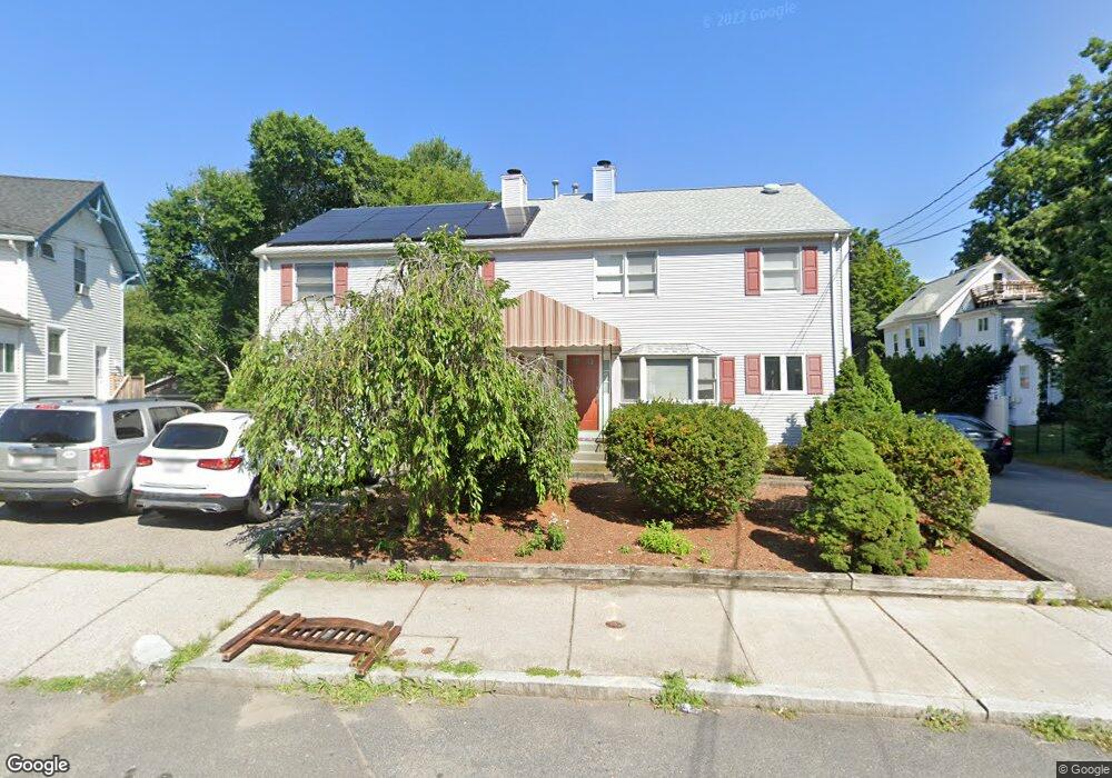
337 Linwood Ave Newtonville, MA 02460
Nonantum NeighborhoodEstimated Value: $823,230 - $1,047,000
3
Beds
3
Baths
1,324
Sq Ft
$681/Sq Ft
Est. Value
About This Home
This home is located at 337 Linwood Ave, Newtonville, MA 02460 and is currently estimated at $901,308, approximately $680 per square foot. 337 Linwood Ave is a home located in Middlesex County with nearby schools including Horace Mann Elementary School, F.A. Day Middle School, and Newton North High School.
Ownership History
Date
Name
Owned For
Owner Type
Purchase Details
Closed on
Sep 1, 2004
Sold by
Stux Elizabeth and Stux Ronald
Bought by
Trivedi Kartikey U and Trivedi Manisha
Current Estimated Value
Home Financials for this Owner
Home Financials are based on the most recent Mortgage that was taken out on this home.
Original Mortgage
$332,000
Interest Rate
6.01%
Mortgage Type
Purchase Money Mortgage
Purchase Details
Closed on
Apr 16, 1993
Sold by
Keyes Stanley W
Bought by
Coppola Mark D
Create a Home Valuation Report for This Property
The Home Valuation Report is an in-depth analysis detailing your home's value as well as a comparison with similar homes in the area
Home Values in the Area
Average Home Value in this Area
Purchase History
| Date | Buyer | Sale Price | Title Company |
|---|---|---|---|
| Trivedi Kartikey U | $415,000 | -- | |
| Trivedi Kartikey U | $415,000 | -- | |
| Coppola Mark D | $115,000 | -- | |
| Coppola Mark D | $115,000 | -- |
Source: Public Records
Mortgage History
| Date | Status | Borrower | Loan Amount |
|---|---|---|---|
| Open | Coppola Mark D | $345,000 | |
| Closed | Coppola Mark D | $380,800 | |
| Closed | Trivedi Kartikey U | $332,000 |
Source: Public Records
Tax History Compared to Growth
Tax History
| Year | Tax Paid | Tax Assessment Tax Assessment Total Assessment is a certain percentage of the fair market value that is determined by local assessors to be the total taxable value of land and additions on the property. | Land | Improvement |
|---|---|---|---|---|
| 2025 | $6,662 | $679,800 | $0 | $679,800 |
| 2024 | $6,442 | $660,000 | $0 | $660,000 |
| 2023 | $6,278 | $616,700 | $0 | $616,700 |
| 2022 | $6,178 | $587,300 | $0 | $587,300 |
| 2021 | $5,962 | $554,100 | $0 | $554,100 |
| 2020 | $5,785 | $554,100 | $0 | $554,100 |
| 2019 | $5,622 | $538,000 | $0 | $538,000 |
| 2018 | $5,612 | $518,700 | $0 | $518,700 |
| 2017 | $5,441 | $489,300 | $0 | $489,300 |
| 2016 | $5,204 | $457,300 | $0 | $457,300 |
| 2015 | $5,056 | $435,500 | $0 | $435,500 |
Source: Public Records
Map
Nearby Homes
- 354 Linwood Ave Unit 1
- 57 Walnut St
- 611 Watertown St Unit 14
- 32-34 Rossmere St
- 321 Albemarle Rd
- 168 Walnut St
- 43 Walker St
- 42-44 Judkins St
- 286 Nevada St Unit 286
- 282 Nevada St Unit 282
- 911 Washington St
- 935 Washington St Unit 8
- 11 Randlett Park
- 957 Washington St Unit 1
- 191 Linwood Ave
- 177 Nevada St
- 77 Court St Unit 205
- 49 Hawthorn St
- 4 Wiswall St
- 12 Wiswall St
- 335 Linwood Ave
- 14 Minot Place
- 341 Linwood Ave
- 341 Linwood Ave Unit 2
- 20 Minot Place Unit 22
- 20 Minot Place Unit 1
- 22 Minot Place
- 334 Linwood Ave
- 334 Linwood Ave Unit 3
- 345 Linwood1 Unit 1
- 340 Linwood Ave Unit 3
- 340 Linwood Ave Unit 2
- 340 Linwood Ave Unit 1
- 340 Linwood Ave
- 26 Minot Place
- 343 Linwood Ave Unit 1
- 343 Linwood Ave
- 321 Linwood Ave
- 345 Linwood Ave
- 345 Linwood Ave Unit 1