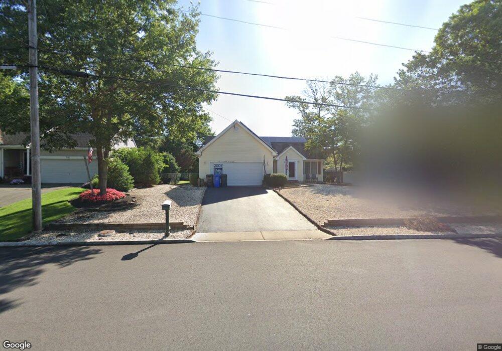
337 Mermaid Dr Manahawkin, NJ 08050
Stafford NeighborhoodEstimated Value: $460,751 - $503,000
3
Beds
2
Baths
1,292
Sq Ft
$370/Sq Ft
Est. Value
About This Home
This home is located at 337 Mermaid Dr, Manahawkin, NJ 08050 and is currently estimated at $478,188, approximately $370 per square foot. 337 Mermaid Dr is a home located in Ocean County with nearby schools including Ocean Acres Elementary School, Oxycocus Elementary School, and McKinley Avenue Elementary School.
Ownership History
Date
Name
Owned For
Owner Type
Purchase Details
Closed on
Apr 23, 2001
Sold by
Bringoli Frank
Bought by
James Darcy and Darcy Sandra
Current Estimated Value
Home Financials for this Owner
Home Financials are based on the most recent Mortgage that was taken out on this home.
Original Mortgage
$145,221
Outstanding Balance
$53,654
Interest Rate
7.05%
Mortgage Type
FHA
Estimated Equity
$424,534
Purchase Details
Closed on
Jun 24, 1994
Sold by
Lake Tupper
Bought by
Bringoh Frank and Mccmahon Sharon
Home Financials for this Owner
Home Financials are based on the most recent Mortgage that was taken out on this home.
Original Mortgage
$100,000
Interest Rate
8.55%
Create a Home Valuation Report for This Property
The Home Valuation Report is an in-depth analysis detailing your home's value as well as a comparison with similar homes in the area
Home Values in the Area
Average Home Value in this Area
Purchase History
| Date | Buyer | Sale Price | Title Company |
|---|---|---|---|
| James Darcy | $147,500 | -- | |
| James Darcy | $147,500 | -- | |
| Bringoh Frank | $104,900 | -- |
Source: Public Records
Mortgage History
| Date | Status | Borrower | Loan Amount |
|---|---|---|---|
| Open | James Darcy | $145,221 | |
| Closed | James Darcy | $145,221 | |
| Previous Owner | Bringoh Frank | $100,000 |
Source: Public Records
Tax History Compared to Growth
Tax History
| Year | Tax Paid | Tax Assessment Tax Assessment Total Assessment is a certain percentage of the fair market value that is determined by local assessors to be the total taxable value of land and additions on the property. | Land | Improvement |
|---|---|---|---|---|
| 2025 | $4,924 | $198,300 | $61,600 | $136,700 |
| 2024 | $4,626 | $198,300 | $61,600 | $136,700 |
| 2023 | $4,418 | $198,300 | $61,600 | $136,700 |
| 2022 | $4,668 | $198,300 | $61,600 | $136,700 |
| 2021 | $4,355 | $198,300 | $61,600 | $136,700 |
| 2020 | $4,610 | $198,300 | $61,600 | $136,700 |
| 2019 | $4,545 | $198,300 | $61,600 | $136,700 |
| 2018 | $4,517 | $198,300 | $61,600 | $136,700 |
| 2017 | $4,497 | $191,100 | $61,600 | $129,500 |
| 2016 | $4,201 | $191,100 | $61,600 | $129,500 |
| 2015 | $4,044 | $191,100 | $61,600 | $129,500 |
| 2014 | $3,977 | $185,800 | $60,800 | $125,000 |
Source: Public Records
Map
Nearby Homes
- 341 Mermaid Dr
- 208 Schooner Rd
- 204 Schooner Rd
- 212 Schooner Rd
- 345 Mermaid Dr
- 234 Neptune Dr
- 336 Mermaid Dr
- 216 Schooner Rd
- 200 Schooner Rd
- 346 Mermaid Dr
- 349 Mermaid Dr
- 330 Mermaid Dr
- 220 Schooner Rd
- 224 Spray Rd
- 353 Mermaid Dr
- 216 Neptune Dr
- 205 Schooner Rd
- 205 Stormy Rd
- 225 Spray Rd
- 557 Mermaid Dr