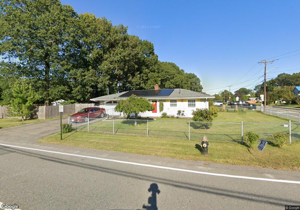
337 Sully Rd Brockton, MA 02302
Montello NeighborhoodEstimated Value: $440,991 - $466,000
3
Beds
1
Bath
1,060
Sq Ft
$428/Sq Ft
Est. Value
About This Home
This home is located at 337 Sully Rd, Brockton, MA 02302 and is currently estimated at $453,498, approximately $427 per square foot. 337 Sully Rd is a home located in Plymouth County with nearby schools including Brookfield Elementary School, Mary E. Baker Elementary School, and Downey Elementary School.
Create a Home Valuation Report for This Property
The Home Valuation Report is an in-depth analysis detailing your home's value as well as a comparison with similar homes in the area
Home Values in the Area
Average Home Value in this Area
Tax History
| Year | Tax Paid | Tax Assessment Tax Assessment Total Assessment is a certain percentage of the fair market value that is determined by local assessors to be the total taxable value of land and additions on the property. | Land | Improvement |
|---|---|---|---|---|
| 2025 | $4,492 | $370,900 | $166,100 | $204,800 |
| 2024 | $4,165 | $346,500 | $166,100 | $180,400 |
| 2023 | $4,498 | $346,500 | $116,900 | $229,600 |
| 2022 | $4,226 | $302,500 | $106,200 | $196,300 |
| 2021 | $4,011 | $276,600 | $99,600 | $177,000 |
| 2020 | $4,128 | $272,500 | $86,800 | $185,700 |
| 2019 | $3,851 | $247,800 | $83,400 | $164,400 |
| 2018 | $3,827 | $238,300 | $83,400 | $154,900 |
| 2017 | $3,453 | $214,500 | $83,400 | $131,100 |
| 2016 | $3,038 | $175,000 | $79,500 | $95,500 |
| 2015 | $2,864 | $157,800 | $79,500 | $78,300 |
| 2014 | $2,598 | $143,300 | $79,500 | $63,800 |
Source: Public Records
Map
Nearby Homes
- 275 Jon Dr
- 170 Elsie Rd
- 1004 S Franklin St
- 45 Braintree Ave
- 133 Ardsley Cir
- 40 Christopher Rd
- 61 Kent St
- 12 Hamilton Way
- 265 Winter St
- 105 Oscar Ave
- 215 North Ave
- 719 S Franklin St Unit C Block 1
- 14 Leonard Ln
- 18 Banks St
- 31 Atlanta St
- 52 Quincy St
- 81 Dixon Rd
- 89 Dixon Rd
- 97 Studley Ave
- 30 Intervale St
Your Personal Tour Guide
Ask me questions while you tour the home.