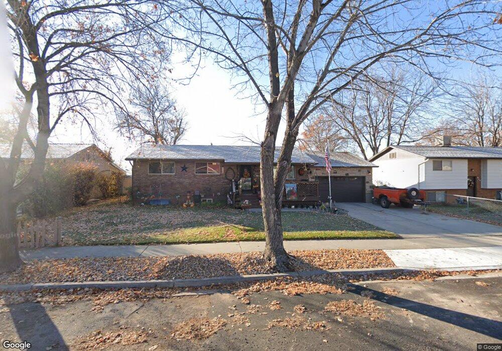
337 W 330 S American Fork, UT 84003
Estimated Value: $460,816 - $479,000
3
Beds
1
Bath
1,025
Sq Ft
$459/Sq Ft
Est. Value
About This Home
This home is located at 337 W 330 S, American Fork, UT 84003 and is currently estimated at $470,704, approximately $459 per square foot. 337 W 330 S is a home located in Utah County with nearby schools including Greenwood Elementary School, American Fork Junior High School, and American Fork High School.
Ownership History
Date
Name
Owned For
Owner Type
Purchase Details
Closed on
Jan 12, 2014
Sold by
Currier Michael A and Currier Shirley A
Bought by
The Michael And Shirley Currier Family R and Currier Shirley A
Current Estimated Value
Purchase Details
Closed on
Jul 16, 1996
Sold by
Currier Mike A and Currier Shirley A
Bought by
Currier Michael A and Currier Shirley A
Home Financials for this Owner
Home Financials are based on the most recent Mortgage that was taken out on this home.
Original Mortgage
$86,400
Outstanding Balance
$6,280
Interest Rate
8.3%
Estimated Equity
$464,424
Create a Home Valuation Report for This Property
The Home Valuation Report is an in-depth analysis detailing your home's value as well as a comparison with similar homes in the area
Home Values in the Area
Average Home Value in this Area
Purchase History
| Date | Buyer | Sale Price | Title Company |
|---|---|---|---|
| The Michael And Shirley Currier Family R | -- | None Available | |
| Currier Michael A | -- | -- |
Source: Public Records
Mortgage History
| Date | Status | Borrower | Loan Amount |
|---|---|---|---|
| Open | Currier Michael A | $86,400 |
Source: Public Records
Tax History Compared to Growth
Tax History
| Year | Tax Paid | Tax Assessment Tax Assessment Total Assessment is a certain percentage of the fair market value that is determined by local assessors to be the total taxable value of land and additions on the property. | Land | Improvement |
|---|---|---|---|---|
| 2025 | $469 | $236,060 | $198,000 | $231,200 |
| 2024 | $469 | $208,725 | $0 | $0 |
| 2023 | $1,786 | $210,375 | $0 | $0 |
| 2022 | $1,913 | $222,365 | $0 | $0 |
| 2021 | $1,582 | $287,300 | $124,300 | $163,000 |
| 2020 | $1,487 | $261,900 | $111,000 | $150,900 |
| 2019 | $1,375 | $250,400 | $100,600 | $149,800 |
| 2018 | $262 | $224,000 | $93,700 | $130,300 |
| 2017 | $127 | $97,515 | $0 | $0 |
| 2016 | -- | $85,745 | $0 | $0 |
| 2015 | $78 | $78,650 | $0 | $0 |
| 2014 | $962 | $78,650 | $0 | $0 |
Source: Public Records
Map
Nearby Homes