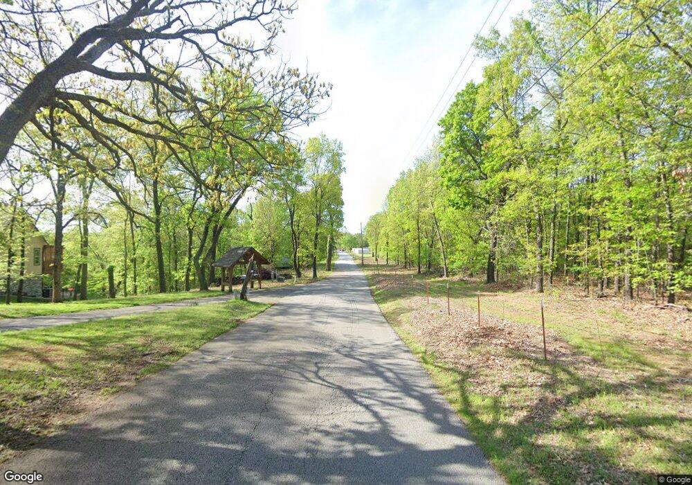
Estimated Value: $419,257 - $612,000
3
Beds
3
Baths
1,874
Sq Ft
$283/Sq Ft
Est. Value
About This Home
This home is located at 33716 S 4505 Rd, Afton, OK 74331 and is currently estimated at $530,064, approximately $282 per square foot. 33716 S 4505 Rd is a home located in Delaware County with nearby schools including Ketchum Elementary School, Ketchum Middle School, and Ketchum High School.
Ownership History
Date
Name
Owned For
Owner Type
Purchase Details
Closed on
Sep 12, 2018
Sold by
Bair Properties Llc
Bought by
Bair Lionel Everett and Bair Debra Marie
Current Estimated Value
Purchase Details
Closed on
Jan 28, 2016
Sold by
Bair Wade E and Bair Holly B
Bought by
Bair Properties Llc
Purchase Details
Closed on
Aug 29, 2006
Sold by
Tomlinson Donald W and Tomlinson Nadine
Bought by
Tomlinson Donald W and Tomlinson Nadine
Purchase Details
Closed on
Mar 20, 1991
Sold by
Burrow Chester and Burrow Betty
Purchase Details
Closed on
Jul 31, 1985
Sold by
Ericsson John
Create a Home Valuation Report for This Property
The Home Valuation Report is an in-depth analysis detailing your home's value as well as a comparison with similar homes in the area
Home Values in the Area
Average Home Value in this Area
Purchase History
| Date | Buyer | Sale Price | Title Company |
|---|---|---|---|
| Bair Lionel Everett | $265,000 | Oklahoma Closing And Title S | |
| Bair Properties Llc | -- | None Available | |
| Tomlinson Donald W | -- | -- | |
| -- | -- | -- | |
| -- | -- | -- |
Source: Public Records
Tax History Compared to Growth
Tax History
| Year | Tax Paid | Tax Assessment Tax Assessment Total Assessment is a certain percentage of the fair market value that is determined by local assessors to be the total taxable value of land and additions on the property. | Land | Improvement |
|---|---|---|---|---|
| 2024 | $2,514 | $33,599 | $3,113 | $30,486 |
| 2023 | $2,514 | $31,998 | $2,971 | $29,027 |
| 2022 | $2,247 | $30,476 | $2,933 | $27,543 |
| 2021 | $2,157 | $30,476 | $2,933 | $27,543 |
| 2020 | $2,080 | $30,476 | $2,933 | $27,543 |
| 2019 | $2,098 | $30,476 | $2,933 | $27,543 |
| 2018 | $1,958 | $28,176 | $2,933 | $25,243 |
| 2017 | $1,973 | $28,176 | $2,933 | $25,243 |
| 2016 | $1,990 | $28,176 | $2,933 | $25,243 |
| 2015 | $1,056 | $16,092 | $2,137 | $13,955 |
| 2014 | $1,006 | $16,092 | $2,239 | $13,853 |
Source: Public Records
Map
Nearby Homes
- 450672 E 338 Rd
- 33861 S 4507 Rd
- 450588 Happy Hollow Rd
- 450319 E 333 Rd
- 33239 Thompson Rd
- 450251 E 340 Rd
- 0 Ridge Rd Unit 2517984
- 450730 Lake Shore Dr
- 450779 E 341 Rd Unit 56
- 451300 Pheasant Ln
- 0 Circle Dr Unit 2530252
- 0 Circle Dr Unit 24-1358
- 55898 Oklahoma 85
- 451100 Circle Dr
- 33469 Blue Grouse Dr
- 0 Blue Grouse Dr
- TBD Blue Grouse Dr
- 0 Pheasant Ln
- 451418 Pheasant Cir
- 0 Pheasant Cir Unit 25-2250
- 33744 S 4505 Rd
- TBD S 4505 Rd
- 33674 S 4505 Rd
- 33674 S 4505 Rd Unit RV
- 33764 S 4505 Rd
- 33764 S 4505 Rd
- 33729 S 4505 Rd
- 450530 E 336 Rd
- 33718 Beach Rd
- 33732 Bakers Beach Rd
- TBD S 4506 Rd
- 33748 S 4506
- 35005 - 29 Colony Cove Dr
- 33796 S 4506 Rd
- 33696 Bakers Beach Rd
- 33635 S Dock Rd
- 33686 Bakers Beach Rd
- 33694 Bakers Beach Rd
- 33635 Dock Rd
- 33796 S 4506 Rd
