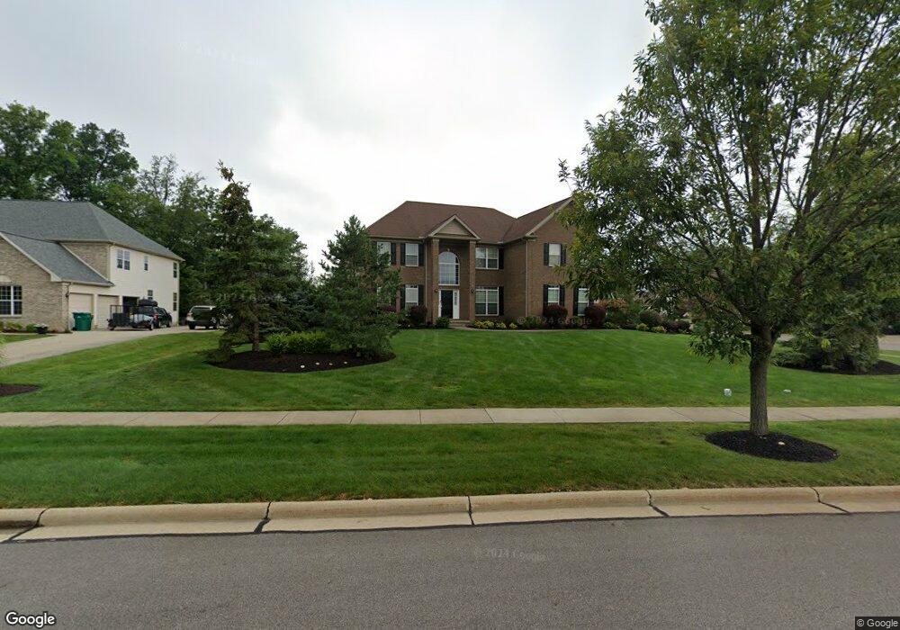
3375 Darien Ln Twinsburg, OH 44087
Estimated Value: $624,000 - $745,000
4
Beds
3
Baths
4,485
Sq Ft
$156/Sq Ft
Est. Value
About This Home
This home is located at 3375 Darien Ln, Twinsburg, OH 44087 and is currently estimated at $697,565, approximately $155 per square foot. 3375 Darien Ln is a home located in Summit County with nearby schools including Wilcox Primary School, Dodge Intermediate School, and Samuel Bissell Elementary School.
Ownership History
Date
Name
Owned For
Owner Type
Purchase Details
Closed on
Oct 21, 2022
Sold by
Given Not
Bought by
Nworie John and Nworie Adaeze I
Current Estimated Value
Purchase Details
Closed on
Oct 12, 2021
Sold by
John Nworie
Bought by
Summit County Treasurer
Purchase Details
Closed on
Oct 16, 2004
Sold by
Norwood Monte E and Norwood Robin G
Bought by
Nworie John and Nworie Adaeze I
Home Financials for this Owner
Home Financials are based on the most recent Mortgage that was taken out on this home.
Original Mortgage
$347,200
Interest Rate
3.87%
Mortgage Type
New Conventional
Purchase Details
Closed on
Jul 14, 2003
Sold by
Kimball Hill Abrams Farm Lp
Bought by
Norwood Monte E and Norwood Robin G
Home Financials for this Owner
Home Financials are based on the most recent Mortgage that was taken out on this home.
Original Mortgage
$388,675
Interest Rate
5.3%
Mortgage Type
Purchase Money Mortgage
Create a Home Valuation Report for This Property
The Home Valuation Report is an in-depth analysis detailing your home's value as well as a comparison with similar homes in the area
Home Values in the Area
Average Home Value in this Area
Purchase History
| Date | Buyer | Sale Price | Title Company |
|---|---|---|---|
| Nworie John | -- | -- | |
| Summit County Treasurer | -- | -- | |
| Nworie John | $434,000 | Multiple | |
| Norwood Monte E | $409,135 | Real Estate Title |
Source: Public Records
Mortgage History
| Date | Status | Borrower | Loan Amount |
|---|---|---|---|
| Closed | Nworie John | $347,200 | |
| Closed | Norwood Monte E | $388,675 | |
| Closed | Nworie John | $86,800 |
Source: Public Records
Tax History Compared to Growth
Tax History
| Year | Tax Paid | Tax Assessment Tax Assessment Total Assessment is a certain percentage of the fair market value that is determined by local assessors to be the total taxable value of land and additions on the property. | Land | Improvement |
|---|---|---|---|---|
| 2025 | $20,333 | $218,551 | $34,531 | $184,020 |
| 2024 | $10,519 | $218,551 | $34,531 | $184,020 |
| 2023 | $20,333 | $218,551 | $34,531 | $184,020 |
| 2022 | $8,497 | $157,490 | $24,843 | $132,647 |
| 2021 | $8,537 | $157,490 | $24,843 | $132,647 |
| 2020 | $8,281 | $157,490 | $24,840 | $132,650 |
| 2019 | $8,122 | $144,360 | $28,820 | $115,540 |
| 2018 | $7,959 | $144,360 | $28,820 | $115,540 |
| 2017 | $7,028 | $144,360 | $28,820 | $115,540 |
| 2016 | $6,985 | $135,110 | $28,820 | $106,290 |
| 2015 | $7,028 | $135,110 | $28,820 | $106,290 |
| 2014 | $7,014 | $135,110 | $28,820 | $106,290 |
| 2013 | $6,919 | $133,410 | $28,820 | $104,590 |
Source: Public Records
Map
Nearby Homes
- 3281 Evans Way
- 2825 Veron Ln
- 2708 Edgebrook Crossing Unit 19
- 2869 Tinkers Ln
- 3284 Cannon Rd
- 2627 Post Rd
- 2590 Post Rd
- 2668 Walton Blvd
- 10000 Ravenna Rd
- 2607 Burridge Cir Unit M29
- 2923 Alling Dr
- 2619 E Aurora Rd
- 3331 Shale Dr
- 10169 Timothy Ln
- 3590 E Aurora Rd
- 3320 Blossom Trail
- 3336 Blossom Trail
- 10358 Townley Ct
- 10413 Fox Hollow Cir
- 9933 Cynthia Dr