Estimated Value: $562,000 - $811,000
4
Beds
2
Baths
1,201
Sq Ft
$578/Sq Ft
Est. Value
About This Home
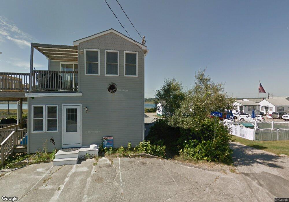
This home is located at 338 Atlantic Ave Unit 1, Wells, ME 04090 and is currently estimated at $694,048, approximately $577 per square foot. 338 Atlantic Ave Unit 1 is a home located in York County with nearby schools including Wells Junior High School, Wells Elementary School, and Wells High School.
Ownership History
Date
Name
Owned For
Owner Type
Purchase Details
Closed on
Jun 11, 2015
Sold by
Thabault Patrice
Bought by
Patrice L Thabault Ft and Thabault
Current Estimated Value
Purchase Details
Closed on
May 21, 2014
Sold by
Thomas Bridget
Bought by
Thabault Patrice
Create a Home Valuation Report for This Property
The Home Valuation Report is an in-depth analysis detailing your home's value as well as a comparison with similar homes in the area
Home Values in the Area
Average Home Value in this Area
Purchase History
| Date | Buyer | Sale Price | Title Company |
|---|---|---|---|
| Patrice L Thabault Ft | -- | -- | |
| Patrice L Thabault Ft | -- | -- | |
| Thabault Patrice | -- | -- | |
| Thabault Patrice | -- | -- |
Source: Public Records
Mortgage History
| Date | Status | Borrower | Loan Amount |
|---|---|---|---|
| Previous Owner | Thabault Patrice | $417,000 |
Source: Public Records
Tax History Compared to Growth
Tax History
| Year | Tax Paid | Tax Assessment Tax Assessment Total Assessment is a certain percentage of the fair market value that is determined by local assessors to be the total taxable value of land and additions on the property. | Land | Improvement |
|---|---|---|---|---|
| 2024 | $4,051 | $666,340 | $511,230 | $155,110 |
| 2023 | $3,971 | $666,340 | $511,230 | $155,110 |
| 2022 | $4,876 | $466,180 | $333,220 | $132,960 |
| 2021 | $4,904 | $466,180 | $333,220 | $132,960 |
| 2020 | $4,886 | $466,180 | $333,220 | $132,960 |
| 2019 | $4,858 | $466,180 | $333,220 | $132,960 |
| 2018 | $4,811 | $466,180 | $333,220 | $132,960 |
| 2017 | $4,736 | $466,180 | $333,220 | $132,960 |
| 2016 | $4,690 | $466,180 | $333,220 | $132,960 |
| 2015 | $4,638 | $466,180 | $333,220 | $132,960 |
| 2013 | $4,252 | $466,180 | $333,220 | $132,960 |
Source: Public Records
Map
Nearby Homes
- 9 Robert Ln
- 229 Atlantic Ave
- 446 Atlantic Ave
- 500 Atlantic Ave Unit 2
- 61 Atlantic Ave Unit 3
- 58 Atlantic Ave Unit 12B
- 46 Ox Cart Ln
- 105 Harbor Rd
- 99 Harbor Rd Unit Lot 52
- 99 Harbor Rd Unit Lot 54
- 42 Rachel Carson Ln
- 4 Tidal Ct
- 1351 Post Rd Unit 49
- 1373 Post Rd Unit 10A
- 1373 Post Rd Unit 4E
- 1373 Post Rd Unit 2C
- 1373 Post Rd Unit 6B
- 1373 Post Rd Unit 1F
- 1413 Post Rd Unit 58
- 1372 Post Rd Unit 1C
- 338 Atlantic Ave Unit 2
- 334 Atlantic Ave
- 12 Starboard Ln
- 330 Atlantic Ave
- 328 Atlantic Ave
- 326 Atlantic Ave
- 15 Robert Ln
- 331 Atlantic Ave
- 325 Atlantic Ave Unit 3
- 325 Atlantic Ave Unit 2
- 325 Atlantic Ave Unit 1
- 325 Atlantic Ave Unit ID1248570P
- 325 Atlantic Ave Unit ID1248589P
- 335 Atlantic Ave
- 339 Atlantic Ave
- 341 Atlantic Ave
- 321 Atlantic Ave
- 14 Robert Ln
- 10 Robert Ln
- 322 Atlantic Ave