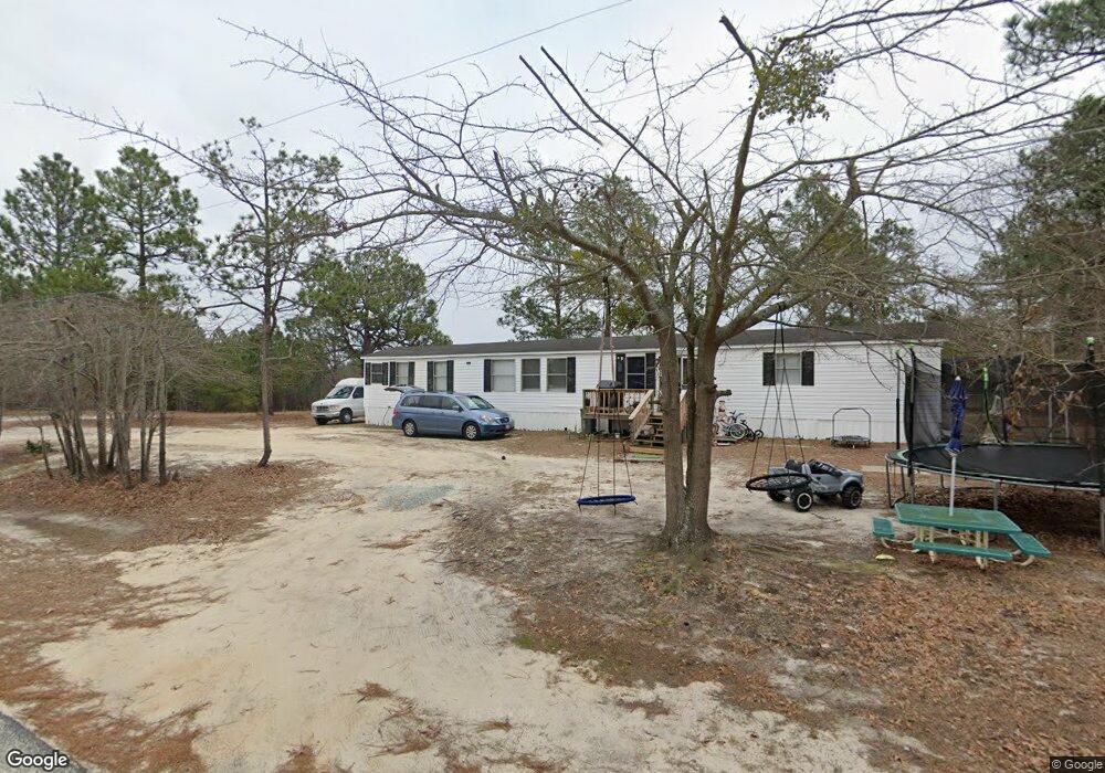
338 Calvin Rd Cameron, NC 28326
Estimated Value: $36,000 - $230,000
Studio
--
Bath
--
Sq Ft
20,909
Sq Ft Lot
About This Home
This home is located at 338 Calvin Rd, Cameron, NC 28326 and is currently estimated at $109,667. 338 Calvin Rd is a home located in Harnett County with nearby schools including Johnsonville Elementary School, Highland Middle School, and Western Harnett High School.
Ownership History
Date
Name
Owned For
Owner Type
Purchase Details
Closed on
Feb 24, 2018
Sold by
Patterson Clyde L and Mangum Douglas Wayne
Bought by
Rosales Maria
Current Estimated Value
Purchase Details
Closed on
Dec 9, 2015
Sold by
Curtis Paul R
Bought by
Patterson Clyde L and Mangum Douglas Wayne
Purchase Details
Closed on
Feb 15, 2015
Sold by
Mangum Douglas Wayne and Mangum Mary Elizabrth
Bought by
Curtis Paul R and Curtis Laura J
Home Financials for this Owner
Home Financials are based on the most recent Mortgage that was taken out on this home.
Original Mortgage
$15,500
Interest Rate
3.77%
Mortgage Type
Commercial
Purchase Details
Closed on
Sep 23, 2014
Sold by
Smith Aleasha Gayl
Bought by
Patterson Clyde L and Mangum Douglas Wayne
Purchase Details
Closed on
Jan 23, 2009
Sold by
Smith Raymond A and Smith Aleasha Gayl
Bought by
Smith Aleasha Gayl
Create a Home Valuation Report for This Property
The Home Valuation Report is an in-depth analysis detailing your home's value as well as a comparison with similar homes in the area
Home Values in the Area
Average Home Value in this Area
Purchase History
| Date | Buyer | Sale Price | Title Company |
|---|---|---|---|
| Rosales Maria | $45,000 | None Available | |
| Patterson Clyde L | -- | -- | |
| Curtis Paul R | $18,500 | None Available | |
| Patterson Clyde L | $7,000 | None Available | |
| Smith Aleasha Gayl | -- | None Available | |
| Smith Aleasha Gayl | -- | -- |
Source: Public Records
Mortgage History
| Date | Status | Borrower | Loan Amount |
|---|---|---|---|
| Previous Owner | Curtis Paul R | $15,500 |
Source: Public Records
Tax History
| Year | Tax Paid | Tax Assessment Tax Assessment Total Assessment is a certain percentage of the fair market value that is determined by local assessors to be the total taxable value of land and additions on the property. | Land | Improvement |
|---|---|---|---|---|
| 2025 | $228 | $20,160 | $0 | $0 |
| 2024 | $228 | $20,160 | $0 | $0 |
| 2023 | $228 | $20,160 | $0 | $0 |
| 2022 | $3 | $20,160 | $0 | $0 |
| 2021 | $259 | $20,000 | $0 | $0 |
| 2020 | $259 | $20,000 | $0 | $0 |
| 2019 | $244 | $20,000 | $0 | $0 |
| 2018 | $240 | $20,000 | $0 | $0 |
| 2017 | $240 | $20,000 | $0 | $0 |
| 2016 | $172 | $12,000 | $0 | $0 |
| 2015 | -- | $12,000 | $0 | $0 |
| 2014 | -- | $12,000 | $0 | $0 |
Source: Public Records
Map
Nearby Homes
- 429 Akor Place
- 175 Travis Dr
- Tbd Brooks Mangum Rd
- 71 Havistock Ct
- 275 Independence Way
- 83 Lockwood Dr
- 189 Valley Forge Way S
- 306 Asheford Way
- 78 Georgia Way
- 227 Constitution Way
- 528 Heritage Way
- 137 Virginia Ln
- 544 Asheford Way
- 16.16 Acres Nc 24 Nc
- 38 Bone Oak
- 343 Deer View
- 1371 Heritage Way
- 321 Winding Ridge
- 0 Brookridge Dr Unit 756982
- 266 Brower Rd
Your Personal Tour Guide
Ask me questions while you tour the home.