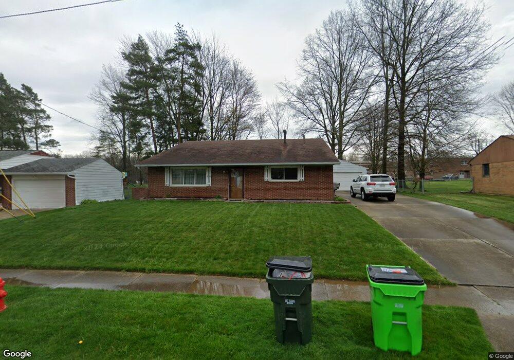
338 Charring Cross Dr Munroe Falls, OH 44262
Estimated Value: $256,671 - $271,000
3
Beds
2
Baths
1,140
Sq Ft
$233/Sq Ft
Est. Value
About This Home
This home is located at 338 Charring Cross Dr, Munroe Falls, OH 44262 and is currently estimated at $265,418, approximately $232 per square foot. 338 Charring Cross Dr is a home located in Summit County with nearby schools including Stow-Munroe Falls High School, Holy Family Elementary School, and Walsh Jesuit High School.
Ownership History
Date
Name
Owned For
Owner Type
Purchase Details
Closed on
Aug 14, 2014
Sold by
Walko Gregory S and Walko Judy M
Bought by
Bfg Fcu
Current Estimated Value
Purchase Details
Closed on
Mar 27, 2000
Sold by
Robinson Mark and Robinson Angela
Bought by
Walko Gregory S and Walko Judy M
Home Financials for this Owner
Home Financials are based on the most recent Mortgage that was taken out on this home.
Original Mortgage
$113,300
Interest Rate
8.56%
Purchase Details
Closed on
May 21, 1997
Sold by
Nanchoff Louie
Bought by
Robinson Mark and Robinson Angela
Home Financials for this Owner
Home Financials are based on the most recent Mortgage that was taken out on this home.
Original Mortgage
$92,400
Interest Rate
8.24%
Mortgage Type
New Conventional
Create a Home Valuation Report for This Property
The Home Valuation Report is an in-depth analysis detailing your home's value as well as a comparison with similar homes in the area
Home Values in the Area
Average Home Value in this Area
Purchase History
| Date | Buyer | Sale Price | Title Company |
|---|---|---|---|
| Bfg Fcu | $10,000 | None Available | |
| Walko Gregory S | $126,000 | 21St Century Title | |
| Robinson Mark | $115,500 | -- |
Source: Public Records
Mortgage History
| Date | Status | Borrower | Loan Amount |
|---|---|---|---|
| Previous Owner | Walko Gregory S | $113,300 | |
| Previous Owner | Robinson Mark | $92,400 |
Source: Public Records
Tax History Compared to Growth
Tax History
| Year | Tax Paid | Tax Assessment Tax Assessment Total Assessment is a certain percentage of the fair market value that is determined by local assessors to be the total taxable value of land and additions on the property. | Land | Improvement |
|---|---|---|---|---|
| 2025 | $3,390 | $60,935 | $13,937 | $46,998 |
| 2024 | $3,390 | $60,935 | $13,937 | $46,998 |
| 2023 | $3,390 | $60,935 | $13,937 | $46,998 |
| 2022 | $3,257 | $50,663 | $11,519 | $39,144 |
| 2021 | $2,827 | $50,663 | $11,519 | $39,144 |
| 2020 | $2,777 | $50,660 | $11,520 | $39,140 |
| 2019 | $2,792 | $47,010 | $10,180 | $36,830 |
| 2018 | $2,746 | $47,010 | $10,180 | $36,830 |
| 2017 | $2,437 | $47,010 | $10,180 | $36,830 |
| 2016 | $2,602 | $43,710 | $10,180 | $33,530 |
| 2015 | $2,437 | $43,710 | $10,180 | $33,530 |
| 2014 | $2,440 | $43,710 | $10,180 | $33,530 |
| 2013 | $2,473 | $41,780 | $10,180 | $31,600 |
Source: Public Records
Map
Nearby Homes
- 226 Gaylord Dr
- 400 Cathy Dr
- 64 River Ridge Ln Unit H64
- 75 River Ridge Ln
- 82 Silver Valley Blvd Unit B82
- 3383 Suffolk Downs
- 100 Trudy Ave
- 1974 Hawthorne Ave
- 3128 Bay Meadows Cir
- 44 S River Rd
- 2194 Santom Rd E
- 3366 Darrow Rd
- 3642 Northport Dr
- 3511 Whit Ave
- 1861 Gorge Park Blvd
- 3560 Orchard Dr Unit A22
- 135 Guise Park Dr
- 3679 Sanford Ave
- 70 Richard Dr
- 2919 Thomas Dr
- 334 Charring Cross Dr
- 342 Charring Cross Dr
- 346 Charring Cross Dr
- 332 Charring Cross Dr
- 341 Charring Cross Dr
- 337 Charring Cross Dr
- 346 Kenroe Ave
- 333 Charring Cross Dr
- 340 Kenroe Ave
- 309 Berwin Place
- 332 Kenroe Ave
- 310 Archwood Ave
- 352 Charring Cross Dr
- 324 Charring Cross Dr
- 291 Berwin Place
- 354 Charring Cross Dr
- 302 Archwood Ave
- 287 Berwin Place
- 309 Archwood Ave
- 353 Charring Cross Dr