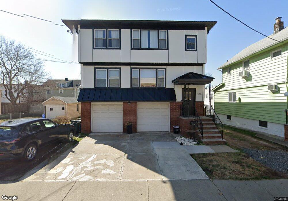
338 Long Ave Unit 2 Hillside, NJ 07205
Estimated Value: $652,000 - $791,000
6
Beds
4
Baths
2,730
Sq Ft
$261/Sq Ft
Est. Value
About This Home
This home is located at 338 Long Ave Unit 2, Hillside, NJ 07205 and is currently estimated at $711,451, approximately $260 per square foot. 338 Long Ave Unit 2 is a home located in Union County with nearby schools including Abram P. Morris-Saybrook Elementary School, Hurden Looker School, and Ola Edwards Community School.
Ownership History
Date
Name
Owned For
Owner Type
Purchase Details
Closed on
Mar 29, 2021
Sold by
Mb Hillside Llc
Bought by
Defreitas Giuliana M
Current Estimated Value
Home Financials for this Owner
Home Financials are based on the most recent Mortgage that was taken out on this home.
Original Mortgage
$430,402
Outstanding Balance
$388,601
Interest Rate
3%
Mortgage Type
FHA
Estimated Equity
$322,850
Purchase Details
Closed on
Jun 28, 2017
Sold by
Rbt Holdings Llc
Bought by
Mb Hillside Llc
Purchase Details
Closed on
May 10, 2017
Sold by
Manceri Mark R and Paula Becker Revocable Living
Bought by
Rbt Holdings Llc
Purchase Details
Closed on
Feb 5, 2016
Sold by
Shuman-Auspitz Lori Grdn
Bought by
Paula Becker Revocable Living Trust
Create a Home Valuation Report for This Property
The Home Valuation Report is an in-depth analysis detailing your home's value as well as a comparison with similar homes in the area
Home Values in the Area
Average Home Value in this Area
Purchase History
| Date | Buyer | Sale Price | Title Company |
|---|---|---|---|
| Defreitas Giuliana M | $485,000 | Title Guarantee Inc | |
| Mb Hillside Llc | -- | None Available | |
| Rbt Holdings Llc | $211,000 | None Available | |
| Paula Becker Revocable Living Trust | -- | -- |
Source: Public Records
Mortgage History
| Date | Status | Borrower | Loan Amount |
|---|---|---|---|
| Open | Defreitas Giuliana M | $430,402 |
Source: Public Records
Tax History
| Year | Tax Paid | Tax Assessment Tax Assessment Total Assessment is a certain percentage of the fair market value that is determined by local assessors to be the total taxable value of land and additions on the property. | Land | Improvement |
|---|---|---|---|---|
| 2025 | $13,205 | $160,000 | $63,800 | $96,200 |
| 2024 | $12,821 | $160,000 | $63,800 | $96,200 |
| 2023 | $12,821 | $160,000 | $63,800 | $96,200 |
| 2022 | $12,702 | $160,000 | $63,800 | $96,200 |
| 2021 | $12,619 | $160,000 | $63,800 | $96,200 |
| 2020 | $12,546 | $160,000 | $63,800 | $96,200 |
| 2019 | $12,302 | $160,000 | $63,800 | $96,200 |
| 2018 | $12,179 | $160,000 | $63,800 | $96,200 |
| 2017 | $12,106 | $160,000 | $63,800 | $96,200 |
| 2016 | $12,091 | $160,000 | $63,800 | $96,200 |
| 2015 | $15,092 | $201,500 | $63,800 | $137,700 |
| 2014 | $14,855 | $201,500 | $63,800 | $137,700 |
Source: Public Records
Map
Nearby Homes
- 359 Harvard Ave
- 386 Yale Ave
- 260 Millard Ave
- 339 Hillside Ave
- 339 Hillside Ave Unit 2
- 222 Boston Ave
- 525 Us Highway 22
- 1426 Franklin St
- 537 Us Highway 22
- 542 Leo St
- 292 Crann St
- 1442 Highland Ave
- 1414 Boa Place Unit 2
- 564 Chapman St
- 149 Baltimore Ave
- 1470B Liberty Ave
- 1406 Maple Ave
- 128 Baltimore Ave
- 1437 Parkview Terrace
- 1393 Cornell Place
Your Personal Tour Guide
Ask me questions while you tour the home.