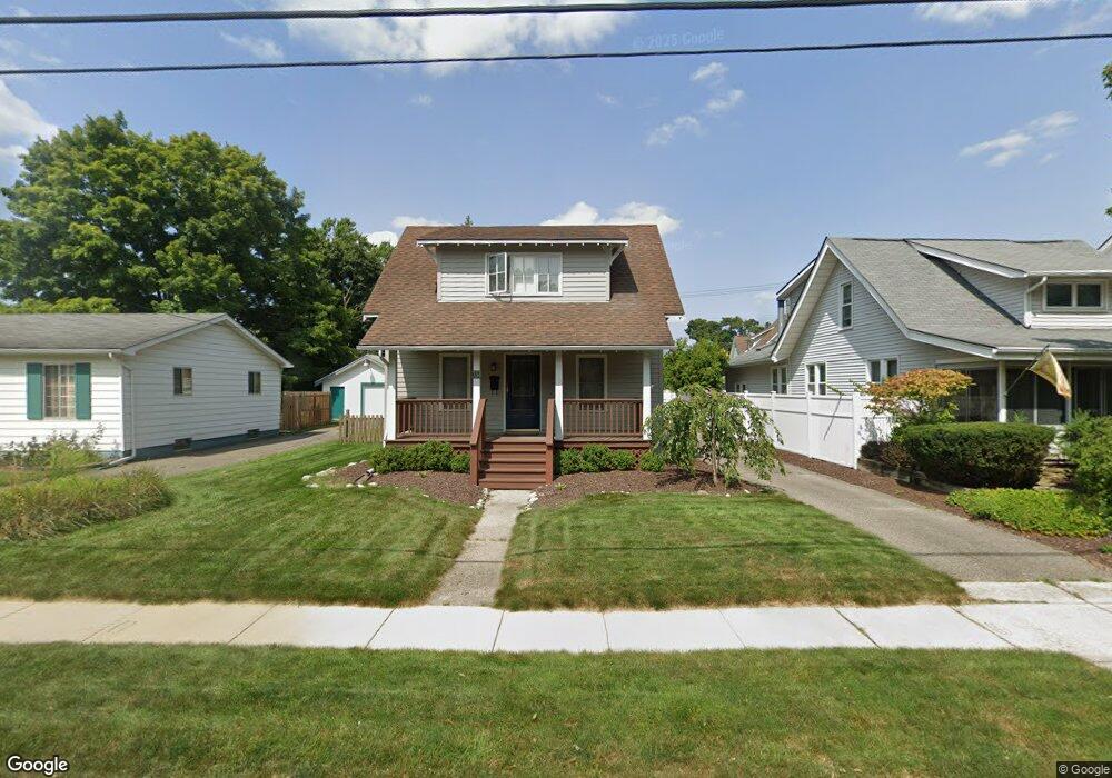
338 Maple St Plymouth, MI 48170
Estimated Value: $393,735 - $488,000
1
Bed
2
Baths
982
Sq Ft
$443/Sq Ft
Est. Value
About This Home
This home is located at 338 Maple St, Plymouth, MI 48170 and is currently estimated at $435,184, approximately $443 per square foot. 338 Maple St is a home located in Wayne County with nearby schools including Canton High School, Smith Elementary School, and East Middle School.
Ownership History
Date
Name
Owned For
Owner Type
Purchase Details
Closed on
Oct 11, 2005
Sold by
White Carey and White Jennifer
Bought by
White Randal P
Current Estimated Value
Purchase Details
Closed on
Aug 12, 2004
Sold by
Bruchnak Kirk A and Bruchnak Elizabeth A
Bought by
White Carey
Home Financials for this Owner
Home Financials are based on the most recent Mortgage that was taken out on this home.
Original Mortgage
$59,400
Interest Rate
6.08%
Mortgage Type
Credit Line Revolving
Purchase Details
Closed on
Jun 18, 2002
Sold by
Knopf Karin S
Bought by
Bruchnak Kirk A
Home Financials for this Owner
Home Financials are based on the most recent Mortgage that was taken out on this home.
Original Mortgage
$196,000
Interest Rate
6.8%
Purchase Details
Closed on
Apr 11, 2000
Sold by
Czaplicki Wesley Q
Bought by
Michael J Kelly
Create a Home Valuation Report for This Property
The Home Valuation Report is an in-depth analysis detailing your home's value as well as a comparison with similar homes in the area
Home Values in the Area
Average Home Value in this Area
Purchase History
| Date | Buyer | Sale Price | Title Company |
|---|---|---|---|
| White Randal P | $282,000 | Metropolitan Title Company | |
| White Carey | $252,000 | 1St Security Title Agency In | |
| Bruchnak Kirk A | $245,000 | -- | |
| Michael J Kelly | $102,000 | -- |
Source: Public Records
Mortgage History
| Date | Status | Borrower | Loan Amount |
|---|---|---|---|
| Previous Owner | White Carey | $59,400 | |
| Previous Owner | White Carey | $180,000 | |
| Previous Owner | Bruchnak Kirk A | $196,000 |
Source: Public Records
Tax History Compared to Growth
Tax History
| Year | Tax Paid | Tax Assessment Tax Assessment Total Assessment is a certain percentage of the fair market value that is determined by local assessors to be the total taxable value of land and additions on the property. | Land | Improvement |
|---|---|---|---|---|
| 2025 | $4,505 | $186,300 | $0 | $0 |
| 2024 | $4,505 | $168,600 | $0 | $0 |
| 2023 | $4,388 | $164,600 | $0 | $0 |
| 2022 | $4,651 | $153,500 | $0 | $0 |
| 2021 | $4,507 | $150,800 | $0 | $0 |
| 2020 | $4,495 | $147,700 | $0 | $0 |
| 2019 | $3,957 | $131,500 | $0 | $0 |
| 2018 | $3,844 | $129,800 | $0 | $0 |
| 2017 | $814 | $125,000 | $0 | $0 |
| 2016 | $4,187 | $120,700 | $0 | $0 |
| 2015 | $9,591 | $108,750 | $0 | $0 |
| 2013 | $9,291 | $99,570 | $0 | $0 |
| 2011 | -- | $88,350 | $0 | $0 |
Source: Public Records
Map
Nearby Homes
- 278 Maple St
- 256 Maple St
- 381 Hamilton St
- 300 Hamilton St Unit 201
- 300 Hamilton St Unit 306
- 525 W Ann Arbor Trail
- 190 Hamilton St
- 163 Hamilton St
- 628 Maple St
- 644 Maple St
- 636 Maple St
- 660 Maple St
- 668 Maple St
- 543 Deer St
- 221 Pinewood Cir Unit 25
- 333 N Sydney Ct
- 364 N Sydney Ct
- 396 N Sydney Ct
- 303 N Sydney Ct
- 372 N Sydney Ct
- 326 Maple St
- 340 Maple St
- 314 Maple St
- 308 Maple St
- 333 W Ann Arbor Trail
- 358 Maple St
- 345 W Ann Arbor Trail
- 319 W Ann Arbor Trail
- 345 W Ann Arbor Trail Ct
- 333 Maple St
- 325 W Ann Arbor Trail
- 302 Maple St
- 323 Maple St
- 349 W Ann Arbor Trail Ct
- 323 W Ann Arbor Trail Ct Unit 5
- 370 Maple St
- 303 W Ann Arbor Trail
- 303 W Ann Arbor Trail Unit 3
- 303 W Ann Arbor Trail Unit 1
- 303 W Ann Arbor Trail Unit 2