Estimated Value: $103,000 - $151,568
3
Beds
1
Bath
1,020
Sq Ft
$129/Sq Ft
Est. Value
About This Home
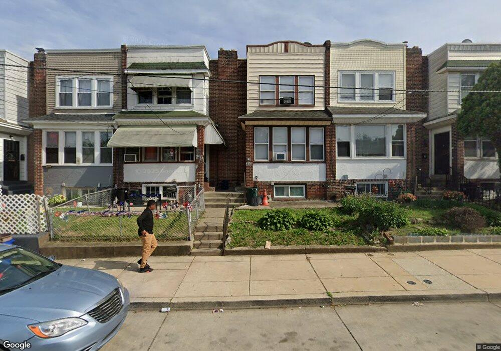
This home is located at 338 N 10th St, Darby, PA 19023 and is currently estimated at $131,892, approximately $129 per square foot. 338 N 10th St is a home located in Delaware County with nearby schools including Park Lane Elementary School, Penn Wood Middle School, and Penn Wood High School - Cypress Street Campus.
Ownership History
Date
Name
Owned For
Owner Type
Purchase Details
Closed on
May 28, 2004
Sold by
Hf Holdings Inc
Bought by
Kane Francis
Current Estimated Value
Home Financials for this Owner
Home Financials are based on the most recent Mortgage that was taken out on this home.
Original Mortgage
$51,592
Outstanding Balance
$25,203
Interest Rate
5.99%
Mortgage Type
FHA
Estimated Equity
$106,689
Purchase Details
Closed on
Jan 8, 2003
Sold by
Associates
Bought by
Hf Holdings Inc
Purchase Details
Closed on
Nov 8, 2002
Sold by
Branch Linda
Bought by
Associates
Purchase Details
Closed on
Jun 6, 1994
Sold by
Roye Gladys J
Bought by
Branch Linda
Purchase Details
Closed on
May 3, 1994
Sold by
Hackett Linwood L
Bought by
Roye Gladys J
Create a Home Valuation Report for This Property
The Home Valuation Report is an in-depth analysis detailing your home's value as well as a comparison with similar homes in the area
Home Values in the Area
Average Home Value in this Area
Purchase History
| Date | Buyer | Sale Price | Title Company |
|---|---|---|---|
| Kane Francis | $52,000 | -- | |
| Hf Holdings Inc | $20,500 | -- | |
| Associates | -- | -- | |
| Branch Linda | -- | -- | |
| Roye Gladys J | $25,000 | Commonwealth Land Title Ins |
Source: Public Records
Mortgage History
| Date | Status | Borrower | Loan Amount |
|---|---|---|---|
| Open | Kane Francis | $51,592 |
Source: Public Records
Tax History Compared to Growth
Tax History
| Year | Tax Paid | Tax Assessment Tax Assessment Total Assessment is a certain percentage of the fair market value that is determined by local assessors to be the total taxable value of land and additions on the property. | Land | Improvement |
|---|---|---|---|---|
| 2025 | $3,410 | $68,860 | $13,740 | $55,120 |
| 2024 | $3,410 | $68,860 | $13,740 | $55,120 |
| 2023 | $3,208 | $68,860 | $13,740 | $55,120 |
| 2022 | $3,121 | $68,860 | $13,740 | $55,120 |
| 2021 | $4,355 | $68,860 | $13,740 | $55,120 |
| 2020 | $2,909 | $39,820 | $13,030 | $26,790 |
| 2019 | $2,786 | $39,820 | $13,030 | $26,790 |
| 2018 | $2,752 | $39,820 | $0 | $0 |
| 2017 | $2,701 | $39,820 | $0 | $0 |
| 2016 | $219 | $39,820 | $0 | $0 |
| 2015 | $219 | $39,820 | $0 | $0 |
| 2014 | $219 | $39,820 | $0 | $0 |
Source: Public Records
Map
Nearby Homes
- 908 Cedar Ave
- 252 N 9th St
- 909 Maple Terrace
- 221 N 9th St
- 902 Maple Terrace
- 1203 Edgehill Rd
- 225 Wright Ave
- 214 N 6th St
- 1237 Edgehill Rd
- 1232 Edgehill Rd
- 1246 Wycombe Ave
- 200 N 6th St
- 209 Weymouth Rd
- 112 Ridge Ave
- 210 Londonderry Ln
- 1210 Berkley Rd
- 14 N Macdade Blvd
- 704 Main St
- 1125 Main St
- 11 Mill St