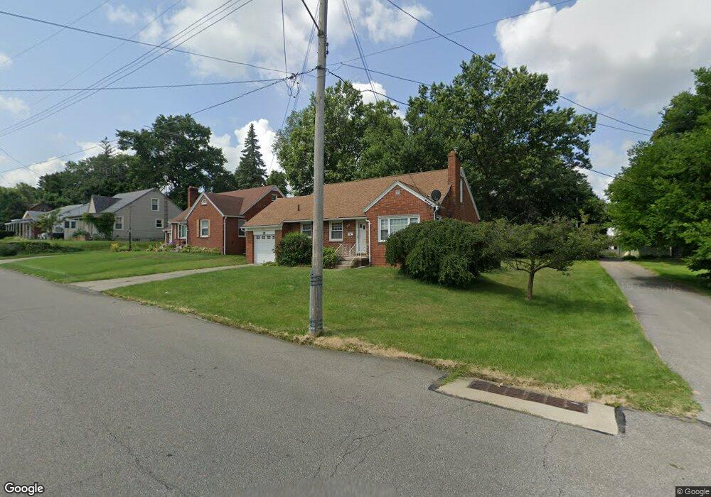
338 Taylor Rd Mansfield, OH 44903
Estimated Value: $146,000 - $154,099
2
Beds
1
Bath
1,182
Sq Ft
$127/Sq Ft
Est. Value
About This Home
This home is located at 338 Taylor Rd, Mansfield, OH 44903 and is currently estimated at $150,525, approximately $127 per square foot. 338 Taylor Rd is a home located in Richland County with nearby schools including Goal Digital Academy and Discovery School.
Ownership History
Date
Name
Owned For
Owner Type
Purchase Details
Closed on
Apr 11, 2007
Sold by
Decker Jerry F and Decker Carolyn Faye
Bought by
Fulmer Frances
Current Estimated Value
Purchase Details
Closed on
Aug 7, 1998
Sold by
Veard Raymond C
Bought by
J C Meyer Co
Purchase Details
Closed on
May 12, 1997
Sold by
Spencer Charlene R
Bought by
Veard Raymond C
Home Financials for this Owner
Home Financials are based on the most recent Mortgage that was taken out on this home.
Original Mortgage
$61,200
Interest Rate
7.57%
Mortgage Type
New Conventional
Purchase Details
Closed on
Oct 1, 1985
Create a Home Valuation Report for This Property
The Home Valuation Report is an in-depth analysis detailing your home's value as well as a comparison with similar homes in the area
Home Values in the Area
Average Home Value in this Area
Purchase History
| Date | Buyer | Sale Price | Title Company |
|---|---|---|---|
| Fulmer Frances | $87,000 | Attorney | |
| J C Meyer Co | $70,000 | -- | |
| Veard Raymond C | $68,000 | -- | |
| -- | $29,500 | -- |
Source: Public Records
Mortgage History
| Date | Status | Borrower | Loan Amount |
|---|---|---|---|
| Previous Owner | Veard Raymond C | $61,200 |
Source: Public Records
Tax History
| Year | Tax Paid | Tax Assessment Tax Assessment Total Assessment is a certain percentage of the fair market value that is determined by local assessors to be the total taxable value of land and additions on the property. | Land | Improvement |
|---|---|---|---|---|
| 2024 | $1,230 | $37,250 | $4,530 | $32,720 |
| 2023 | $1,285 | $37,250 | $4,530 | $32,720 |
| 2022 | $1,004 | $26,720 | $3,880 | $22,840 |
| 2021 | $1,011 | $26,720 | $3,880 | $22,840 |
| 2020 | $1,034 | $26,720 | $3,880 | $22,840 |
| 2019 | $1,146 | $26,720 | $3,880 | $22,840 |
| 2018 | $1,130 | $26,720 | $3,880 | $22,840 |
| 2017 | $1,128 | $26,720 | $3,880 | $22,840 |
| 2016 | $1,155 | $27,060 | $4,940 | $22,120 |
| 2015 | $1,104 | $27,060 | $4,940 | $22,120 |
| 2014 | $1,089 | $27,060 | $4,940 | $22,120 |
| 2012 | $1,081 | $28,480 | $5,200 | $23,280 |
Source: Public Records
Map
Nearby Homes
- 679 Coleman Rd
- 356 S Linden Rd
- 616 Cline Ave
- 143 Fairlawn Ave
- 135 Fairlawn Ave
- 129 Fairlawn Ave
- 189 Westwood Ave
- 960 W Linden Cir
- 455 Marion Ave
- 133 Stewart Ave S
- 487 Davey Ave
- 116 Stewart Ave S
- 108 Stewart Ave S
- 244 S Trimble Rd Unit 246
- 232 S Trimble Rd Unit 234
- 216 S Trimble Rd Unit 218
- 988 Kentland Dr
- 24 Stewart Ave S
- 282 Vennum Ave
- 655 Woodhill Rd
- 342 Taylor Rd
- 324 Taylor Rd
- 348 Taylor Rd
- 750 Barnard Ave
- 335 Fairlawn Ave
- 339 Fairlawn Ave
- 341 Taylor Rd
- 345 Fairlawn Ave
- 333 Taylor Rd
- 320 Taylor Rd
- 329 Fairlawn Ave
- 356 Taylor Rd Unit 54
- 325 Fairlawn Ave
- 351 Fairlawn Ave
- 314 Taylor Rd
- 349 Taylor Rd
- 325 Taylor Rd
- 360 Taylor Rd
- 715 Barnard Ave
- 315 Taylor Rd
Your Personal Tour Guide
Ask me questions while you tour the home.