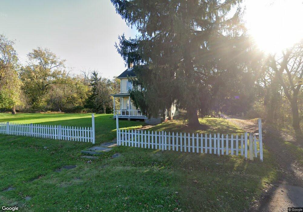
338 W Main St Bound Brook, NJ 08805
Estimated Value: $1,041,458 - $1,230,000
Studio
--
Bath
3,010
Sq Ft
$381/Sq Ft
Est. Value
About This Home
This home is located at 338 W Main St, Bound Brook, NJ 08805 and is currently estimated at $1,147,115, approximately $381 per square foot. 338 W Main St is a home located in Somerset County with nearby schools including LaMonte Annex Elementary School, Lafayette Elementary School, and Bound Brook High School.
Ownership History
Date
Name
Owned For
Owner Type
Purchase Details
Closed on
Aug 27, 2025
Sold by
Mcewen Living Trust and Mcewen Cameron
Bought by
Titan Mahagun Llc
Current Estimated Value
Purchase Details
Closed on
Jun 24, 1999
Sold by
United States Of America
Bought by
State Of New Jersey Department Of Environment
Purchase Details
Closed on
Nov 7, 1988
Sold by
Consalvo Frank J and Consalvo Jeanette E
Bought by
Robles-Diaz Carmen E and Robles-Diaz Mcewen,W C
Create a Home Valuation Report for This Property
The Home Valuation Report is an in-depth analysis detailing your home's value as well as a comparison with similar homes in the area
Home Values in the Area
Average Home Value in this Area
Purchase History
| Date | Buyer | Sale Price | Title Company |
|---|---|---|---|
| Titan Mahagun Llc | $1,200,000 | None Listed On Document | |
| State Of New Jersey Department Of Environment | -- | None Listed On Document | |
| State Of New Jersey Department Of Environment | -- | None Listed On Document | |
| Robles-Diaz Carmen E | $195,000 | -- |
Source: Public Records
Tax History
| Year | Tax Paid | Tax Assessment Tax Assessment Total Assessment is a certain percentage of the fair market value that is determined by local assessors to be the total taxable value of land and additions on the property. | Land | Improvement |
|---|---|---|---|---|
| 2025 | $9,616 | $468,200 | $134,600 | $333,600 |
| 2024 | $9,616 | $423,800 | $126,100 | $297,700 |
| 2023 | $9,529 | $404,100 | $113,400 | $290,700 |
| 2022 | $9,283 | $373,100 | $96,400 | $276,700 |
| 2021 | $9,429 | $332,200 | $79,400 | $252,800 |
| 2020 | $9,122 | $295,500 | $66,600 | $228,900 |
| 2019 | $9,429 | $291,300 | $62,400 | $228,900 |
| 2018 | $8,808 | $264,200 | $53,900 | $210,300 |
| 2017 | $8,790 | $257,700 | $53,900 | $203,800 |
| 2016 | $9,721 | $287,100 | $26,700 | $260,400 |
| 2015 | $9,645 | $291,300 | $61,100 | $230,200 |
| 2014 | $11,076 | $323,100 | $92,900 | $230,200 |
Source: Public Records
Map
Nearby Homes
- 311 W Main St
- 430 Talmage Ave
- 430 Talmadge Ave
- 318 W Main St
- 309 W Main St
- 420 Talmage Ave
- 420 Talmage Ave Unit xx
- 316 W Main St
- 307 W Main St
- 312 W Main St
- 431 Talmadge Ave
- 303-305 W Main St
- 437 Talmage Ave
- 303 W Main St Unit 305
- 306 W Main St
- 410 Talmadge Ave
- 304 W Main St Unit 306
- 410 Talmage Ave
- 435 Talmadge Ave
- 417 Talmadge Ave
Your Personal Tour Guide
Ask me questions while you tour the home.