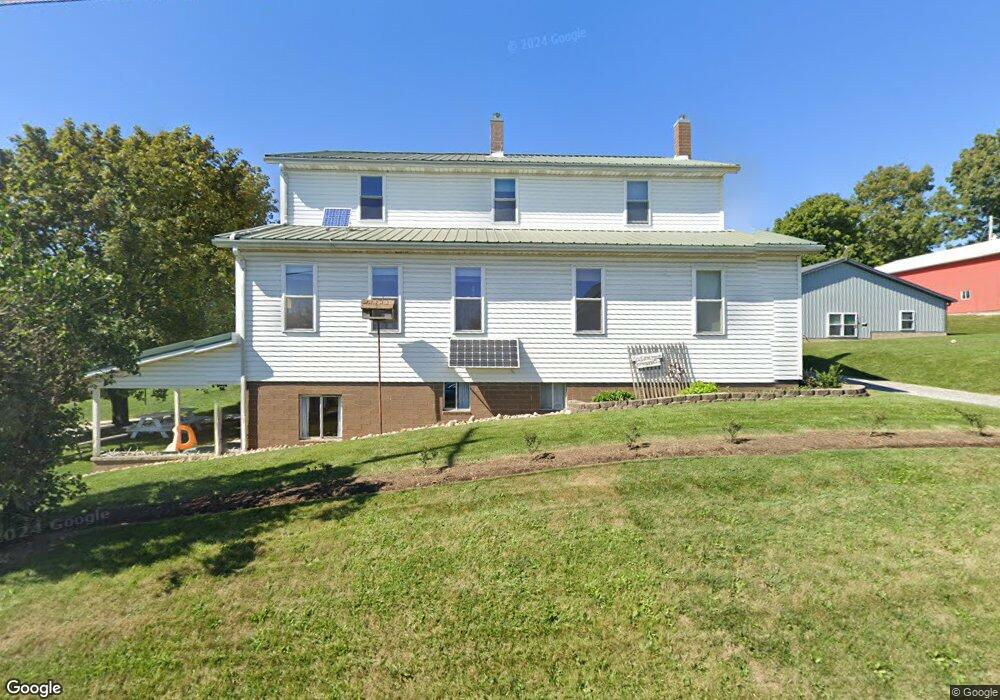
33849 State Route 643 Fresno, OH 43824
Estimated Value: $342,000 - $454,000
6
Beds
2
Baths
2,584
Sq Ft
$152/Sq Ft
Est. Value
About This Home
This home is located at 33849 State Route 643, Fresno, OH 43824 and is currently estimated at $393,139, approximately $152 per square foot. 33849 State Route 643 is a home located in Coshocton County with nearby schools including Garaway High School, Buckeye, and Shutt Valley.
Ownership History
Date
Name
Owned For
Owner Type
Purchase Details
Closed on
May 3, 2017
Sold by
Barkman Eli E and Barkman Esther D
Bought by
Hershberger Ivan D and Hershberger Mary Ann
Current Estimated Value
Home Financials for this Owner
Home Financials are based on the most recent Mortgage that was taken out on this home.
Original Mortgage
$160,000
Outstanding Balance
$108,612
Interest Rate
4.08%
Mortgage Type
Future Advance Clause Open End Mortgage
Estimated Equity
$284,527
Purchase Details
Closed on
May 23, 2002
Bought by
Barkman Eli E
Purchase Details
Closed on
Feb 10, 1998
Sold by
Barkman Eli A
Bought by
Barkman Eli A
Create a Home Valuation Report for This Property
The Home Valuation Report is an in-depth analysis detailing your home's value as well as a comparison with similar homes in the area
Home Values in the Area
Average Home Value in this Area
Purchase History
| Date | Buyer | Sale Price | Title Company |
|---|---|---|---|
| Hershberger Ivan D | $200,000 | Heartland Title Agency | |
| Barkman Eli E | $135,000 | -- | |
| Barkman Eli A | -- | -- |
Source: Public Records
Mortgage History
| Date | Status | Borrower | Loan Amount |
|---|---|---|---|
| Open | Hershberger Ivan D | $160,000 |
Source: Public Records
Tax History Compared to Growth
Tax History
| Year | Tax Paid | Tax Assessment Tax Assessment Total Assessment is a certain percentage of the fair market value that is determined by local assessors to be the total taxable value of land and additions on the property. | Land | Improvement |
|---|---|---|---|---|
| 2024 | $5,225 | $127,310 | $14,360 | $112,950 |
| 2023 | $5,225 | $105,035 | $10,255 | $94,780 |
| 2022 | $3,803 | $87,626 | $10,255 | $77,371 |
| 2021 | $2,904 | $65,398 | $10,255 | $55,143 |
| 2020 | $2,062 | $45,420 | $4,204 | $41,216 |
| 2019 | $2,072 | $45,420 | $4,204 | $41,216 |
| 2018 | $1,776 | $45,420 | $4,204 | $41,216 |
| 2017 | $1,672 | $39,894 | $3,434 | $36,460 |
| 2016 | $1,596 | $39,894 | $3,434 | $36,460 |
| 2015 | $805 | $39,894 | $3,434 | $36,460 |
| 2014 | $1,753 | $42,288 | $3,245 | $39,043 |
Source: Public Records
Map
Nearby Homes
- 31509 Township Road 227
- 31705 Township Road 236
- 310 S Butler St
- 0 Township Road 219
- 0 Township Road 219
- 204 S Butler St
- 306 N Butler St
- 32469 Township Road 219
- 0 Dunker Rd
- 0 Tr-88 Unit 5165275
- 30945 County Road 126
- 29466 Ohio 93
- 10624 Hilltop Rd
- 54972 Township Road 90
- 0 State Rd 93 Unit 23494832
- 4700 Olde Pump St
- 325 Lugano St SW
- 834 Geneva St SW
- 128 Rhine St SW
- 3153 Boltz Orchard Rd SW
- 33852 State Route 643
- 33840 State Route 643
- 33868 State Route 643
- 33972 State Route 643
- 33960 County Road 12
- 0 Ohio 651
- 33954 County Road 12
- 52459 State Route 651
- 33963 County Road 12
- 33841 County Road 10
- 33827 County Road 10
- 33284 County Road 12
- 1390 County Road 600
- 33934 State Route 643
- 33783 County Road 10
- 33587 County Road 12
- 33724 County Road 12
- 33706 County Road 12
- 33643 County Road 12
- 33713 County Road 12