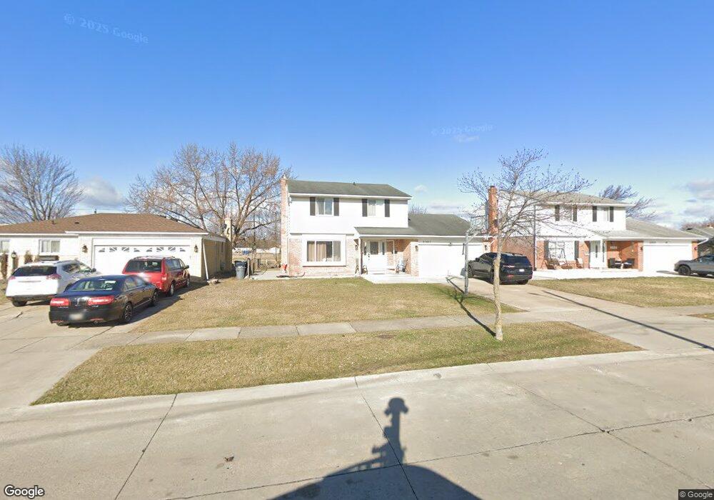
33867 Richard O Dr Sterling Heights, MI 48310
Estimated Value: $303,802 - $340,000
4
Beds
3
Baths
1,722
Sq Ft
$191/Sq Ft
Est. Value
About This Home
This home is located at 33867 Richard O Dr, Sterling Heights, MI 48310 and is currently estimated at $328,201, approximately $190 per square foot. 33867 Richard O Dr is a home located in Macomb County with nearby schools including Angus Elementary School, Grissom Middle School, and Warren Mott High School.
Ownership History
Date
Name
Owned For
Owner Type
Purchase Details
Closed on
May 29, 2009
Sold by
Nafso Kais and Nafso Rhonda
Bought by
Kashat Raed
Current Estimated Value
Home Financials for this Owner
Home Financials are based on the most recent Mortgage that was taken out on this home.
Original Mortgage
$117,826
Outstanding Balance
$74,685
Interest Rate
4.83%
Mortgage Type
FHA
Estimated Equity
$253,516
Purchase Details
Closed on
Oct 10, 1996
Sold by
Zona M and Zona D
Bought by
Nafso K
Create a Home Valuation Report for This Property
The Home Valuation Report is an in-depth analysis detailing your home's value as well as a comparison with similar homes in the area
Home Values in the Area
Average Home Value in this Area
Purchase History
| Date | Buyer | Sale Price | Title Company |
|---|---|---|---|
| Kashat Raed | $120,000 | Capital Title Ins Agency | |
| Nafso K | $135,500 | -- |
Source: Public Records
Mortgage History
| Date | Status | Borrower | Loan Amount |
|---|---|---|---|
| Open | Kashat Raed | $117,826 |
Source: Public Records
Tax History Compared to Growth
Tax History
| Year | Tax Paid | Tax Assessment Tax Assessment Total Assessment is a certain percentage of the fair market value that is determined by local assessors to be the total taxable value of land and additions on the property. | Land | Improvement |
|---|---|---|---|---|
| 2025 | $3,236 | $146,900 | $0 | $0 |
| 2024 | $3,122 | $138,100 | $0 | $0 |
| 2023 | $2,964 | $125,900 | $0 | $0 |
| 2022 | $2,874 | $112,100 | $0 | $0 |
| 2021 | $2,970 | $104,400 | $0 | $0 |
| 2020 | $2,824 | $101,100 | $0 | $0 |
| 2019 | $2,784 | $95,900 | $0 | $0 |
| 2018 | $2,807 | $81,700 | $0 | $0 |
| 2017 | $2,708 | $75,000 | $15,500 | $59,500 |
| 2016 | $2,651 | $75,000 | $0 | $0 |
| 2015 | -- | $71,800 | $0 | $0 |
| 2014 | -- | $60,800 | $0 | $0 |
Source: Public Records
Map
Nearby Homes
- 3538 Cero Dr
- 33569 Breckenridge Dr
- 3040 Alden Dr
- 3528 Byrd Dr
- 34544 Sandwood Dr
- 33735 Kennedy Dr
- 2630 Pall Mall Dr
- 2600 Pall Mall Dr
- 34579 Hawke Dr
- 33288 Viceroy Dr
- 33731 Newport Dr
- 2528 Koper Dr
- 2268 Serra Dr
- 2269 Serra Dr
- 3868 Elvera Ln Unit 11
- 32603 Dowland Dr
- 4468 15 Mile Rd Unit F104
- 32805 Hawthorne Dr
- 34150 Dequindre Rd
- 5575 E 14 Mile Rd
- 33855 Richard O Dr
- 33897 Richard O Dr
- 3511 La Manna Dr
- 33909 Richard O Dr
- 33831 Richard O Dr
- 3508 La Manna Dr
- 3511 Lamanna Dr
- 3510 Grigg Dr
- 3525 La Manna Dr
- 3525 La Manna Dr Unit Drive
- 33923 Richard O Dr
- 3522 La Manna Dr
- 33819 Richard O Dr
- 3509 Hein Dr
- 3524 Grigg Dr
- 3537 La Manna Dr
- 33935 Richard O Dr
- 3534 La Manna Dr
- 3523 Hein Dr
- 3536 Grigg Dr