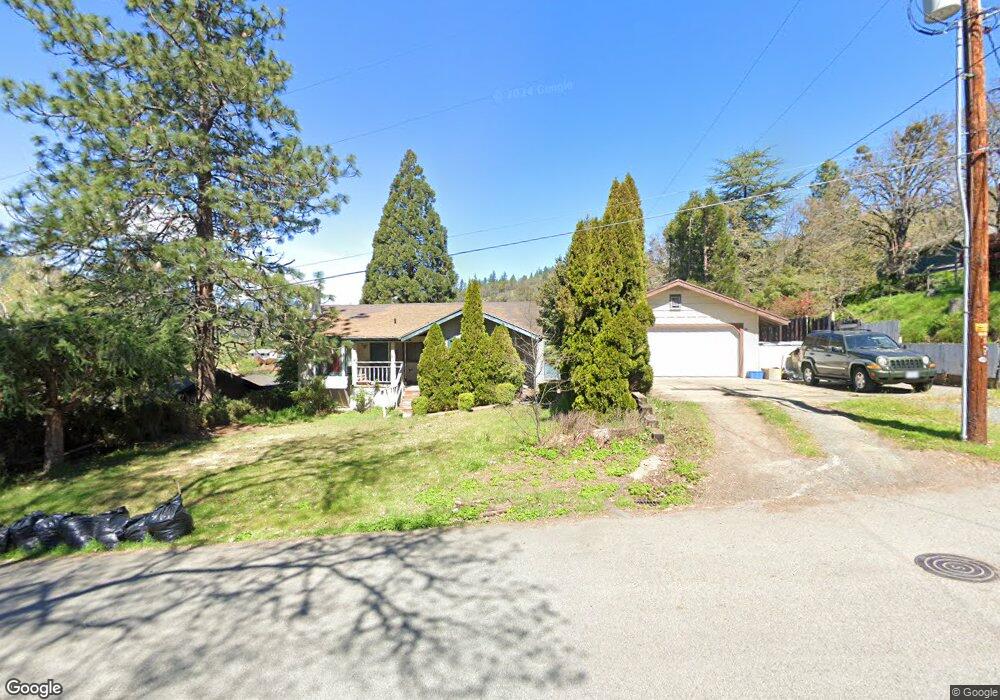
339 7th St Rogue River, OR 97537
Estimated Value: $410,000 - $487,000
3
Beds
2
Baths
1,888
Sq Ft
$240/Sq Ft
Est. Value
About This Home
This home is located at 339 7th St, Rogue River, OR 97537 and is currently estimated at $453,352, approximately $240 per square foot. 339 7th St is a home located in Jackson County with nearby schools including Rogue River Elementary School, South Valley Academy, and Rogue River Junior/Senior High School.
Ownership History
Date
Name
Owned For
Owner Type
Purchase Details
Closed on
Jun 21, 2002
Sold by
Donahue Thomas E and Donahue Deborah A
Bought by
Dee James and Dee Eunice
Current Estimated Value
Purchase Details
Closed on
Oct 12, 1998
Sold by
Grow Daniel E and Grow Vera
Bought by
Donahue Thomas E and Donahue Deborah A
Home Financials for this Owner
Home Financials are based on the most recent Mortgage that was taken out on this home.
Original Mortgage
$101,600
Interest Rate
9.25%
Create a Home Valuation Report for This Property
The Home Valuation Report is an in-depth analysis detailing your home's value as well as a comparison with similar homes in the area
Home Values in the Area
Average Home Value in this Area
Purchase History
| Date | Buyer | Sale Price | Title Company |
|---|---|---|---|
| Dee James | $115,973 | -- | |
| Donahue Thomas E | $127,000 | Crater Title Insurance |
Source: Public Records
Mortgage History
| Date | Status | Borrower | Loan Amount |
|---|---|---|---|
| Previous Owner | Donahue Thomas E | $101,600 | |
| Closed | Donahue Thomas E | $12,700 |
Source: Public Records
Tax History Compared to Growth
Tax History
| Year | Tax Paid | Tax Assessment Tax Assessment Total Assessment is a certain percentage of the fair market value that is determined by local assessors to be the total taxable value of land and additions on the property. | Land | Improvement |
|---|---|---|---|---|
| 2025 | $3,368 | $235,900 | $84,290 | $151,610 |
| 2024 | $3,368 | $229,030 | $81,840 | $147,190 |
| 2023 | $3,259 | $222,360 | $79,450 | $142,910 |
| 2022 | $3,183 | $222,360 | $79,450 | $142,910 |
| 2021 | $3,093 | $215,890 | $77,140 | $138,750 |
| 2020 | $3,013 | $209,610 | $74,890 | $134,720 |
| 2019 | $2,941 | $197,590 | $70,590 | $127,000 |
| 2018 | $2,864 | $191,840 | $68,540 | $123,300 |
| 2017 | $2,799 | $191,840 | $68,540 | $123,300 |
| 2016 | $2,729 | $180,840 | $64,600 | $116,240 |
| 2015 | $2,652 | $180,840 | $62,000 | $118,840 |
| 2014 | $2,567 | $170,470 | $58,450 | $112,020 |
Source: Public Records
Map
Nearby Homes
- 305 Woodville Way
- 300 Woodville Way
- 904 Broadway St Unit 503
- 815 Pine St Unit 10
- 4529 E Evans Creek Rd
- 105 Brolin Ct
- 0 Oak St
- 405 Magerle Ln
- 0 W Evans Creek Rd Unit 1000 220202360
- 0 W Evans Creek Rd Unit 1200 220202358
- 713 Brookside Cir
- 111 Cedar St
- 419 E Main St
- TL 1303 E Main St
- 182 Wards Creek Rd
- 2661 Wards Creek Rd
- 299 Foothill Blvd
- 208 W Main St
- 202 Arbor St
- 207 Madrone St