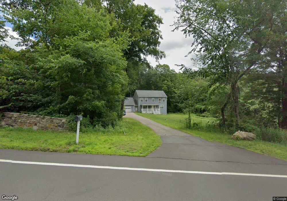
339 Cherry Brook Rd Canton, CT 06019
Estimated Value: $489,899 - $794,000
4
Beds
3
Baths
2,214
Sq Ft
$268/Sq Ft
Est. Value
About This Home
This home is located at 339 Cherry Brook Rd, Canton, CT 06019 and is currently estimated at $593,225, approximately $267 per square foot. 339 Cherry Brook Rd is a home with nearby schools including Cherry Brook Primary School, Canton Intermediate School, and Canton Middle School.
Ownership History
Date
Name
Owned For
Owner Type
Purchase Details
Closed on
Oct 10, 2012
Sold by
Mayo Melvin L
Bought by
Mayo Elizabeth M
Current Estimated Value
Purchase Details
Closed on
Dec 19, 2001
Sold by
Bonczek William J
Bought by
Mayo Melvin L and Mayo Elizabeth M
Home Financials for this Owner
Home Financials are based on the most recent Mortgage that was taken out on this home.
Original Mortgage
$32,000
Interest Rate
6.03%
Create a Home Valuation Report for This Property
The Home Valuation Report is an in-depth analysis detailing your home's value as well as a comparison with similar homes in the area
Home Values in the Area
Average Home Value in this Area
Purchase History
| Date | Buyer | Sale Price | Title Company |
|---|---|---|---|
| Mayo Elizabeth M | -- | -- | |
| Mayo Elizabeth M | -- | -- | |
| Mayo Melvin L | $40,000 | -- | |
| Mayo Melvin L | $40,000 | -- |
Source: Public Records
Mortgage History
| Date | Status | Borrower | Loan Amount |
|---|---|---|---|
| Open | Mayo Melvin L | $275,950 | |
| Previous Owner | Mayo Melvin L | $32,000 |
Source: Public Records
Tax History
| Year | Tax Paid | Tax Assessment Tax Assessment Total Assessment is a certain percentage of the fair market value that is determined by local assessors to be the total taxable value of land and additions on the property. | Land | Improvement |
|---|---|---|---|---|
| 2025 | $9,145 | $272,980 | $75,210 | $197,770 |
| 2024 | $9,322 | $272,980 | $75,210 | $197,770 |
| 2023 | $7,541 | $213,190 | $62,470 | $150,720 |
| 2022 | $7,182 | $213,190 | $62,470 | $150,720 |
| 2021 | $7,082 | $213,190 | $62,470 | $150,720 |
| 2020 | $6,948 | $213,190 | $62,470 | $150,720 |
| 2019 | $6,828 | $213,190 | $62,470 | $150,720 |
| 2018 | $7,425 | $241,850 | $66,500 | $175,350 |
| 2017 | $7,374 | $241,850 | $66,500 | $175,350 |
| 2016 | $5,824 | $195,700 | $66,500 | $129,200 |
| 2015 | $1,941 | $66,500 | $66,500 | $0 |
| 2014 | $1,899 | $66,500 | $66,500 | $0 |
Source: Public Records
Map
Nearby Homes
- 22 Bel Aire Ln
- 308 Cherry Brook Rd
- 73 High Valley Dr
- 33 Westwood Dr
- 11 Timbercrest Dr
- 15 Red Fox Run
- 52 Shingle Mill Rd
- 35 Shingle Mill Rd
- 516 Cherry Brook Rd
- 121 Gracey Rd
- 152 E Hill Rd
- 10 Shingle Mill Dr
- 158 Westledge Rd
- 9 Bridlepath Rd
- 13 Woodland Dr
- 70 E Hill Rd
- 14 Brookview Cir
- 9 Thompson Hill Rd
- 24 Thompson Hill Rd
- 18 Meadowlark Rd
- 333 Cherry Brook Rd
- 343 Cherry Brook Rd
- 340 Cherry Brook Rd
- 331 Cherry Brook Rd
- 347 Cherry Brook Rd
- 335 Cherry Brook Rd
- 327 Cherry Brook Rd
- 351 Cherry Brook Rd
- 356 Cherry Brook Rd
- 321 Cherry Brook Rd
- 355 Cherry Brook Rd
- 317 Cherry Brook Rd
- 6 Bel Aire Ln
- 360 Cherry Brook Rd
- 370 Cherry Brook Rd
- 11 Bel Aire Ln
- 310 Cherry Brook Rd
- 305 Cherry Brook Rd
- 366 Cherry Brook Rd
- 10 Bel Aire Ln
Your Personal Tour Guide
Ask me questions while you tour the home.