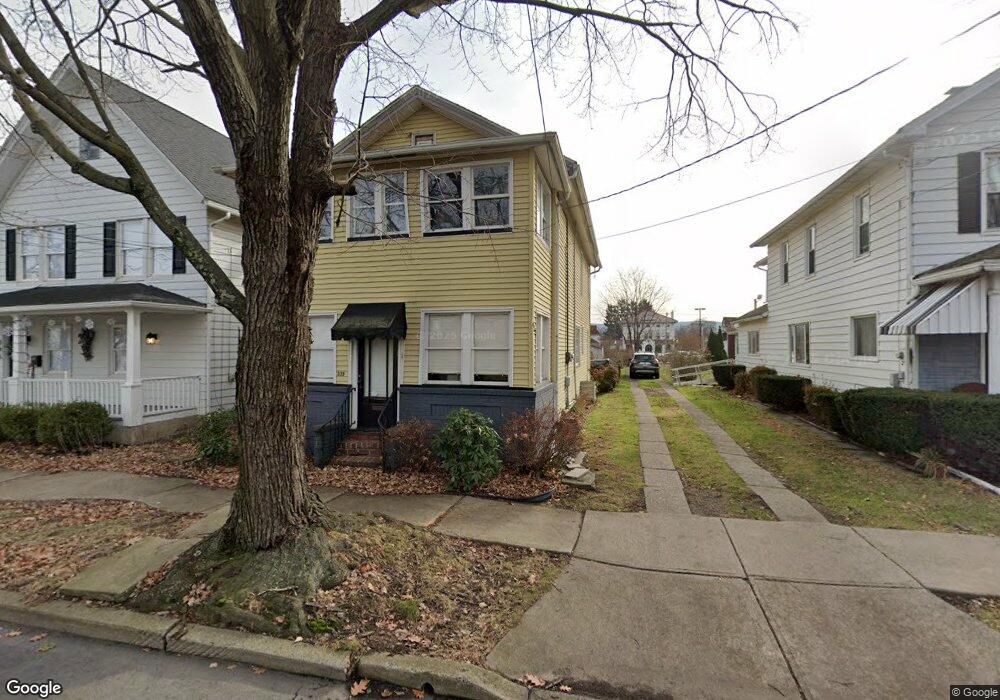
339 Chestnut Ave Kingston, PA 18704
Estimated Value: $214,614 - $261,000
--
Bed
--
Bath
2,064
Sq Ft
$111/Sq Ft
Est. Value
About This Home
This home is located at 339 Chestnut Ave, Kingston, PA 18704 and is currently estimated at $228,154, approximately $110 per square foot. 339 Chestnut Ave is a home located in Luzerne County with nearby schools including Wyoming Valley West Senior High School, Good Shepherd Academy, and St. Hedwig Elementary School.
Ownership History
Date
Name
Owned For
Owner Type
Purchase Details
Closed on
Apr 11, 2016
Sold by
John L Meehan
Bought by
Policare Christine and Policare Gregory
Current Estimated Value
Home Financials for this Owner
Home Financials are based on the most recent Mortgage that was taken out on this home.
Original Mortgage
$80,250
Outstanding Balance
$63,565
Interest Rate
3.59%
Estimated Equity
$164,589
Purchase Details
Closed on
Sep 10, 1996
Bought by
Evans John George
Create a Home Valuation Report for This Property
The Home Valuation Report is an in-depth analysis detailing your home's value as well as a comparison with similar homes in the area
Home Values in the Area
Average Home Value in this Area
Purchase History
| Date | Buyer | Sale Price | Title Company |
|---|---|---|---|
| Policare Christine | -- | -- | |
| Evans John George | $54,000 | -- |
Source: Public Records
Mortgage History
| Date | Status | Borrower | Loan Amount |
|---|---|---|---|
| Open | Policare Christine | $80,250 | |
| Closed | Policare Christine | -- |
Source: Public Records
Tax History Compared to Growth
Tax History
| Year | Tax Paid | Tax Assessment Tax Assessment Total Assessment is a certain percentage of the fair market value that is determined by local assessors to be the total taxable value of land and additions on the property. | Land | Improvement |
|---|---|---|---|---|
| 2025 | $2,720 | $103,100 | $16,000 | $87,100 |
| 2024 | $2,720 | $103,100 | $16,000 | $87,100 |
| 2023 | $2,674 | $103,100 | $16,000 | $87,100 |
| 2022 | $2,655 | $103,100 | $16,000 | $87,100 |
| 2021 | $2,579 | $103,100 | $16,000 | $87,100 |
| 2020 | $2,579 | $103,100 | $16,000 | $87,100 |
| 2019 | $2,503 | $103,100 | $16,000 | $87,100 |
| 2018 | $2,424 | $103,100 | $16,000 | $87,100 |
| 2017 | $2,356 | $103,100 | $16,000 | $87,100 |
| 2016 | -- | $103,100 | $16,000 | $87,100 |
| 2015 | -- | $103,100 | $16,000 | $87,100 |
| 2014 | -- | $103,100 | $16,000 | $87,100 |
Source: Public Records
Map
Nearby Homes
- 474 Chestnut Ave
- 127 Division St
- LOTS Zerby Ave
- 143 Zerby Ave
- 216 Reynolds St
- 116 Herman St
- 38 Hedge Place
- 278 Pringle St
- 100 N Loveland Ave
- 265 Lawrence St
- 59 N Loveland Ave
- 114 W Union St
- 15 Hillside Ave
- 16 Flannagan St
- 70 John St
- 476 Grove St
- 43 Rice Ave
- 153 N Gates Ave
- 745 Main St
- 667 Gibson Ave
- 335 Chestnut Ave
- 333 Chestnut Ave
- 343 Chestnut Ave
- 345 Chestnut Ave
- 347 Chestnut Ave
- 76 Pringle St
- 349 Chestnut Ave
- 72 Pringle St
- 77 Pringle St
- 367 Chestnut Ave
- 63 Pringle St
- 364 Chestnut Ave
- 73 Pringle St
- 368 Chestnut Ave
- 373 Chestnut Ave
- 309 Chestnut Ave
- 372 Chestnut Ave
- 305 Chestnut Ave
- 109 Pringle St
- 368 N Maple Ave