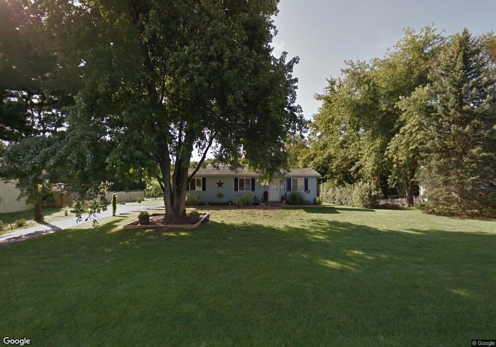
339 Dorwart Cir Etters, PA 17319
Estimated Value: $272,000 - $311,000
3
Beds
2
Baths
1,452
Sq Ft
$202/Sq Ft
Est. Value
About This Home
This home is located at 339 Dorwart Cir, Etters, PA 17319 and is currently estimated at $293,004, approximately $201 per square foot. 339 Dorwart Cir is a home located in York County with nearby schools including Fishing Creek Elementary School, Crossroads Middle School, and Red Land Senior High School.
Ownership History
Date
Name
Owned For
Owner Type
Purchase Details
Closed on
Sep 27, 2007
Sold by
Ensminger Matthew A and Ensminger Jennifer D
Bought by
Sipe Vanessa D
Current Estimated Value
Home Financials for this Owner
Home Financials are based on the most recent Mortgage that was taken out on this home.
Original Mortgage
$145,758
Outstanding Balance
$93,082
Interest Rate
6.65%
Mortgage Type
Purchase Money Mortgage
Estimated Equity
$199,922
Purchase Details
Closed on
Mar 16, 2006
Sold by
Linburg Joel and Linburg Tina M
Bought by
Ensminger Matthew A and Ensminger Jennifer D
Home Financials for this Owner
Home Financials are based on the most recent Mortgage that was taken out on this home.
Original Mortgage
$118,960
Interest Rate
6.27%
Mortgage Type
FHA
Purchase Details
Closed on
Jul 20, 2005
Sold by
Fisher Carl G and Fisher Carolyn K
Bought by
Linburg Joel and Harkins Sheila
Create a Home Valuation Report for This Property
The Home Valuation Report is an in-depth analysis detailing your home's value as well as a comparison with similar homes in the area
Home Values in the Area
Average Home Value in this Area
Purchase History
| Date | Buyer | Sale Price | Title Company |
|---|---|---|---|
| Sipe Vanessa D | $142,900 | None Available | |
| Ensminger Matthew A | $119,900 | None Available | |
| Linburg Joel | $56,000 | -- |
Source: Public Records
Mortgage History
| Date | Status | Borrower | Loan Amount |
|---|---|---|---|
| Open | Sipe Vanessa D | $145,758 | |
| Previous Owner | Ensminger Matthew A | $118,960 |
Source: Public Records
Tax History Compared to Growth
Tax History
| Year | Tax Paid | Tax Assessment Tax Assessment Total Assessment is a certain percentage of the fair market value that is determined by local assessors to be the total taxable value of land and additions on the property. | Land | Improvement |
|---|---|---|---|---|
| 2025 | $3,204 | $122,380 | $31,010 | $91,370 |
| 2024 | $3,034 | $122,380 | $31,010 | $91,370 |
| 2023 | $2,951 | $122,380 | $31,010 | $91,370 |
| 2022 | $2,942 | $122,380 | $31,010 | $91,370 |
| 2021 | $2,768 | $122,380 | $31,010 | $91,370 |
| 2020 | $2,734 | $122,380 | $31,010 | $91,370 |
| 2019 | $2,687 | $122,380 | $31,010 | $91,370 |
| 2018 | $2,634 | $122,380 | $31,010 | $91,370 |
| 2017 | $2,545 | $122,380 | $31,010 | $91,370 |
| 2016 | $0 | $122,380 | $31,010 | $91,370 |
| 2015 | -- | $122,380 | $31,010 | $91,370 |
| 2014 | -- | $110,660 | $31,010 | $79,650 |
Source: Public Records
Map
Nearby Homes
- 300 Valley Rd
- 322 Valley Rd
- 346 Spring Run Ct
- 313 Lamp Post Ln
- 318 Woodbridge Dr
- 330 Braddock Dr
- 633 Canvasbach Dr Unit 17B
- 604 Bluebill Dr Unit 22D
- 603 Bluebill Dr Unit 21B
- 667 Old York Rd
- 60 Red Barberry Dr
- 25 Killinger Rd
- 439 Shuler Rd
- 45 Red Barberry Dr
- 73 Rose of Sharon Dr
- 24 Rose of Sharon Dr
- 2 Russian Olive Dr
- 28 White Dogwood Dr
- 44 N Conley Ln
- 30 Highland Cir
- 337 Dorwart Cir
- 341 Dorwart Cir
- 338 Dorwart Cir
- 336 Dorwart Cir
- 340 Dorwart Cir
- 343 Dorwart Cir
- 335 Dorwart Cir
- 342 Dorwart Cir
- 301 Dorwart Cir
- 334 Dorwart Cir
- 299 Dorwart Cir
- 303 Dorwart Cir
- 345 Dorwart Cir
- 344 Dorwart Cir
- 297 Dorwart Cir
- 333 Dorwart Cir
- 305 Dorwart Cir
- 310 Valley Rd
- 347 Dorwart Cir
- 295 Dorwart Cir