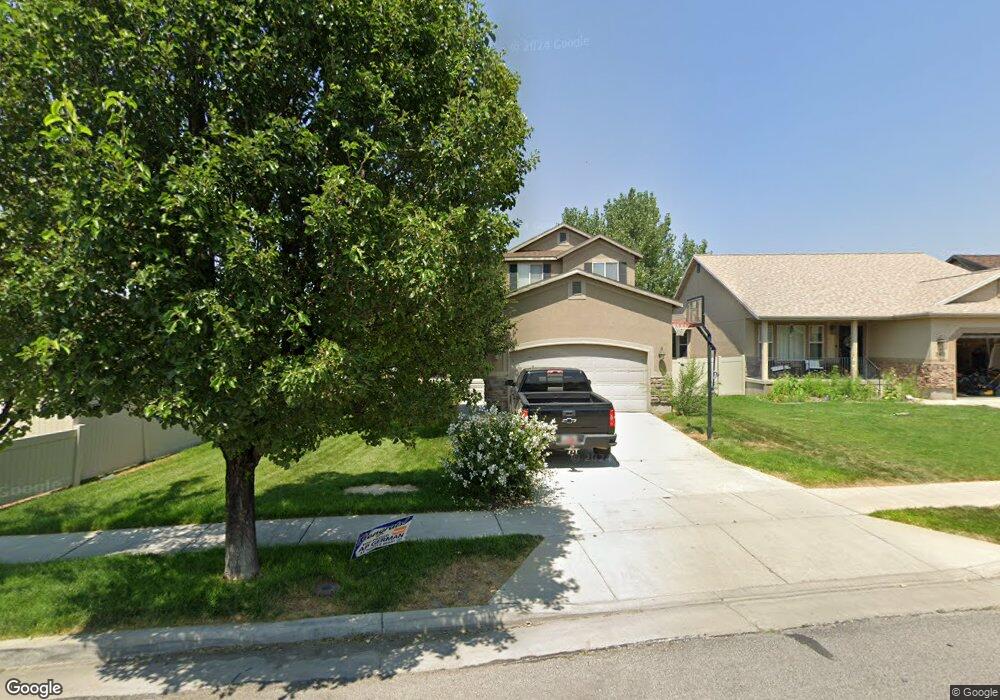
339 E 1720 N Tooele, UT 84074
Estimated Value: $444,000 - $490,000
6
Beds
3
Baths
2,818
Sq Ft
$165/Sq Ft
Est. Value
About This Home
This home is located at 339 E 1720 N, Tooele, UT 84074 and is currently estimated at $464,804, approximately $164 per square foot. 339 E 1720 N is a home located in Tooele County with nearby schools including Copper Canyon Elementary School, Clarke N. Johnsen Junior High School, and Stansbury High School.
Ownership History
Date
Name
Owned For
Owner Type
Purchase Details
Closed on
Dec 26, 2014
Sold by
Hall Andrew Robert and Hall Rebecca
Bought by
Hall Andrew Robert and Hall Rebecca Joe
Current Estimated Value
Purchase Details
Closed on
Mar 3, 2011
Sold by
Culley Dwayne B and Culley Sara L
Bought by
Hall Andrew Robert and Hall Rebecca
Home Financials for this Owner
Home Financials are based on the most recent Mortgage that was taken out on this home.
Original Mortgage
$177,900
Outstanding Balance
$121,773
Interest Rate
4.71%
Mortgage Type
New Conventional
Estimated Equity
$343,031
Purchase Details
Closed on
Mar 6, 2008
Sold by
Reliance Homes Inc
Bought by
Culley Dwayne B and Culley Sara L
Home Financials for this Owner
Home Financials are based on the most recent Mortgage that was taken out on this home.
Original Mortgage
$246,518
Interest Rate
5.41%
Mortgage Type
FHA
Create a Home Valuation Report for This Property
The Home Valuation Report is an in-depth analysis detailing your home's value as well as a comparison with similar homes in the area
Home Values in the Area
Average Home Value in this Area
Purchase History
| Date | Buyer | Sale Price | Title Company |
|---|---|---|---|
| Hall Andrew Robert | -- | None Available | |
| Hall Andrew Robert | -- | Inwest Title Tooele Office | |
| Culley Dwayne B | -- | Merrill Title Co | |
| Reliance Homes Inc | -- | Merrill Title Company |
Source: Public Records
Mortgage History
| Date | Status | Borrower | Loan Amount |
|---|---|---|---|
| Open | Hall Andrew Robert | $177,900 | |
| Previous Owner | Culley Dwayne B | $246,518 |
Source: Public Records
Tax History Compared to Growth
Tax History
| Year | Tax Paid | Tax Assessment Tax Assessment Total Assessment is a certain percentage of the fair market value that is determined by local assessors to be the total taxable value of land and additions on the property. | Land | Improvement |
|---|---|---|---|---|
| 2025 | $3,080 | $467,078 | $100,000 | $367,078 |
| 2024 | $3,092 | $236,045 | $55,000 | $181,045 |
| 2023 | $3,092 | $265,275 | $52,383 | $212,892 |
| 2022 | $3,172 | $272,873 | $51,906 | $220,967 |
| 2021 | $2,651 | $190,738 | $20,763 | $169,975 |
| 2020 | $2,513 | $313,683 | $37,750 | $275,933 |
| 2019 | $2,448 | $300,543 | $37,750 | $262,793 |
| 2018 | $2,256 | $262,706 | $40,000 | $222,706 |
| 2017 | $1,695 | $234,167 | $35,000 | $199,167 |
| 2016 | $1,362 | $114,504 | $19,250 | $95,254 |
| 2015 | $1,362 | $99,055 | $0 | $0 |
| 2014 | -- | $99,055 | $0 | $0 |
Source: Public Records
Map
Nearby Homes
- 348 1770 N
- 1737 N Broadway Ave
- 1721 Copper Canyon Dr Unit 1282
- 1725 Copper Canyon Dr Unit 1283
- 1833 N Blue Iris Ave Unit 1073
- 1756 N Patchwork Ave Unit 1258
- 1752 N Patchwork Ave Unit 1259
- 1727 N Patchwork Ave Unit 1268
- 1737 N Patchwork Ave Unit 1266
- 1693 N Patchwork Ave Unit 1275
- 1713 N Patchwork Ave Unit 1271
- 1778 N Patchwork Ave Unit 1253
- 1834 N 370 E
- 1917 N Blue Iris Ave Unit 1090
- 1618 N 210 E
- 1598 N 210 E Unit 107
- 1725 180 E Unit D137
- 277 E Serenity Ave Unit 1009
- 203 E Serenity Ave Unit 1214
- Dalton Plan at Western Acres
- 347 E 1720 N
- 1726 N Broadway Ave Unit 3
- 1726 N Broadway Ave
- 1734 N Broadway
- 355 E 1720 N
- 358 E 1770 N
- 1742 N Broadway
- 356 E 1770 N
- 364 E 1770 N
- 354 1770 N
- 1731 N 370 E
- 365 E 1720 N Unit 7
- 348 E 1720 N
- 332 E 1720 N
- 1741 N 370 E
- 352 E 1770 N
- 1748 N Broadway Ave Unit 103
- 358 E 1720 N
- 1721 N Broadway Ave
- 1762 N Broadway Ave Unit 9