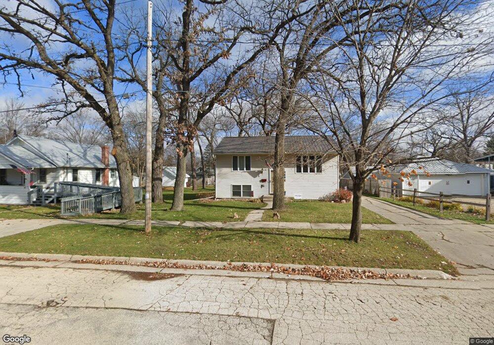
339 Forest Park Blvd South Beloit, IL 61080
Estimated Value: $145,000 - $158,000
4
Beds
2
Baths
832
Sq Ft
$180/Sq Ft
Est. Value
About This Home
This home is located at 339 Forest Park Blvd, South Beloit, IL 61080 and is currently estimated at $149,954, approximately $180 per square foot. 339 Forest Park Blvd is a home located in Winnebago County with nearby schools including Clark Elementary School, Riverview Elementary School, and South Beloit Junior High School.
Ownership History
Date
Name
Owned For
Owner Type
Purchase Details
Closed on
Jan 8, 2002
Sold by
Brown Jeffrey R and Brown Lynn F
Bought by
Walmer Randy A
Current Estimated Value
Home Financials for this Owner
Home Financials are based on the most recent Mortgage that was taken out on this home.
Original Mortgage
$60,200
Interest Rate
4%
Mortgage Type
New Conventional
Create a Home Valuation Report for This Property
The Home Valuation Report is an in-depth analysis detailing your home's value as well as a comparison with similar homes in the area
Home Values in the Area
Average Home Value in this Area
Purchase History
| Date | Buyer | Sale Price | Title Company |
|---|---|---|---|
| Walmer Randy A | $86,000 | Rtc | |
| Walmer Randy | $86,000 | -- |
Source: Public Records
Mortgage History
| Date | Status | Borrower | Loan Amount |
|---|---|---|---|
| Previous Owner | Walmer Randy A | $60,200 |
Source: Public Records
Tax History Compared to Growth
Tax History
| Year | Tax Paid | Tax Assessment Tax Assessment Total Assessment is a certain percentage of the fair market value that is determined by local assessors to be the total taxable value of land and additions on the property. | Land | Improvement |
|---|---|---|---|---|
| 2024 | $2,866 | $43,904 | $2,652 | $41,252 |
| 2023 | $2,454 | $35,589 | $2,150 | $33,439 |
| 2022 | $2,293 | $32,513 | $1,964 | $30,549 |
| 2021 | $2,183 | $30,426 | $1,838 | $28,588 |
| 2020 | $2,122 | $29,460 | $1,780 | $27,680 |
| 2019 | $2,104 | $28,379 | $1,715 | $26,664 |
| 2018 | $2,021 | $27,049 | $1,635 | $25,414 |
| 2017 | $2,039 | $25,926 | $1,567 | $24,359 |
| 2016 | $1,987 | $0 | $0 | $0 |
| 2015 | $1,962 | $24,502 | $1,481 | $23,021 |
| 2014 | $1,961 | $24,502 | $1,481 | $23,021 |
Source: Public Records
Map
Nearby Homes
- xxx Perry Ave
- 317 Burr Oak Ave
- 314 Liston Ave
- 320 Liston Ave
- 110 Smith Ln
- 214 Sauk Ridge Dr Unit 1
- 214 Sauk Ridge Dr Unit 18214
- 666 S Bluff #818 St
- 553 Northwestern Ave
- 540 Eastern Ave
- 735 Eastern Ave
- 15361 S Bluff Rd
- 532 Hemenway Place
- 472 Clark St
- 1912 Blackhawk Blvd
- 620 Hemenway Place
- 215 S Moore St
- 127 S Blackhawk Blvd
- 1523 Fern (Lots 38-42) Ln
- 1523 Fern Ln
- 333 Forest Park Blvd
- 332 Forest Park Blvd
- 327 Forest Park Blvd
- 340 Forest Park Blvd
- 345 Forest Park Blvd
- 334 Forest Park Blvd
- 330 Forest Park Blvd
- 338 Perry Ave
- 325 Forest Park Blvd
- 344 Perry Ave
- 330 Perry Ave
- 349 Forest Park Blvd
- 346 Forest Park Blvd
- 346 Perry Ave
- 1202 Shaw St
- 1106 Shaw St
- 319 Forest Park Blvd
- 337 Fair Oaks Blvd
- 324 Forest Park Blvd
- 333 Fair Oaks Blvd