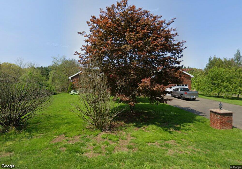
339 Mohegan Rd Shelton, CT 06484
Estimated Value: $772,847 - $942,000
4
Beds
4
Baths
2,986
Sq Ft
$284/Sq Ft
Est. Value
About This Home
This home is located at 339 Mohegan Rd, Shelton, CT 06484 and is currently estimated at $847,712, approximately $283 per square foot. 339 Mohegan Rd is a home located in Fairfield County with nearby schools including Mohegan Elementary School, Perry Hill School, and Shelton Intermediate School.
Ownership History
Date
Name
Owned For
Owner Type
Purchase Details
Closed on
Jan 5, 2011
Sold by
Bank Of New York
Bought by
Matos 3Rd Francisco
Current Estimated Value
Purchase Details
Closed on
Nov 23, 2010
Sold by
Stevenson Jacinta
Bought by
Bank Of New York
Purchase Details
Closed on
Jan 7, 2005
Sold by
Feola Enrico and Feola Mary
Bought by
Stevenson Jacinth
Create a Home Valuation Report for This Property
The Home Valuation Report is an in-depth analysis detailing your home's value as well as a comparison with similar homes in the area
Home Values in the Area
Average Home Value in this Area
Purchase History
| Date | Buyer | Sale Price | Title Company |
|---|---|---|---|
| Matos 3Rd Francisco | $335,000 | -- | |
| Matos 3Rd Francisco | $335,000 | -- | |
| Bank Of New York | -- | -- | |
| Bank Of New York | -- | -- | |
| Stevenson Jacinth | $500,000 | -- | |
| Stevenson Jacinth | $500,000 | -- |
Source: Public Records
Mortgage History
| Date | Status | Borrower | Loan Amount |
|---|---|---|---|
| Closed | Stevenson Jacinth | $60,000 | |
| Closed | Stevenson Jacinth | $40,000 |
Source: Public Records
Tax History Compared to Growth
Tax History
| Year | Tax Paid | Tax Assessment Tax Assessment Total Assessment is a certain percentage of the fair market value that is determined by local assessors to be the total taxable value of land and additions on the property. | Land | Improvement |
|---|---|---|---|---|
| 2025 | $7,590 | $403,270 | $105,000 | $298,270 |
| 2024 | $7,735 | $403,270 | $105,000 | $298,270 |
| 2023 | $7,045 | $403,270 | $105,000 | $298,270 |
| 2022 | $7,045 | $403,270 | $105,000 | $298,270 |
| 2021 | $6,653 | $301,980 | $66,710 | $235,270 |
| 2020 | $6,770 | $301,980 | $66,710 | $235,270 |
| 2019 | $6,770 | $301,980 | $66,710 | $235,270 |
| 2017 | $6,707 | $301,980 | $66,710 | $235,270 |
| 2015 | $6,202 | $277,970 | $64,190 | $213,780 |
| 2014 | $6,202 | $277,970 | $64,190 | $213,780 |
Source: Public Records
Map
Nearby Homes
- 43 Moose Hill Rd
- 36 Moose Hill Rd
- 184 Hurd Rd
- 340 Moose Hill Rd
- 6 Brookview Dr
- 137 Greenwood Ln
- 152 Richards Dr
- 1209 Daniels Farm Rd
- 6 Dartmouth Dr
- 121 Lewis Rd
- 19 Pamela Dr
- 119 Lewis Rd
- 18 Skating Pond Rd
- 23 Bonita Dr
- 3 Pam Bar Dr
- 349 Spring Hill Rd
- 13 School St
- 21 Philip Dr
- 13 Jeanette St
- Lot A Abbey Ln
- 329 Mohegan Rd Unit A
- 329 Mohegan Rd
- 325 Mohegan Rd
- 321 Mohegan Rd
- 335 Mohegan Rd
- 24 Moose Hill Rd
- 20 Moose Hill Rd
- 16 Moose Hill Rd
- 12 Moose Hill Rd
- 378 Mohegan Rd
- 11 Moose Hill Rd
- 286 Mohegan Rd
- 382 Mohegan Rd
- 15A Moose Hill Rd
- 1 High Meadow Rd
- 11 Stag Ln
- 5 High Meadow Rd
- 2 High Meadow Rd
- 216 Moose Hill Rd