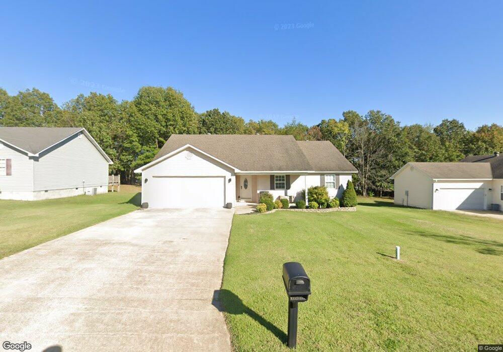
339 Murfield Dr Poplar Bluff, MO 63901
Estimated Value: $210,000 - $222,000
3
Beds
--
Bath
1,770
Sq Ft
$121/Sq Ft
Est. Value
About This Home
This home is located at 339 Murfield Dr, Poplar Bluff, MO 63901 and is currently estimated at $214,442, approximately $121 per square foot. 339 Murfield Dr is a home located in Butler County with nearby schools including Poplar Bluff Fifth & Sixth Grade Center, Oak Grove Elementary School, and Poplar Bluff Junior High School.
Ownership History
Date
Name
Owned For
Owner Type
Purchase Details
Closed on
May 3, 2022
Sold by
Mccauley Danner L and Mccauley Ashley D
Bought by
Hoon Justin T and Hoon Darby L
Current Estimated Value
Home Financials for this Owner
Home Financials are based on the most recent Mortgage that was taken out on this home.
Original Mortgage
$192,929
Outstanding Balance
$183,030
Interest Rate
5.1%
Mortgage Type
New Conventional
Estimated Equity
$31,412
Purchase Details
Closed on
Jan 9, 2012
Sold by
Nelson Nelson Bob C Bob C and Nelson Bob C
Bought by
Mccauley Danner L and Pennington Ashley D
Home Financials for this Owner
Home Financials are based on the most recent Mortgage that was taken out on this home.
Original Mortgage
$137,755
Interest Rate
4.04%
Mortgage Type
New Conventional
Create a Home Valuation Report for This Property
The Home Valuation Report is an in-depth analysis detailing your home's value as well as a comparison with similar homes in the area
Home Values in the Area
Average Home Value in this Area
Purchase History
| Date | Buyer | Sale Price | Title Company |
|---|---|---|---|
| Hoon Justin T | -- | None Listed On Document | |
| Mccauley Danner L | -- | None Available |
Source: Public Records
Mortgage History
| Date | Status | Borrower | Loan Amount |
|---|---|---|---|
| Open | Hoon Justin T | $192,929 | |
| Previous Owner | Mccauley Danner L | $137,755 |
Source: Public Records
Tax History
| Year | Tax Paid | Tax Assessment Tax Assessment Total Assessment is a certain percentage of the fair market value that is determined by local assessors to be the total taxable value of land and additions on the property. | Land | Improvement |
|---|---|---|---|---|
| 2024 | $12 | $28,040 | $0 | $0 |
| 2023 | $1,249 | $28,040 | $0 | $0 |
| 2022 | $1,208 | $27,180 | $0 | $0 |
| 2021 | $1,209 | $27,180 | $0 | $0 |
| 2020 | $1,195 | $26,460 | $0 | $0 |
| 2019 | $1,194 | $26,460 | $0 | $0 |
| 2018 | $1,194 | $26,460 | $0 | $0 |
| 2017 | -- | $26,460 | $0 | $0 |
| 2016 | -- | $26,460 | $0 | $0 |
| 2015 | -- | $26,460 | $0 | $0 |
| 2014 | -- | $25,680 | $0 | $0 |
| 2012 | -- | $25,680 | $0 | $0 |
Source: Public Records
Map
Nearby Homes
- 213 Murfield Dr
- 233 Ruth Harris Ln
- 231 Ruth Harris Ln
- 238 Ruth Harris Ln
- 145 Fortitude Ave
- 647 County Road 470
- 534 Highway M
- 303 Grady
- 265 Berkshire Dr
- 269 Berkshire Dr
- 2031 Carter State Highway M
- 0 Lot 22 Legacy Estates Unit MAR25007101
- 0 Lot 15 Legacy Estates
- Lot 1 W Highland Cir
- Lot 3 W Highland Cir
- Lot 2 W Highland Cir
- 0 Lot 23 Legacy Estates
- 325 County Road 467
- 0 Lot 62 Legacy Estates
- 246 Berkshire Dr
- 333 Murfield Dr
- 345 Murfield Dr
- 327 Murfield Dr
- 357 Murfield Dr
- 351 Murfield Dr
- 336 Murfield Dr
- 0 Murfield Dr
- 342 Murfield Dr
- 348 Murfield Dr
- 324 Murfield Dr
- 354 Murfield Dr
- 220 Murfield Dr
- 318 Murfield Dr
- 208 Murfield Dr
- 363 Murfield Dr
- 261 Murfield Dr
- 252 Murfield Dr
- 246 Murfield Dr
- 243 Murfield Dr
- 214 Murfield Dr
Your Personal Tour Guide
Ask me questions while you tour the home.