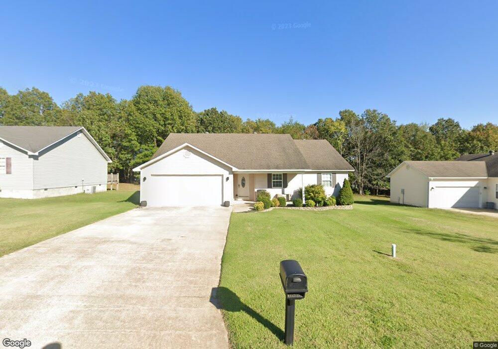
339 Murfield Dr Poplar Bluff, MO 63901
Estimated Value: $209,281 - $235,000
About This Home
This home is located at 339 Murfield Dr, Poplar Bluff, MO 63901 and is currently estimated at $218,320, approximately $123 per square foot. 339 Murfield Dr is a home located in Butler County with nearby schools including Poplar Bluff Fifth & Sixth Grade Center, Oak Grove Elementary School, and Poplar Bluff Junior High School.
Ownership History
We collect this data history from publicly available records. To have your information removed, we recommend requesting removal directly through your county’s website.
Purchase Details
Home Financials for this Owner
Home Financials are based on the most recent Mortgage that was taken out on this home.Purchase Details
Home Financials for this Owner
Home Financials are based on the most recent Mortgage that was taken out on this home.Home Values in the Area
Average Home Value in this Area
Purchase History
We collect this data history from publicly available records. To have your information removed, we recommend requesting removal directly through your county’s website.
| Date | Buyer | Sale Price | Title Company |
|---|---|---|---|
| -- | None Listed On Document | ||
| -- | None Available |
Mortgage History
We collect this data history from publicly available records. To have your information removed, we recommend requesting removal directly through your county’s website.
| Date | Status | Borrower | Loan Amount |
|---|---|---|---|
| Open | $192,929 | ||
| Previous Owner | $137,755 |
Tax History
We collect this data history from publicly available records. To have your information removed, we recommend requesting removal directly through your county’s website.
| Year | Tax Paid | Tax Assessment Tax Assessment Total Assessment is a certain percentage of the fair market value that is determined by local assessors to be the total taxable value of land and additions on the property. | Land | Improvement |
|---|---|---|---|---|
| 2025 | $1,323 | $30,420 | $0 | $0 |
| 2024 | $12 | $28,040 | $0 | $0 |
| 2023 | $1,249 | $28,040 | $0 | $0 |
| 2022 | $1,208 | $27,180 | $0 | $0 |
| 2021 | $1,209 | $27,180 | $0 | $0 |
| 2020 | $1,195 | $26,460 | $0 | $0 |
| 2019 | $1,194 | $26,460 | $0 | $0 |
| 2018 | $1,194 | $26,460 | $0 | $0 |
| 2017 | -- | $26,460 | $0 | $0 |
| 2016 | -- | $26,460 | $0 | $0 |
| 2015 | -- | $26,460 | $0 | $0 |
| 2014 | -- | $25,680 | $0 | $0 |
| 2012 | -- | $25,680 | $0 | $0 |
Map
- 225 Ruth Harris Ln
- 251 Ruth Harris Ln
- 523 Sunny Valley Ln
- 233 Ruth Harris Ln
- 973 Sunny Valley Ln
- 205 County Road 464
- 647 County Road 470
- 269 Berkshire Dr
- 5919 Melissa Ln
- 0 Lot 22 Legacy Estates Unit MAR25007101
- 0 Lot 15 Legacy Estates
- Lot 1 W Highland Cir
- Lot 3 W Highland Cir
- Lot 2 W Highland Cir
- 2031 Carter State Highway M
- 0 Lot 23 Legacy Estates
- 00 E Outer Rd
- 0 Lot 62 Legacy Estates
- 246 Berkshire Dr
- 0 Estates
- 327 Murfield Dr
- 0 Murfield Dr
- 315 Murfield Dr
- 303 Murfield Dr
- 311 Murfield Dr
- 333 Murfield Dr
- 318 Murfield Dr
- 324 Murfield Dr
- 314 Murfield Dr
- 265 Ruth Harris Ln
- 336 Murfield Dr
- 234 Murfield Dr
- 304 Murfield Dr
- 226 Murfield Dr
- 345 Murfield Dr
- 240 Murfield Dr
- 342 Murfield Dr
- 220 Murfield Dr
- 302 Murfield Dr
- 375 Murfield Dr
Ask me questions while you tour the home.