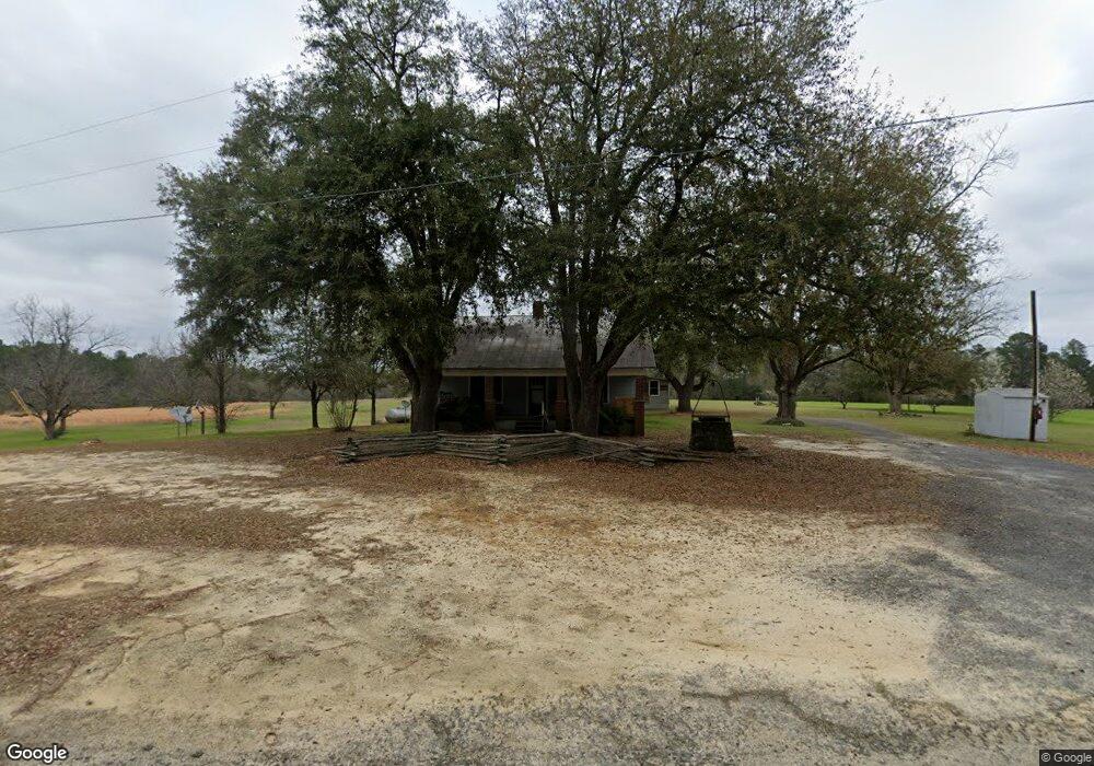
339 Nesmith Rd Cochran, GA 31014
Estimated Value: $182,000 - $364,448
3
Beds
1
Bath
1,576
Sq Ft
$173/Sq Ft
Est. Value
About This Home
This home is located at 339 Nesmith Rd, Cochran, GA 31014 and is currently estimated at $273,224, approximately $173 per square foot. 339 Nesmith Rd is a home located in Bleckley County with nearby schools including Bleckley County Primary School, Bleckley County Elementary School, and Bleckley Middle School.
Ownership History
Date
Name
Owned For
Owner Type
Purchase Details
Closed on
Jul 19, 2016
Sold by
Daniel A
Bought by
Bowen Brett K and Bowen Rebekah N
Current Estimated Value
Purchase Details
Closed on
Feb 25, 2016
Sold by
Nesmith Ray
Bought by
Nesmith Daniel A
Purchase Details
Closed on
Oct 14, 1992
Sold by
Nesmith Ray
Bought by
Fairfield Ronnie J
Purchase Details
Closed on
Jan 27, 1972
Bought by
Nesmith Ray
Create a Home Valuation Report for This Property
The Home Valuation Report is an in-depth analysis detailing your home's value as well as a comparison with similar homes in the area
Home Values in the Area
Average Home Value in this Area
Purchase History
| Date | Buyer | Sale Price | Title Company |
|---|---|---|---|
| Bowen Brett K | -- | -- | |
| Nesmith Daniel A | -- | -- | |
| Fairfield Ronnie J | -- | -- | |
| Nesmith Ray | -- | -- |
Source: Public Records
Tax History
| Year | Tax Paid | Tax Assessment Tax Assessment Total Assessment is a certain percentage of the fair market value that is determined by local assessors to be the total taxable value of land and additions on the property. | Land | Improvement |
|---|---|---|---|---|
| 2025 | $1,662 | $102,796 | $55,920 | $46,876 |
| 2024 | $1,666 | $102,796 | $55,920 | $46,876 |
| 2023 | $1,655 | $102,796 | $55,920 | $46,876 |
| 2022 | $1,512 | $96,476 | $55,920 | $40,556 |
| 2021 | $1,306 | $86,156 | $55,920 | $30,236 |
| 2020 | $884 | $90,636 | $55,920 | $34,716 |
| 2019 | $875 | $55,296 | $38,452 | $16,844 |
| 2018 | $1,627 | $55,297 | $38,453 | $16,844 |
| 2017 | $925 | $55,297 | $38,453 | $16,844 |
| 2016 | $939 | $61,755 | $44,911 | $16,844 |
| 2015 | -- | $61,755 | $44,911 | $16,844 |
| 2014 | -- | $61,755 | $44,911 | $16,844 |
| 2013 | -- | $61,755 | $44,910 | $61,755 |
Source: Public Records
Map
Nearby Homes
- 0 Rock Hill Rd
- 166 Pebble Hills Rd
- 319 Country Club Rd
- 176 Pineland Estates Rd
- 288 Frank Cook Rd
- 238 Wood Oak Cir
- 205 Smith Sapp Rd
- 131 Redwood Dr
- 114 Miles Rd
- 172 Old Eastman Rd
- Lots Crest Dr
- LAND Crest Dr
- 0 Wood Oak Cir Unit 233873
- 0 Wood Oak Cir Unit 9278951
- 150 Wood Oak Cir
- 264 Ann St
- 260 Ann St
- 0 Jones Rd
- 119 Moll Dr
- 216 E Peter St
- 661 Frank Cook Rd
- 664 Frank Cook Rd
- 486 Country Club Rd
- 514 Country Club Rd
- 719 Frank Cook Rd
- 717 Frank Cook Rd
- 603 Frank Cook Rd
- 735 Frank Cook Rd
- 311 Walker School Rd
- 671 Country Club Rd
- 671 Country Club Rd
- 671 Country Club Rd
- 671 Country Club Rd
- 726 Frank Cook Rd
- 606 Frank Cook Rd
- 618 Frank Cook Rd
- 301 Walker School Rd
- 738 Frank Cook Rd
- 480 Country Club Rd
- 690 Country Club Rd
Your Personal Tour Guide
Ask me questions while you tour the home.