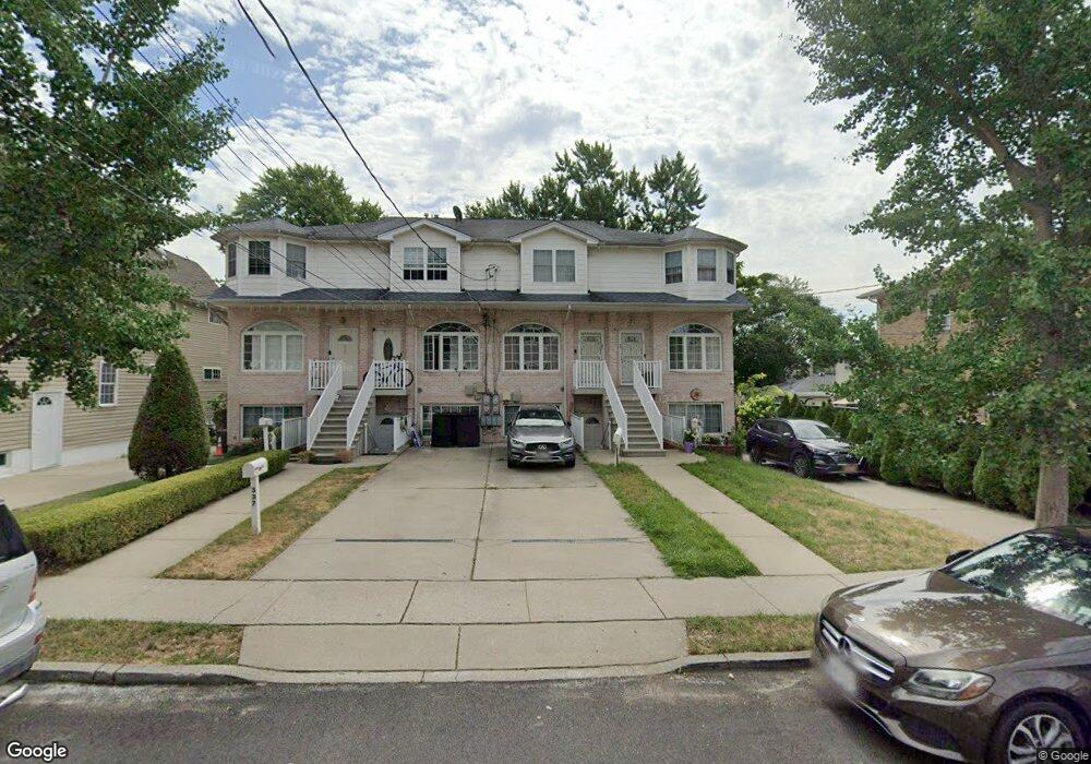
339 Nicholas Ave Staten Island, NY 10302
Port Richmond NeighborhoodEstimated Value: $582,000 - $688,000
4
Beds
3
Baths
1,560
Sq Ft
$405/Sq Ft
Est. Value
About This Home
This home is located at 339 Nicholas Ave, Staten Island, NY 10302 and is currently estimated at $631,271, approximately $404 per square foot. 339 Nicholas Ave is a home located in Richmond County with nearby schools including P.S. 22 Graniteville, I.S. 51 Edwin Markham, and Port Richmond High School.
Ownership History
Date
Name
Owned For
Owner Type
Purchase Details
Closed on
Oct 20, 2005
Sold by
Hylan Builders Of S I Inc
Bought by
Holmes Ronald
Current Estimated Value
Home Financials for this Owner
Home Financials are based on the most recent Mortgage that was taken out on this home.
Original Mortgage
$333,600
Outstanding Balance
$203,368
Interest Rate
8.05%
Mortgage Type
Fannie Mae Freddie Mac
Estimated Equity
$427,903
Create a Home Valuation Report for This Property
The Home Valuation Report is an in-depth analysis detailing your home's value as well as a comparison with similar homes in the area
Home Values in the Area
Average Home Value in this Area
Purchase History
| Date | Buyer | Sale Price | Title Company |
|---|---|---|---|
| Holmes Ronald | $439,000 | -- |
Source: Public Records
Mortgage History
| Date | Status | Borrower | Loan Amount |
|---|---|---|---|
| Open | Holmes Ronald | $333,600 | |
| Closed | Holmes Ronald | $83,400 |
Source: Public Records
Tax History Compared to Growth
Tax History
| Year | Tax Paid | Tax Assessment Tax Assessment Total Assessment is a certain percentage of the fair market value that is determined by local assessors to be the total taxable value of land and additions on the property. | Land | Improvement |
|---|---|---|---|---|
| 2025 | $4,460 | $36,240 | $3,897 | $32,343 |
| 2024 | $4,460 | $32,400 | $4,112 | $28,288 |
| 2023 | $4,510 | $22,205 | $3,480 | $18,725 |
| 2022 | $4,240 | $32,160 | $6,000 | $26,160 |
| 2021 | $4,375 | $29,640 | $6,000 | $23,640 |
| 2020 | $4,152 | $29,280 | $6,000 | $23,280 |
| 2019 | $3,871 | $25,440 | $6,000 | $19,440 |
| 2018 | $3,772 | $18,504 | $4,696 | $13,808 |
| 2017 | $3,608 | $17,700 | $6,000 | $11,700 |
| 2016 | $3,463 | $17,325 | $5,364 | $11,961 |
| 2015 | $2,959 | $16,345 | $4,405 | $11,940 |
| 2014 | $2,959 | $15,420 | $4,980 | $10,440 |
Source: Public Records
Map
Nearby Homes
- 38 Laforge Ave
- 28 Hooker Place
- 13 Laforge Ave
- 11 Laforge Ave
- 145 Clinton Place
- 469 Port Richmond Ave
- 98 Saint Josephs Ave
- 152 Port Richmond Ave
- 209 Nicholas Ave
- 211 Morningstar Rd
- 47 Montell St
- 231 Charles Ave
- 28 Clinton Place
- 145 Morningside Ave Unit 2C
- 471 Heberton Ave
- 306 Morningstar Rd
- 646 Port Richmond Ave
- 322 Morningstar Rd
- 646-662 Port Richmond Ave
- 325 Pulaski Ave
- 337 Nicholas Ave
- 341 Nicholas Ave
- 335 Nicholas Ave
- 333 Nicholas Ave
- 333 Nicholas Ave
- 333 Nicholas Ave
- 343 Nicholas Ave
- 63 Hooker Place
- 61 Hooker Place
- 329 Nicholas Ave
- 57 Hooker Place
- 327 Nicholas Ave
- 345 Nicholas Ave
- 32 Laforge Place
- 30 Laforge Place
- 36 Laforge Place Unit 38
- 36 Laforge Place Unit 36/38
- 36 Laforge Place
- 36 Laforge Ave
- 40-42 Laforge Place