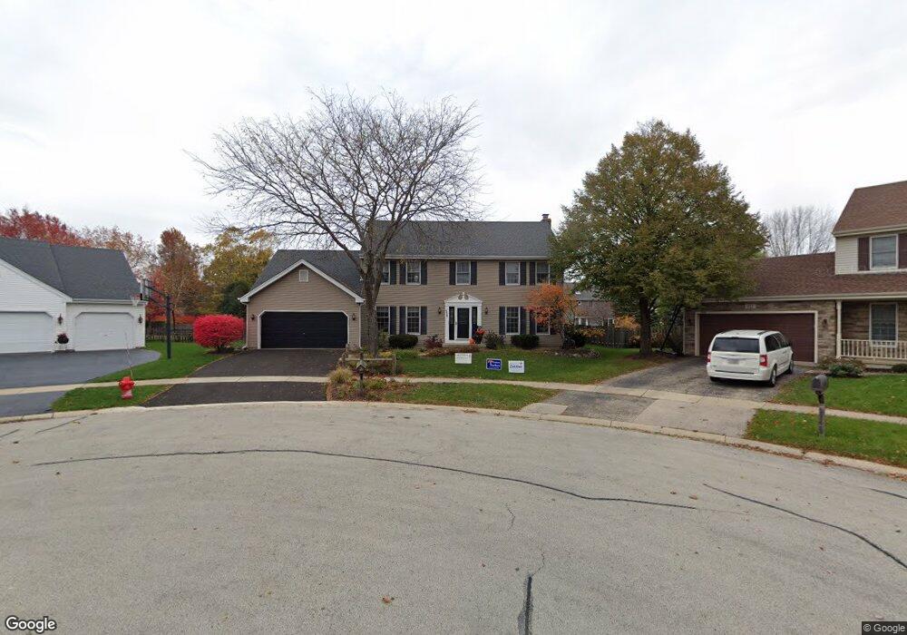
339 Olson Ct Geneva, IL 60134
Northwest Central Geneva NeighborhoodEstimated Value: $559,590 - $587,000
4
Beds
3
Baths
2,451
Sq Ft
$233/Sq Ft
Est. Value
About This Home
This home is located at 339 Olson Ct, Geneva, IL 60134 and is currently estimated at $570,398, approximately $232 per square foot. 339 Olson Ct is a home located in Kane County with nearby schools including Williamsburg Elementary School, Geneva Middle School North, and Geneva Middle School South.
Ownership History
Date
Name
Owned For
Owner Type
Purchase Details
Closed on
Jan 26, 2015
Sold by
Brady John J and Brady Diane M
Bought by
Brady Joint Trust and Brady Diane M
Current Estimated Value
Create a Home Valuation Report for This Property
The Home Valuation Report is an in-depth analysis detailing your home's value as well as a comparison with similar homes in the area
Home Values in the Area
Average Home Value in this Area
Purchase History
We collect this data history from publicly available records. To have your information removed, we recommend requesting removal directly through your county’s website.
| Date | Buyer | Sale Price | Title Company |
|---|---|---|---|
| Brady Joint Trust | -- | None Available |
Source: Public Records
Tax History
| Year | Tax Paid | Tax Assessment Tax Assessment Total Assessment is a certain percentage of the fair market value that is determined by local assessors to be the total taxable value of land and additions on the property. | Land | Improvement |
|---|---|---|---|---|
| 2024 | $10,815 | $157,287 | $39,475 | $117,812 |
| 2023 | $11,774 | $142,988 | $35,886 | $107,102 |
| 2022 | $11,135 | $132,864 | $33,345 | $99,519 |
| 2021 | $10,828 | $127,926 | $32,106 | $95,820 |
| 2020 | $10,710 | $125,973 | $31,616 | $94,357 |
| 2019 | $10,690 | $123,587 | $31,017 | $92,570 |
| 2018 | $10,475 | $121,276 | $31,017 | $90,259 |
| 2017 | $10,372 | $118,042 | $30,190 | $87,852 |
| 2016 | $10,433 | $116,447 | $29,782 | $86,665 |
| 2015 | -- | $110,712 | $28,315 | $82,397 |
| 2014 | -- | $110,712 | $28,315 | $82,397 |
| 2013 | -- | $110,712 | $28,315 | $82,397 |
Source: Public Records
Map
Nearby Homes
- 549 Bloomfield Cir
- 221 Wakefield Ln
- 2255 Vanderbilt Dr
- 2267 Vanderbilt Dr
- 2123 Vanderbilt Dr
- 559 Bradbury Ln Unit 559
- 512 West Ln
- 544 Bradbury Ln Unit 544
- 223 Willow Ln
- 2582 Lorraine Cir Unit 2582
- 326 Maple Ln
- 2154 Pepper Valley Dr
- 263 Lillian Ct
- 2530 Lorraine Cir
- 702 Maple Ln
- 1501 North St
- 2719 Stone Cir
- 1736 Kaneville Rd
- 326 Charles St
- 1601 Kaneville Rd
- 375 Colonial Cir
- 377 Colonial Cir Unit 4
- 373 Colonial Cir
- 2026 Wellington Ct
- 379 Colonial Cir
- 366 Colonial Cir
- 2024 Wellington Ct
- 364 Colonial Cir
- 2023 Wellington Ct Unit 4
- 374 Colonial Cir Unit 4
- 376 Colonial Cir
- 381 Colonial Cir
- 362 Colonial Cir
- 372 Colonial Cir
- 378 Colonial Cir
- 2022 Wellington Ct
- 360 Colonial Cir
- 383 Colonial Cir
- 380 Colonial Cir Unit 4
- 2021 Wellington Ct
Your Personal Tour Guide
Ask me questions while you tour the home.