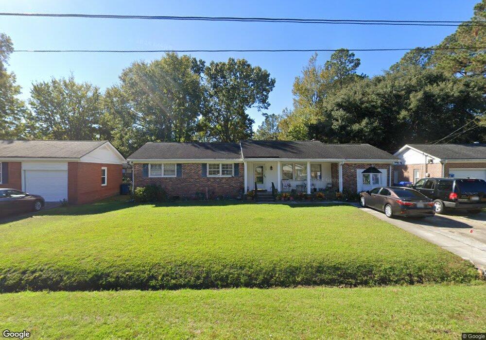
339 Swift Ave Charleston, SC 29407
Dupont Station NeighborhoodEstimated Value: $484,000 - $548,000
3
Beds
2
Baths
1,900
Sq Ft
$267/Sq Ft
Est. Value
About This Home
This home is located at 339 Swift Ave, Charleston, SC 29407 and is currently estimated at $506,941, approximately $266 per square foot. 339 Swift Ave is a home located in Charleston County with nearby schools including Stono Park Elementary School, West Ashley High School, and Carolina Voyager Charter.
Ownership History
Date
Name
Owned For
Owner Type
Purchase Details
Closed on
Jun 26, 2009
Sold by
Anderson Lanard
Bought by
Anderson Lanard and Anderson Leona
Current Estimated Value
Home Financials for this Owner
Home Financials are based on the most recent Mortgage that was taken out on this home.
Original Mortgage
$188,975
Interest Rate
4.88%
Mortgage Type
FHA
Purchase Details
Closed on
May 17, 2001
Sold by
Lanard Anderson
Bought by
Anderson Leona
Create a Home Valuation Report for This Property
The Home Valuation Report is an in-depth analysis detailing your home's value as well as a comparison with similar homes in the area
Home Values in the Area
Average Home Value in this Area
Purchase History
| Date | Buyer | Sale Price | Title Company |
|---|---|---|---|
| Anderson Lanard | -- | -- | |
| Anderson Leona | -- | Southern Title Company | |
| Anderson Lanard | -- | Southern Title Company |
Source: Public Records
Mortgage History
| Date | Status | Borrower | Loan Amount |
|---|---|---|---|
| Closed | Anderson Lanard | $188,975 |
Source: Public Records
Tax History Compared to Growth
Tax History
| Year | Tax Paid | Tax Assessment Tax Assessment Total Assessment is a certain percentage of the fair market value that is determined by local assessors to be the total taxable value of land and additions on the property. | Land | Improvement |
|---|---|---|---|---|
| 2024 | $1,306 | $7,000 | $0 | $0 |
| 2023 | $1,306 | $7,000 | $0 | $0 |
| 2022 | $1,221 | $7,000 | $0 | $0 |
| 2021 | $1,260 | $7,000 | $0 | $0 |
| 2020 | $1,273 | $7,000 | $0 | $0 |
| 2019 | $1,110 | $6,090 | $0 | $0 |
| 2017 | $1,056 | $6,090 | $0 | $0 |
| 2016 | $1,017 | $6,090 | $0 | $0 |
| 2015 | $1,015 | $6,090 | $0 | $0 |
| 2014 | $952 | $0 | $0 | $0 |
| 2011 | -- | $0 | $0 | $0 |
Source: Public Records
Map
Nearby Homes
- 301 Culver Ave
- 396 Culver Ave
- 374 Culver Ave
- 498 Cessna Ave
- 233 Lands End Dr Unit T233
- 198 River Breeze Dr Unit 75
- 205 River Breeze Dr Unit A205
- 486 Cessna Ave
- 507 Stinson Dr Unit 10d
- 507 Stinson Dr Unit 8d
- 507 Stinson Dr Unit D8
- 507 Stinson Dr Unit 7f
- 3006 S Shore Dr
- 323 Millcreek Dr
- 335 Clayton Dr
- 3020 S Shore Dr
- 339 Clayton Dr
- 244 Marsh Oaks Dr
- 2045 Rondo St Unit B
- 439 Geddes Ave
- 335 Swift Ave
- 341 Swift Ave
- 2038 Boeing Ave
- 2036 Boeing Ave
- 331 Swift Ave
- 345 Swift Ave
- 340 Swift Ave
- 344 Swift Ave
- 2032 Boeing Ave
- 308 Culver Ave
- 334 Swift Ave
- 302 Culver Ave
- 329 Swift Ave
- 312 Culver Ave
- 347 Swift Ave
- 350 Swift Ave
- 2030 Boeing Ave
- 332 Swift Ave
- 300 Culver Ave Unit LORD
- 325 Swift Ave